Nestled in the breathtaking landscape of Big Bear Lake, California, the Castle Rock Trail offers an invigorating climb to panoramic vistas that will leave you in awe. As a highlight for any visitor to the region and a gem for rock enthusiasts, this trail culminates at the iconic Castle Rock, a natural rock formation providing stunning views of Big Bear Lake and the encircling mountains. While challenging due to its steep incline, the relatively short length of the Castle Rock Trail makes it accessible to many hikers seeking rewarding scenery. For those desiring a longer adventure, an easily accessible extension leads to the serene Bluff Lake, adding historical intrigue with remnants of a 19th-century mountain resort. Prepare to be captivated by the natural beauty and geological wonders packed into this memorable hike.
Planning Your Hike to Castle Rock
Getting There & Parking
The Castle Rock Trailhead is conveniently situated on the south side of Big Bear Lake, making it a readily accessible natural escape. To pinpoint your journey, use the address: Castle Rock Trail 1W03, Big Bear Blvd, Big Bear Lake, CA 92315.
Parking near the Castle Rock Trailhead can be one of the trickiest aspects of this popular hike. The primary parking area is a small lot located approximately 0.25 miles east of the trailhead itself. Spaces here are limited, and it’s advisable to arrive early, especially on weekends or during peak season, to secure a spot.
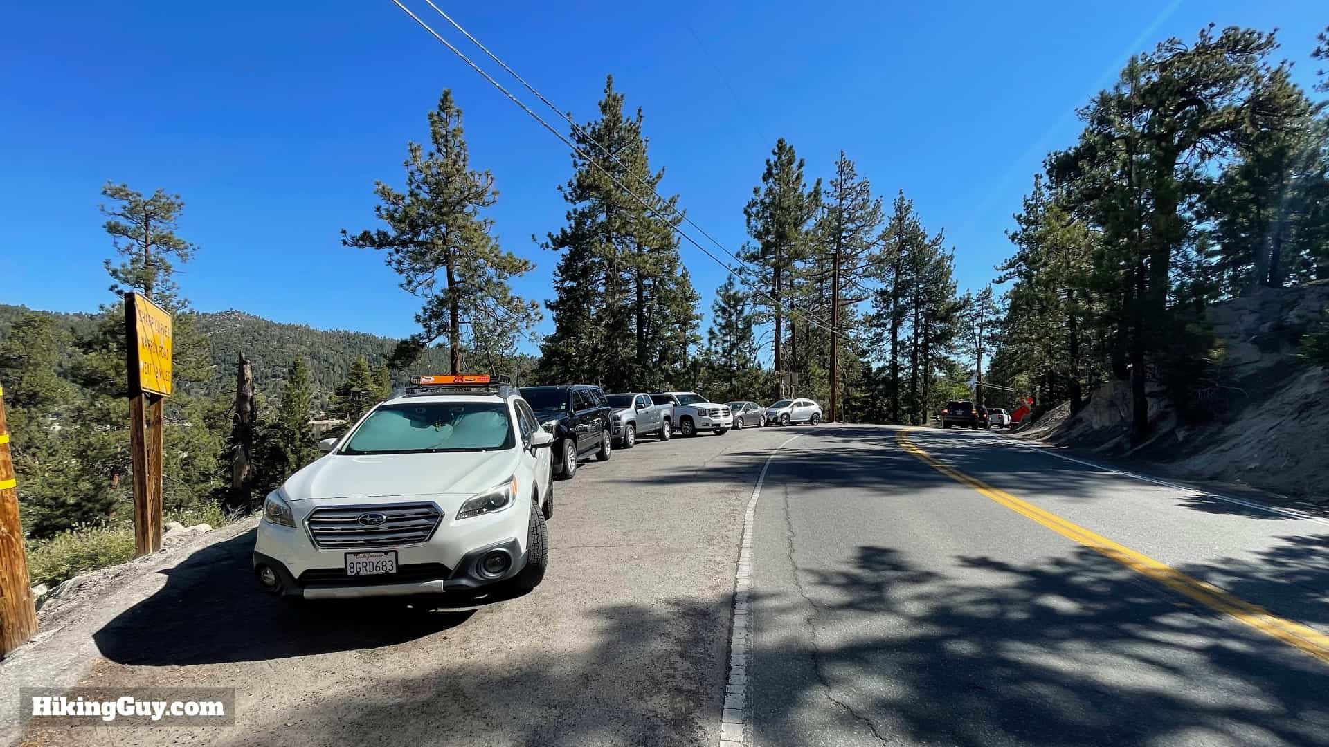 Limited parking area along Big Bear Boulevard for Castle Rock Trail
If the main lot is full, alternative parking can be found, though still limited. About 150 feet to the west of the trailhead, a small shoulder along the road provides space for a few vehicles to park. This area is less formal but often utilized when the main lot is at capacity.
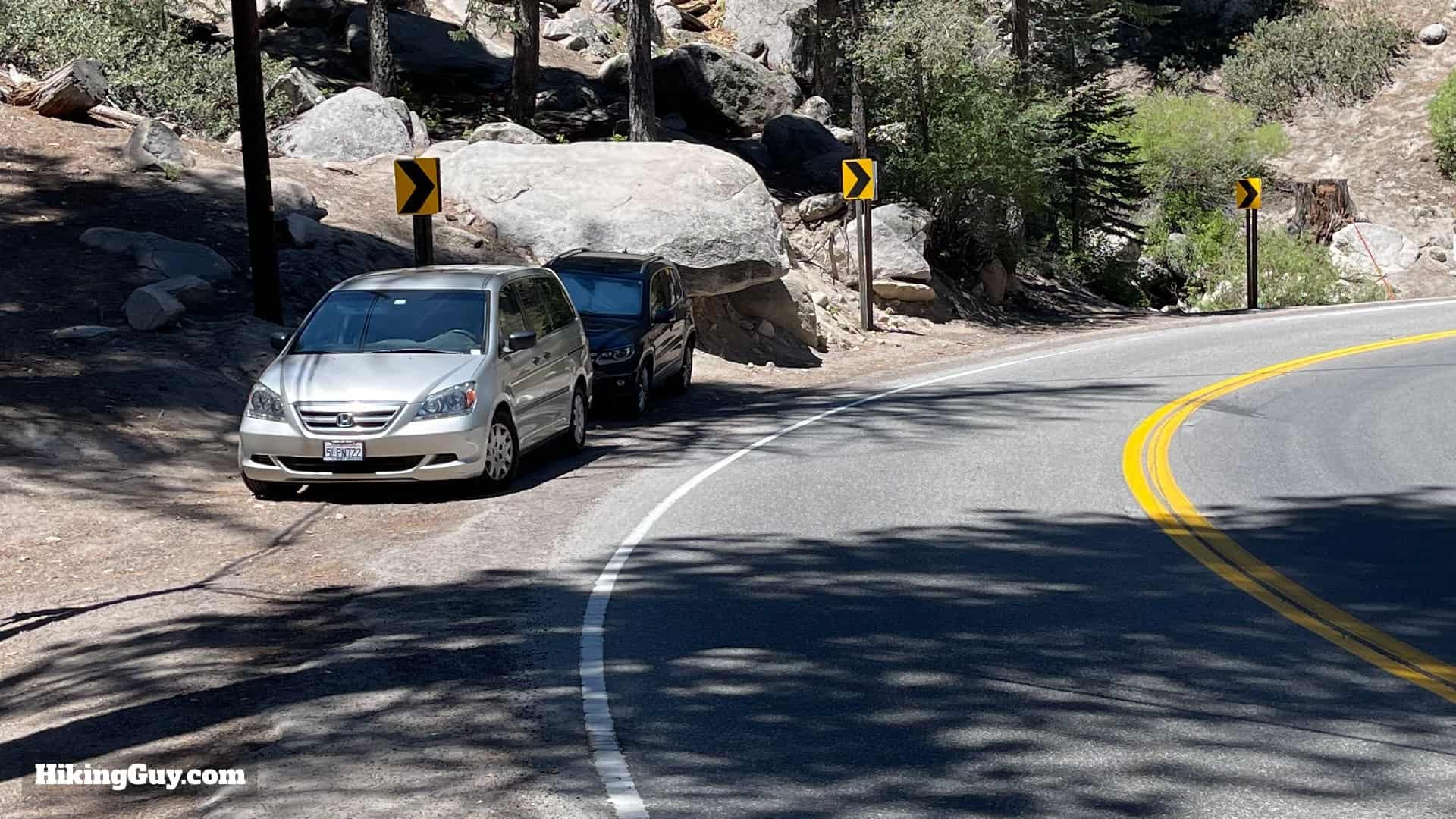 Roadside shoulder parking west of Castle Rock Trail entrance
Further west, about 0.25 miles from the trailhead, another small shoulder offers additional parking possibilities. While slightly further away, this option can be useful when other spots are taken.
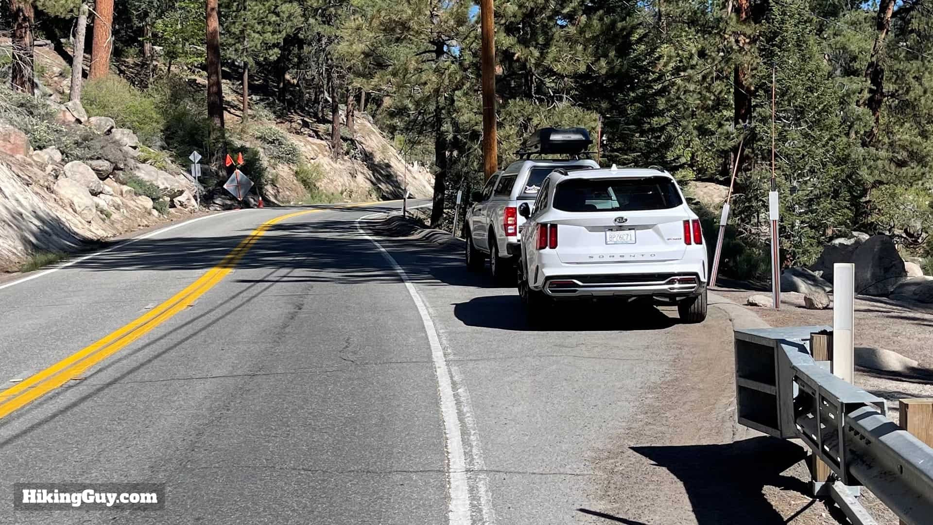 Additional roadside parking further west from Castle Rock Trailhead
A crucial safety note regarding parking for Castle Rock Trail: all parking locations require a walk along Big Bear Boulevard to reach the trailhead. This road can be busy, and vehicles often navigate the sharp turns at considerable speed. Exercise extreme caution while walking along the roadside. It’s vital to stay as far to the side as possible, remain alert, and assume you are not visible to drivers. Defensive walking is key to safely reaching the trail entrance.
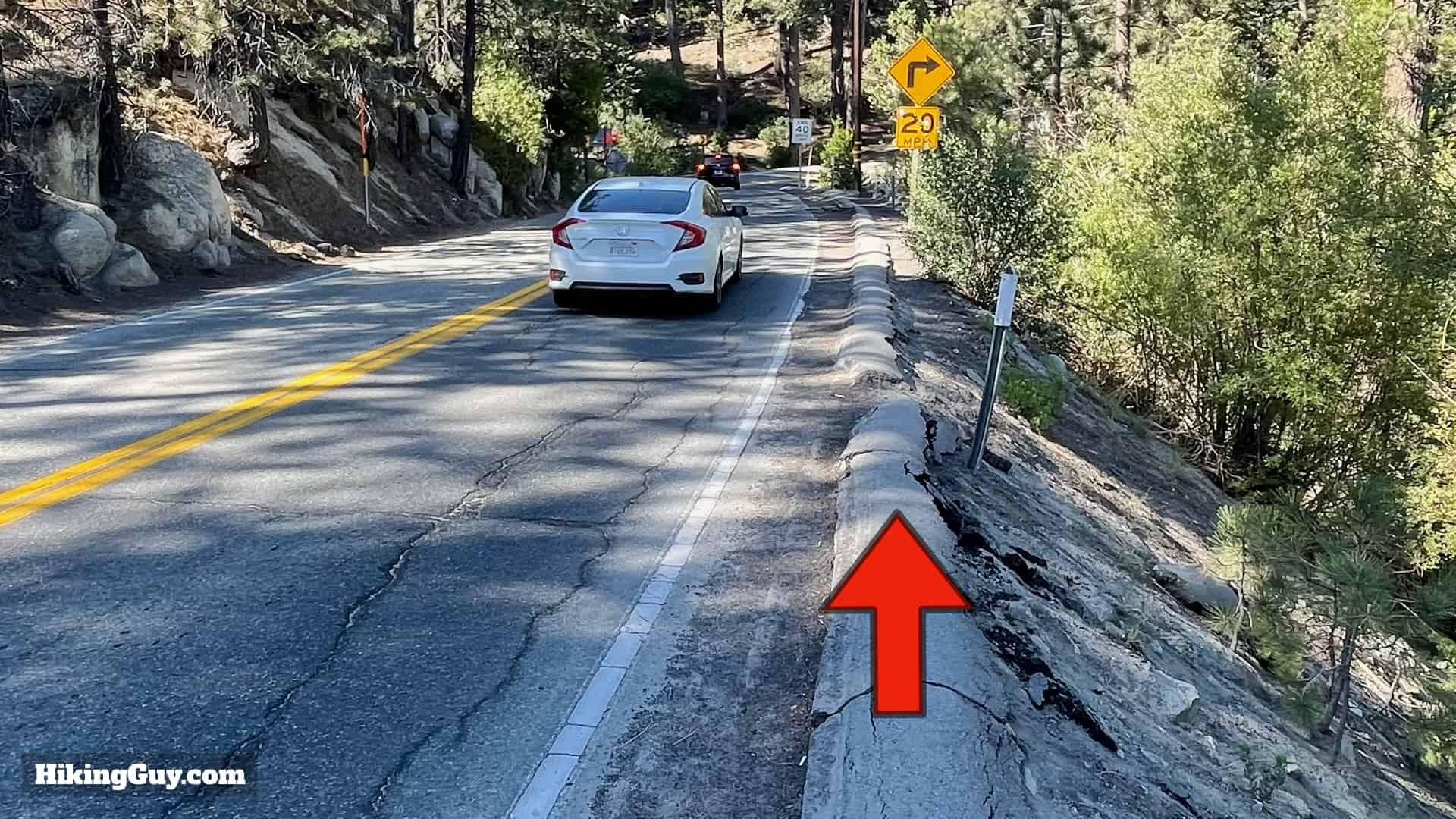 Hikers walking cautiously along Big Bear Boulevard to access Castle Rock Trail
Once you’ve navigated the roadside walk, the Castle Rock Trailhead will be located just off the road, on the mountainside away from the lake.
Essential Gear for Castle Rock Trail
Given that the Castle Rock Trail is relatively short and not overly strenuous, specialized gear is not essential. Comfortable fitness or light hiking attire is perfectly suitable. However, carrying water is highly recommended, particularly during warmer months, as the uphill climb can be demanding. Aim to bring at least 1 liter of water, especially if you plan to extend your hike to Bluff Lake.
For footwear, sturdy hiking shoes or trail runners are advisable to provide good traction on the sometimes loose and rocky terrain. While not mandatory, trekking poles can be beneficial for those who prefer extra stability on steep inclines.
It’s important to note that during winter, the Castle Rock Trail transforms into a challenging icy and snowy path, often becoming unsafe to hike due to its steepness. The ideal seasons to fully enjoy this trail are spring, summer, and fall when the conditions are more favorable.
For those interested in upgrading their hiking gear, you can explore recommended equipment on a dedicated gear page here for updated suggestions (January 2025).
Navigating the Trail: Maps & Markers
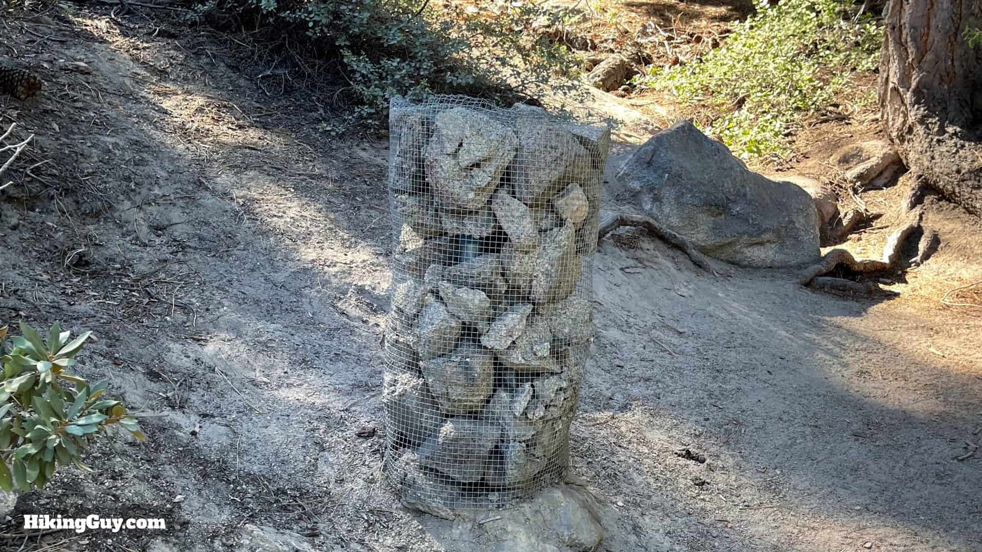 Stone bin trail marker on the Castle Rock Trail
A distinctive feature of the Castle Rock Trail is its unique trail markers: wire bins filled with rocks, often referred to as cairns. These stone bins serve as your primary guide as you ascend towards Castle Rock. Staying on the official path is straightforward as long as you keep an eye out for these markers; you should typically spot one every few minutes. If you find yourself walking for longer without seeing a marker, it’s a good indication you’ve veered off course.
Due to its popularity and short length, numerous unofficial paths and shortcuts have developed along the Castle Rock Trail. It’s crucial to disregard these and consistently follow the official trail marked by the stone bins. Some maps might incorrectly depict trails branching off; always prioritize the physical stone markers on the ground to stay on the intended route to Castle Rock.
For enhanced navigation, consider using interactive maps and GPS tools.
Interactive Map Placeholder
Click for Interactive Map
For those who prefer downloadable resources, GPX data is available: GPX Download. You can also view and print maps on CalTopo: Print & View on CalTopo. For navigation gear recommendations, refer to: My Nav Gear.
Trail Difficulty & Elevation Profile
The hike to Castle Rock is characterized by a consistent uphill climb, demanding a moderate level of physical exertion. The elevation profile illustrates a steady ascent for the majority of the trail, although there is a brief flatter section providing a slight respite midway.
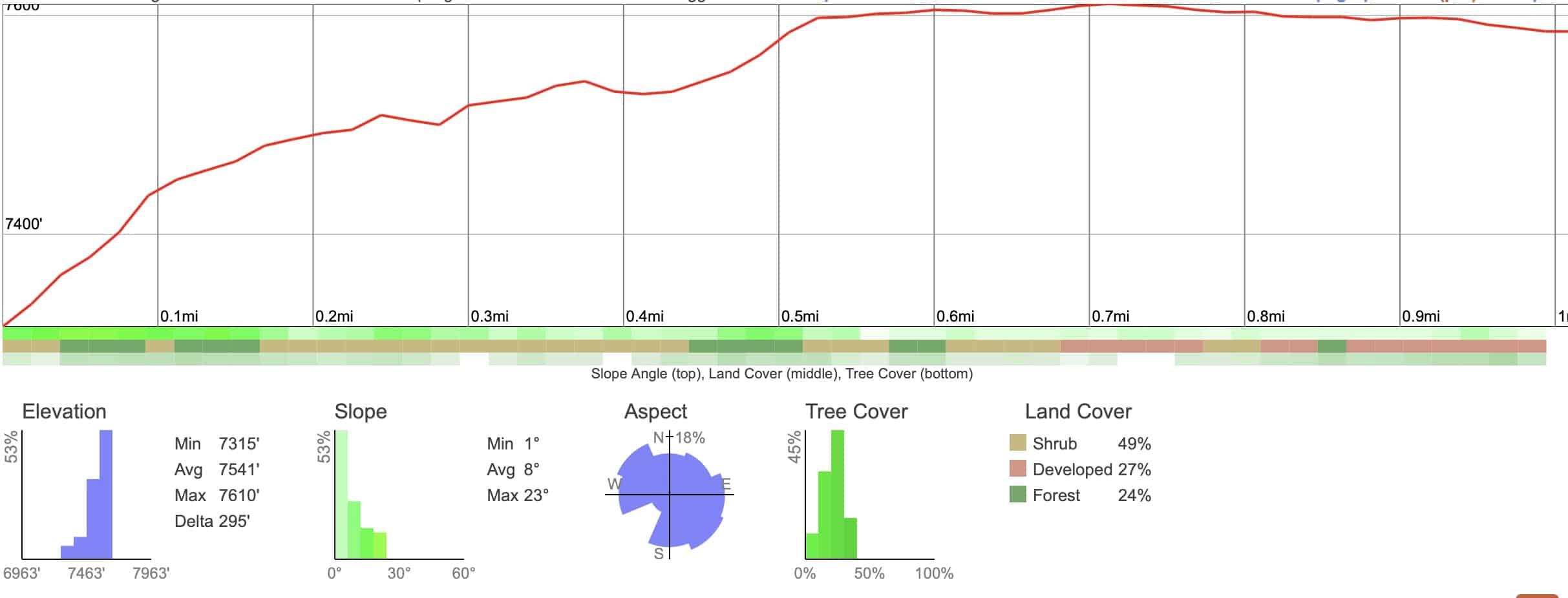 Elevation graph for Castle Rock Trail showing steady incline
Extending your hike to Bluff Lake involves a short additional uphill section beyond Castle Rock, after which the trail becomes significantly easier, transitioning to a relatively flat and gentle walk to the lake.
For a comprehensive understanding of the terrain, a 3D map view provides perspective on the trail’s layout, highlighting shaded areas and the overall route from the lakeside road to Castle Rock and onward to Bluff Lake. As visualized, much of the trail is pleasantly shaded, offering relief from the sun, particularly during warmer parts of the day.
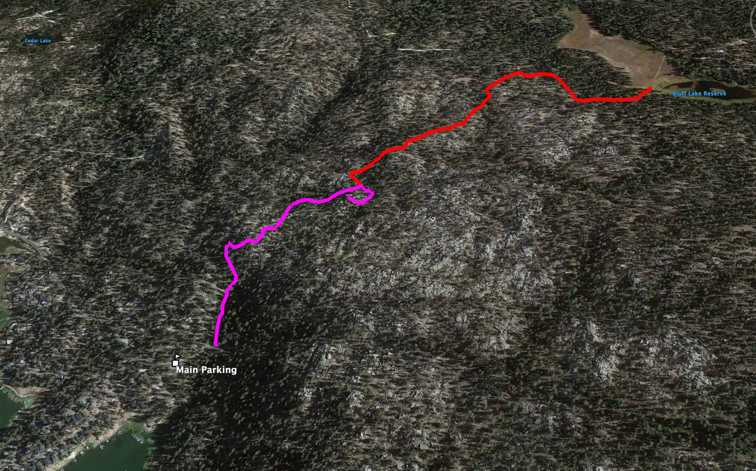 3D terrain map of Castle Rock Trail and Bluff Lake extension
Step-by-Step Trail Directions to Castle Rock Viewpoint
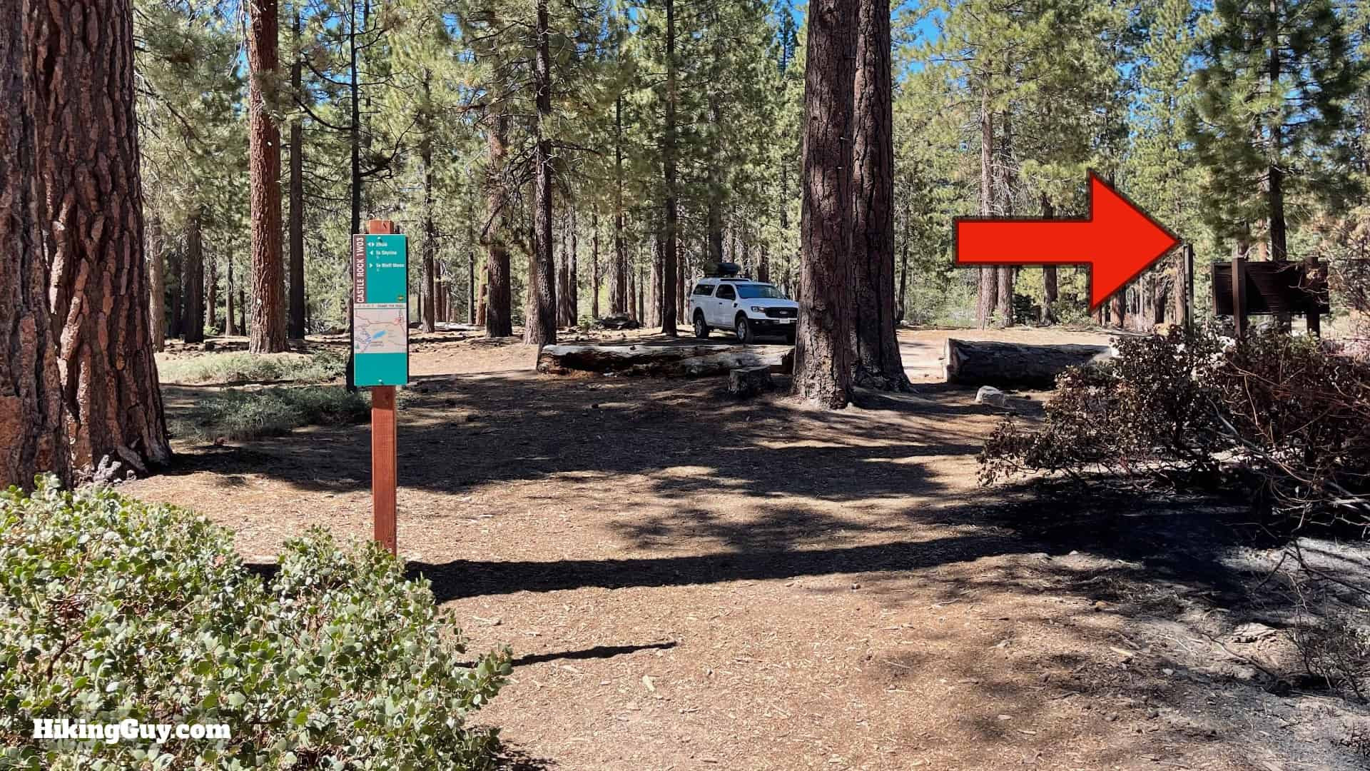
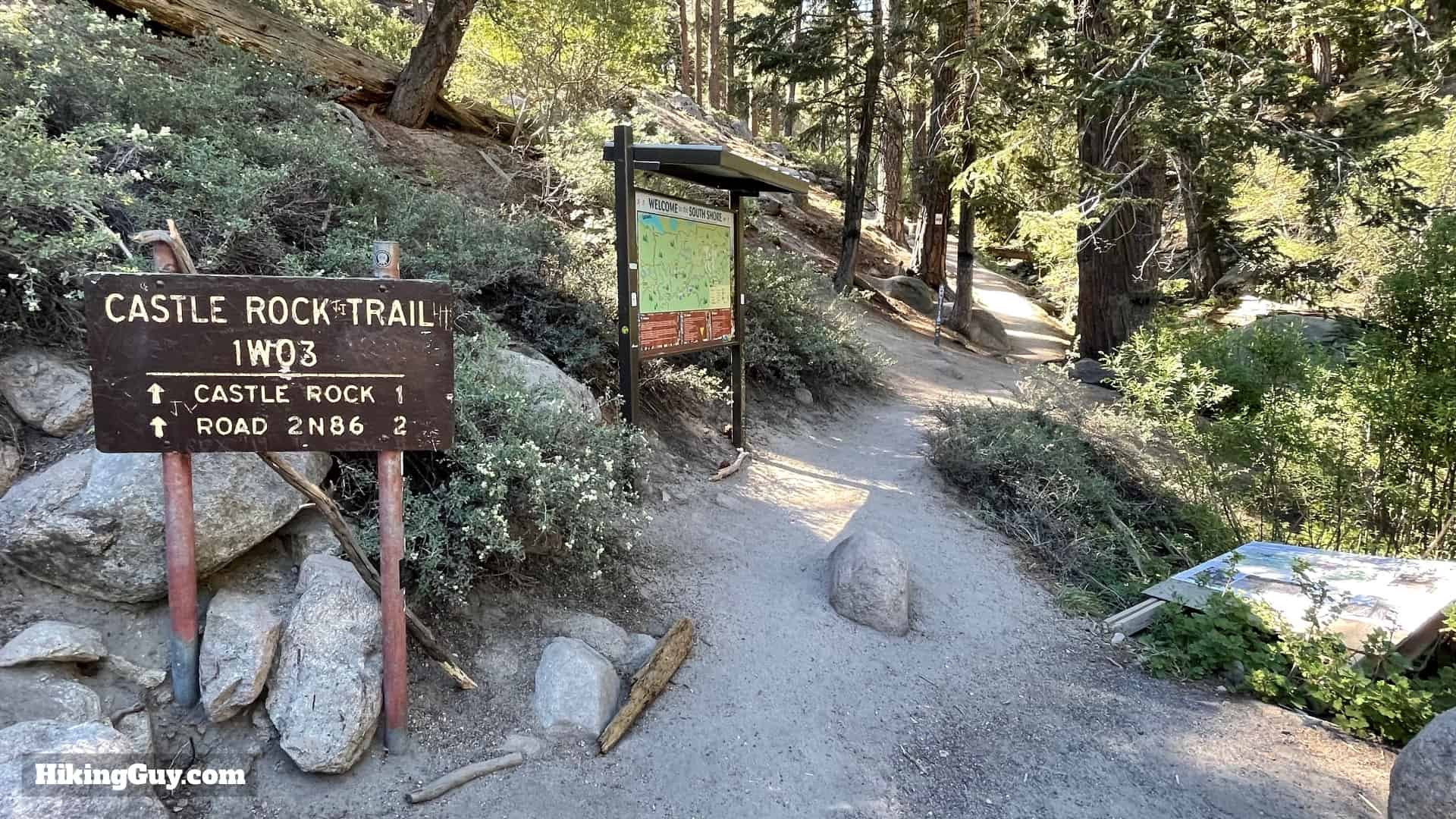 Well-marked trailhead sign for Castle Rock Trail entrance
- Begin at the clearly marked trailhead. Before starting, take a moment to check the notice board for any recent updates or advisories related to the trail.
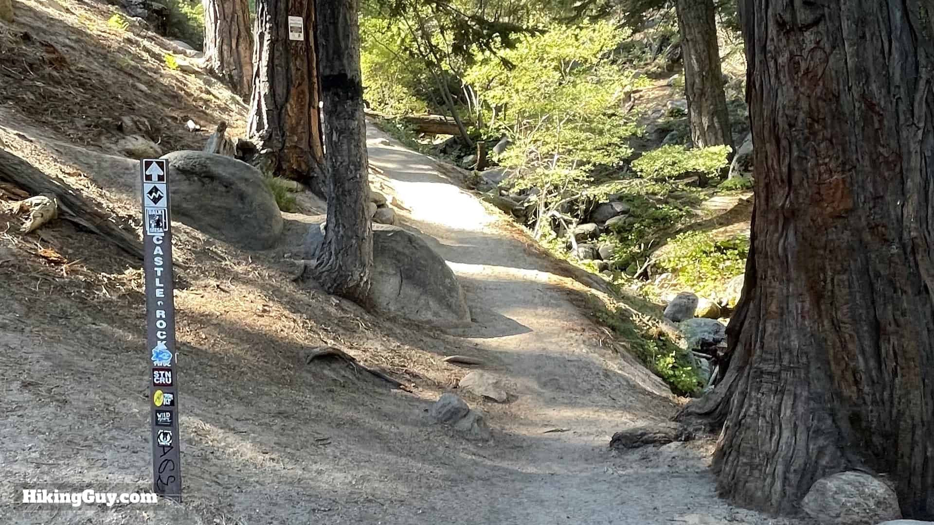 Trail sign at the start of Castle Rock Trail
- You’ll see a small trail sign confirming you are at the start of the Castle Rock Trail.
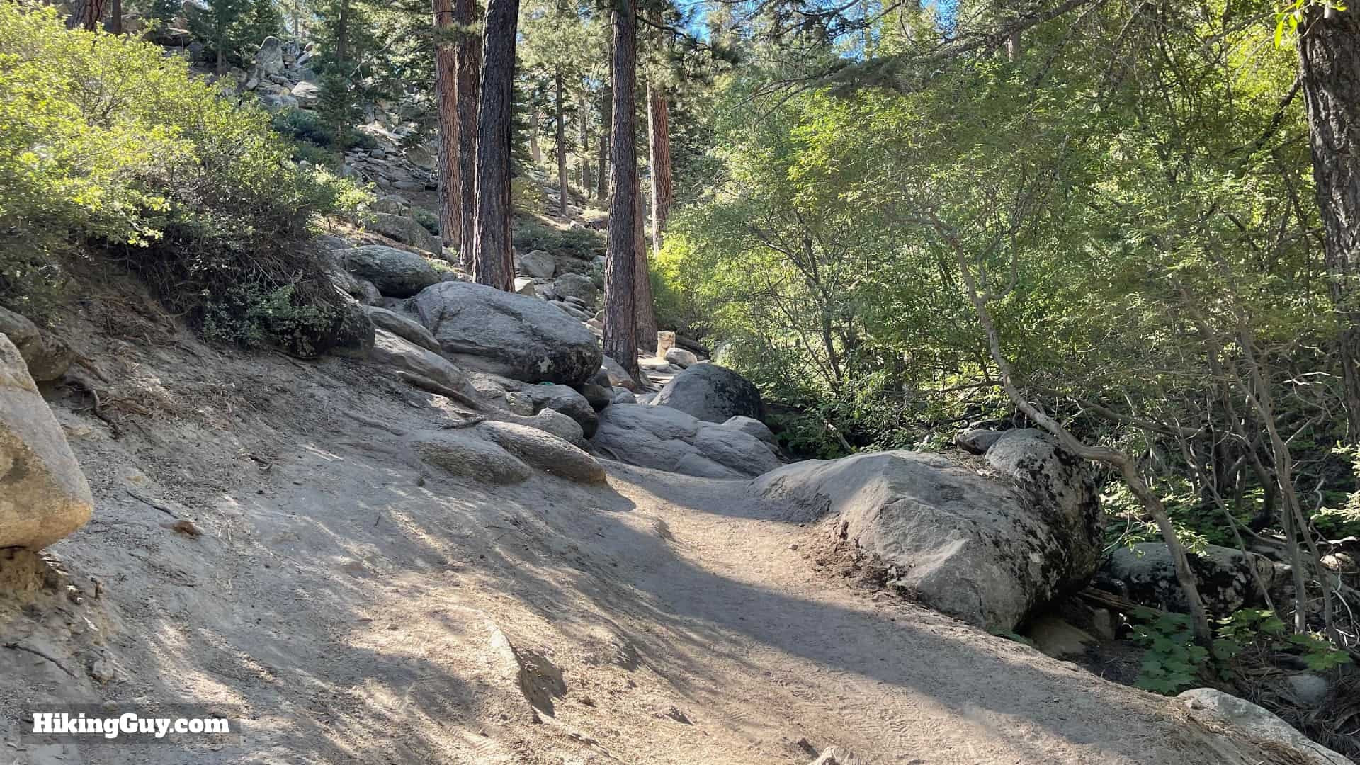 Steep initial climb at Castle Rock Trail alongside dry stream
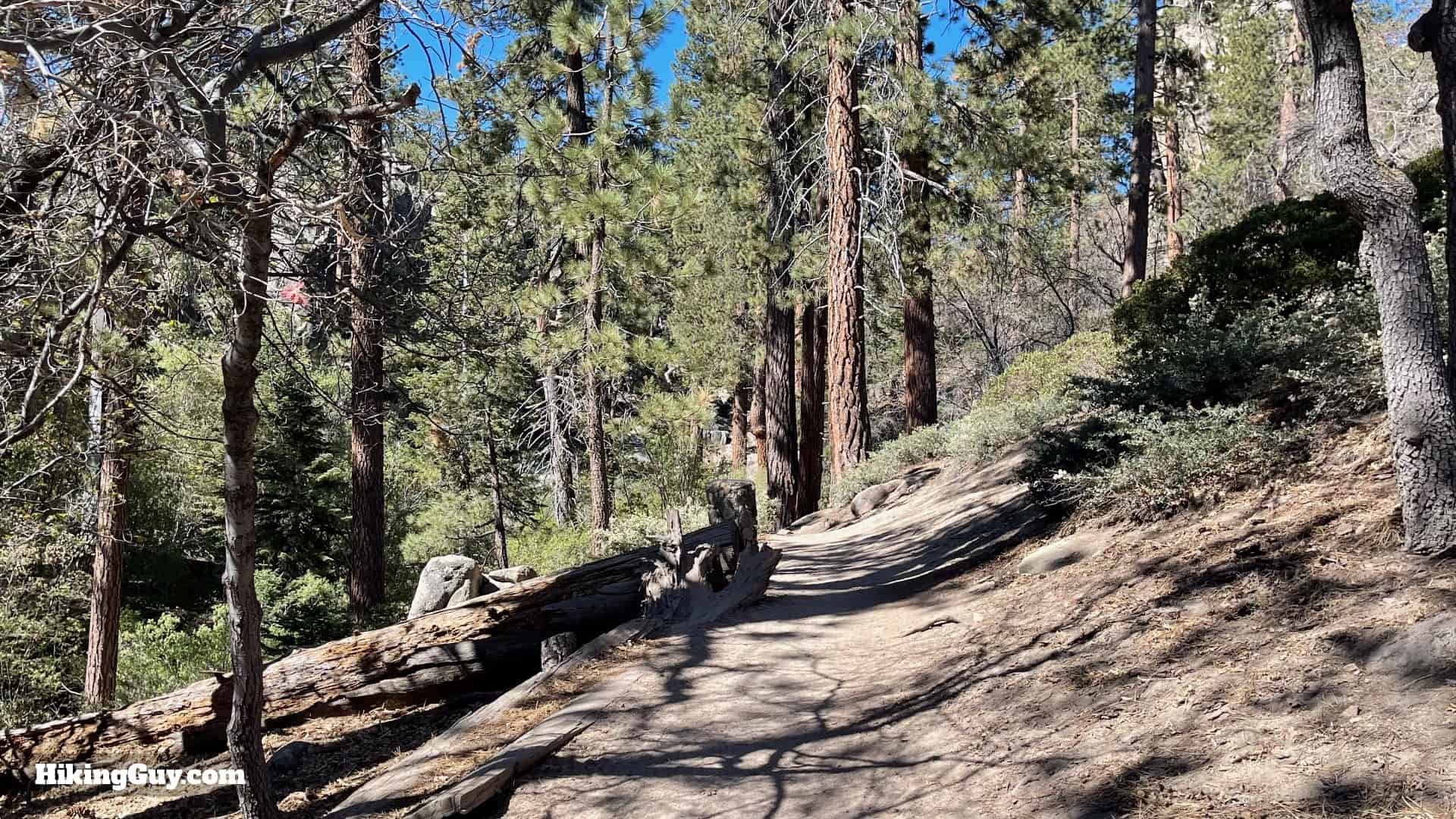
- Immediately from the trailhead, the path ascends steeply, following the left bank of what is typically a dry stream bed.
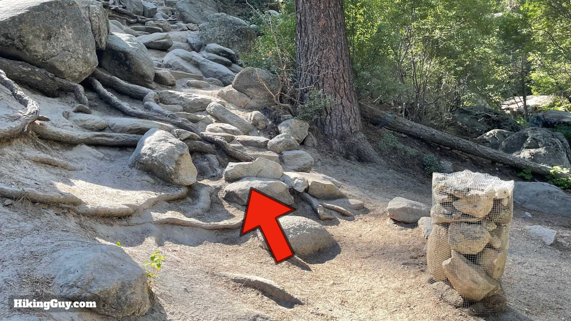 First stone marker encountered on Castle Rock Trail
- Shortly after beginning your ascent, you’ll encounter the first of the stone bin trail markers. Continue uphill, keeping these markers in sight.
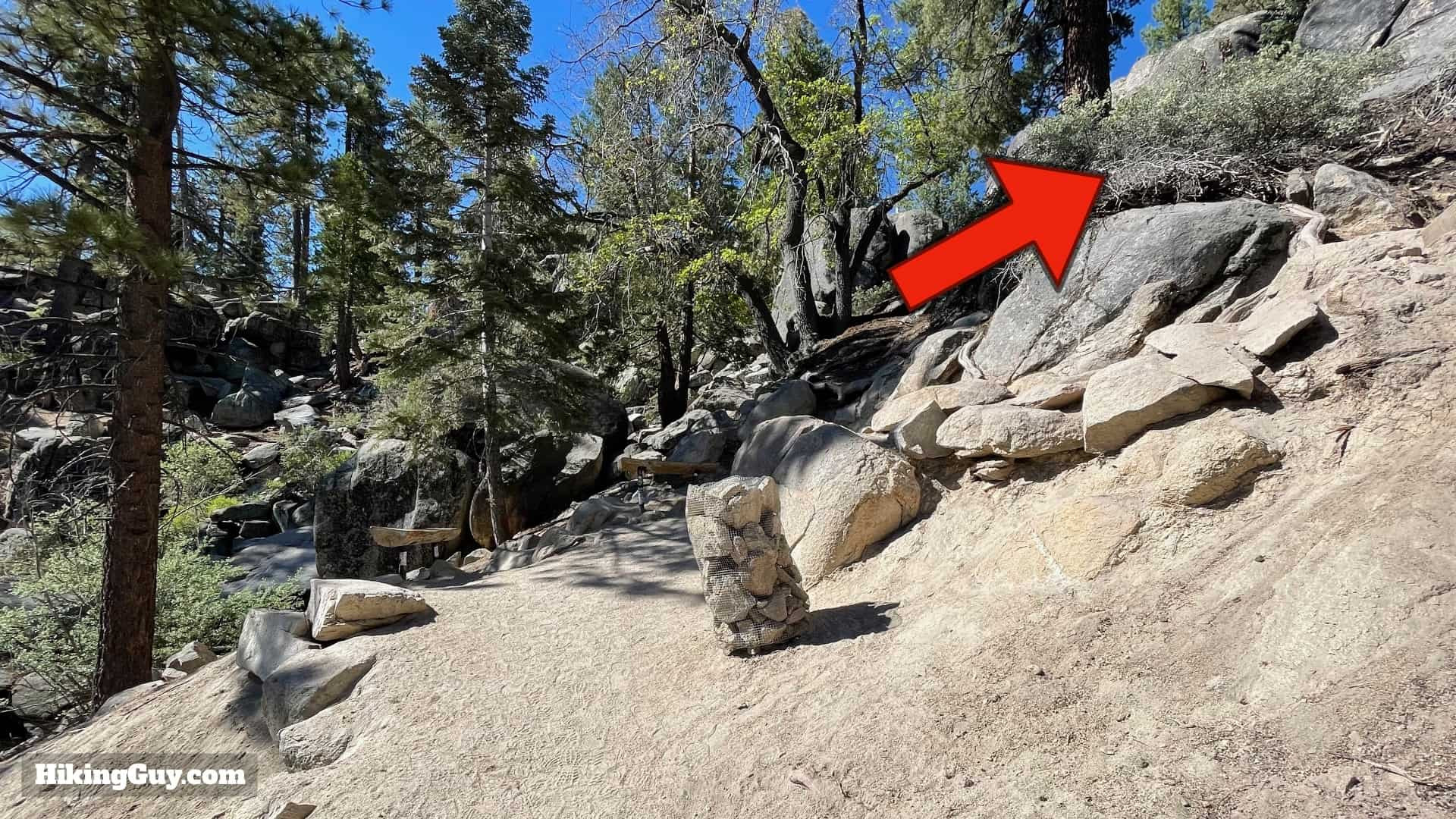
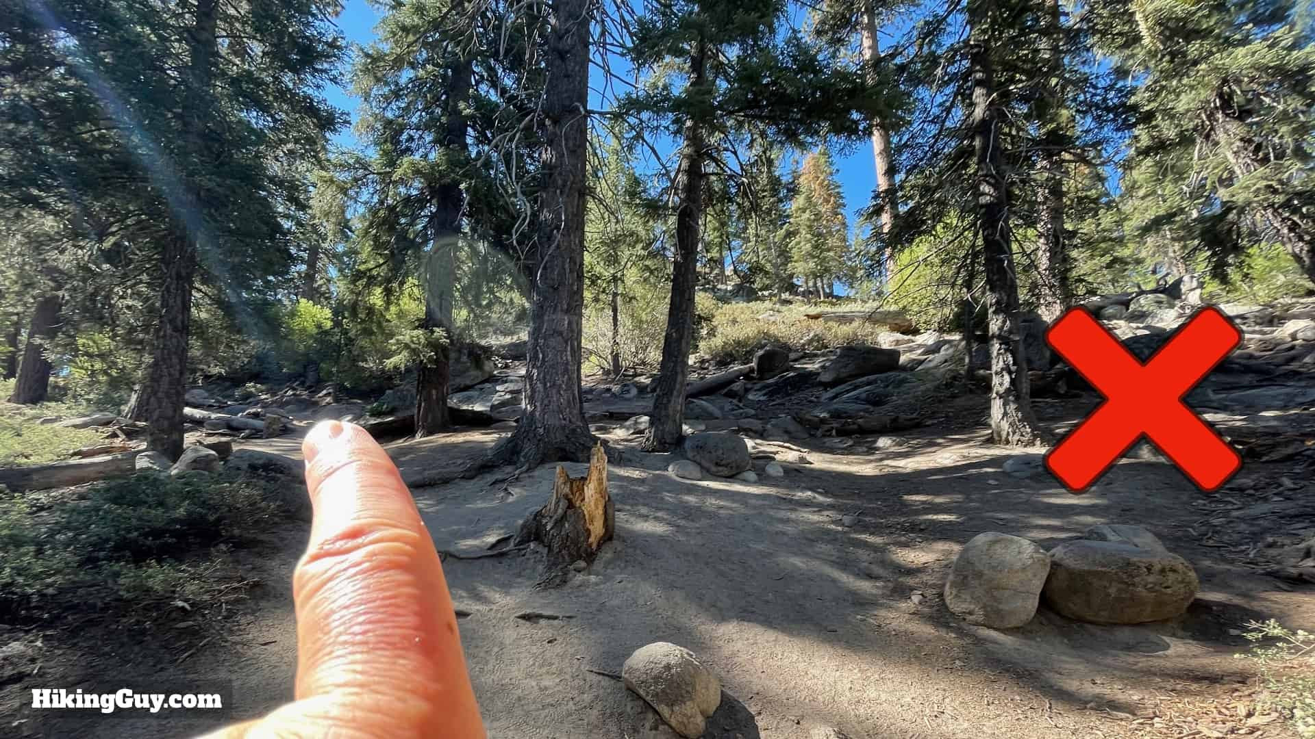 Clearing on Castle Rock Trail, stay left to continue official path
- At a larger clearing, be aware of an unofficial trail branching off to the right. Stay on the official path by continuing upwards and to the left, following the stone markers.
 Slightly easier section of Castle Rock Trail
- The trail gradient eases slightly for a brief stretch, offering a moment of less strenuous hiking.
 Benches marking the return to steeper section on Castle Rock Trail
- The trail then curves back to the right near some benches, and the steep incline resumes.
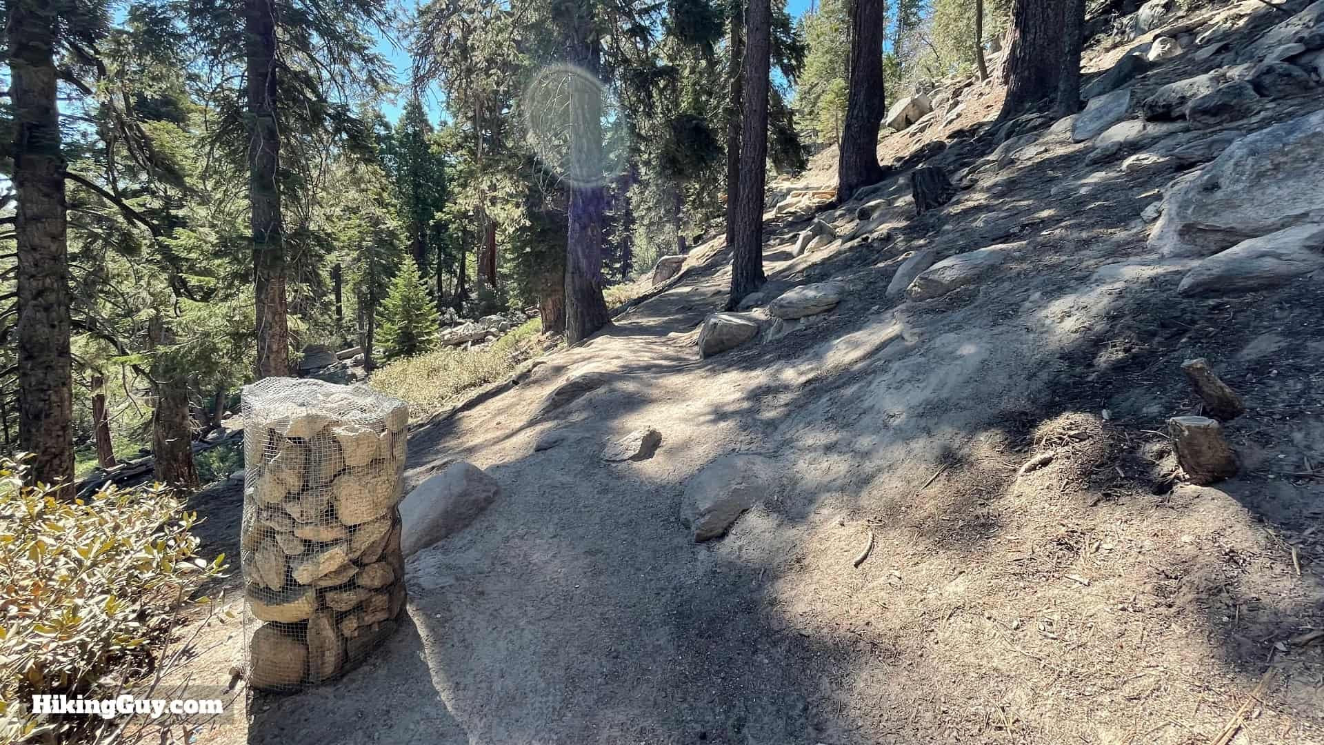
 Following stone markers uphill on Castle Rock Trail
- Continue your climb, navigating from one stone marker to the next, being sure to avoid any diverging side trails.
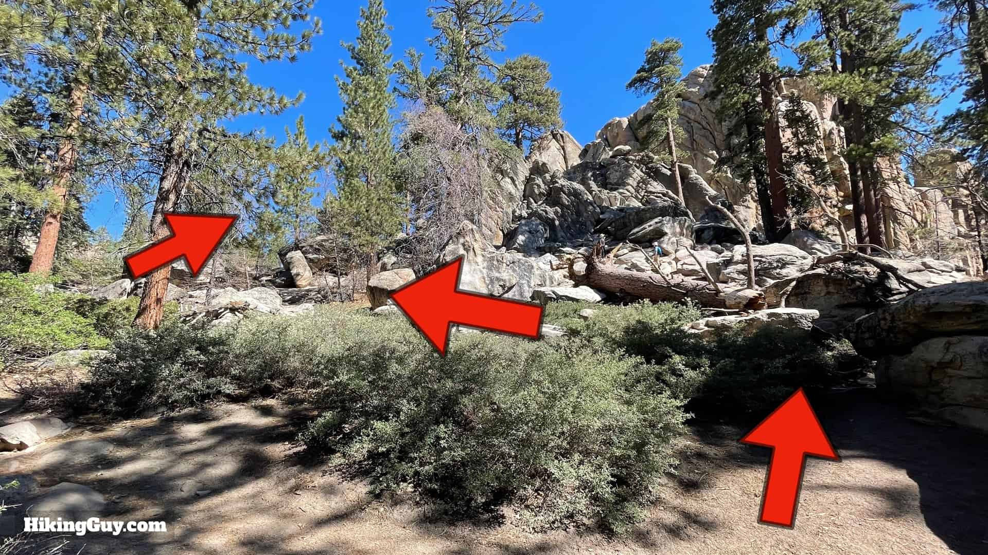
 Views of Big Bear Lake starting to appear on Castle Rock Trail
- In the mid-section of the hike, as views of Big Bear Lake begin to emerge, you’ll notice several smaller, unofficial trails. Again, rely on the stone markers to stay on the correct path.
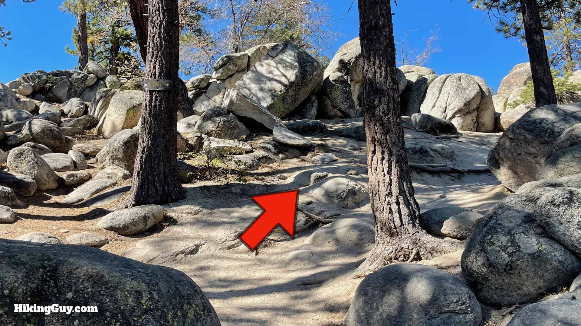
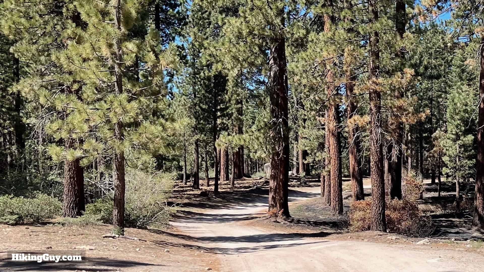
 Level forest section of Castle Rock Trail
- You’ll traverse through a flatter section of forest, providing a brief, less steep interlude in the climb.
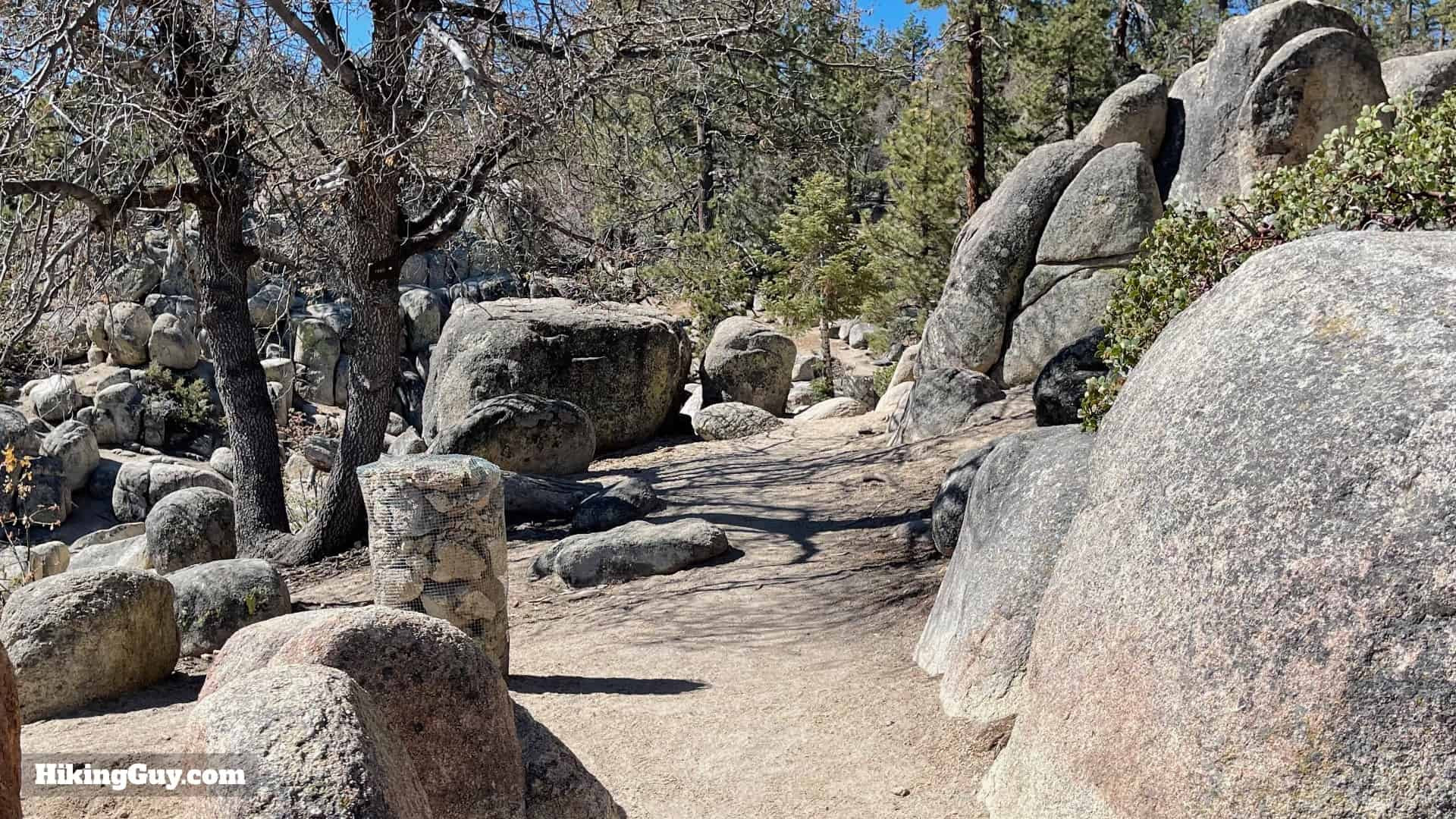
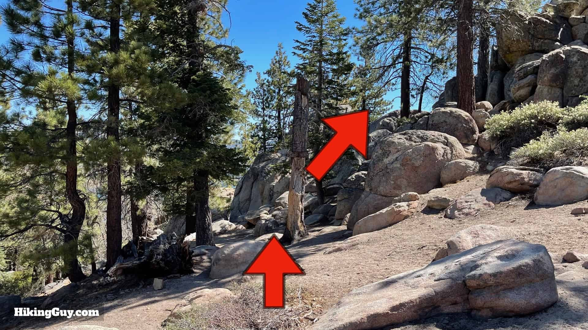
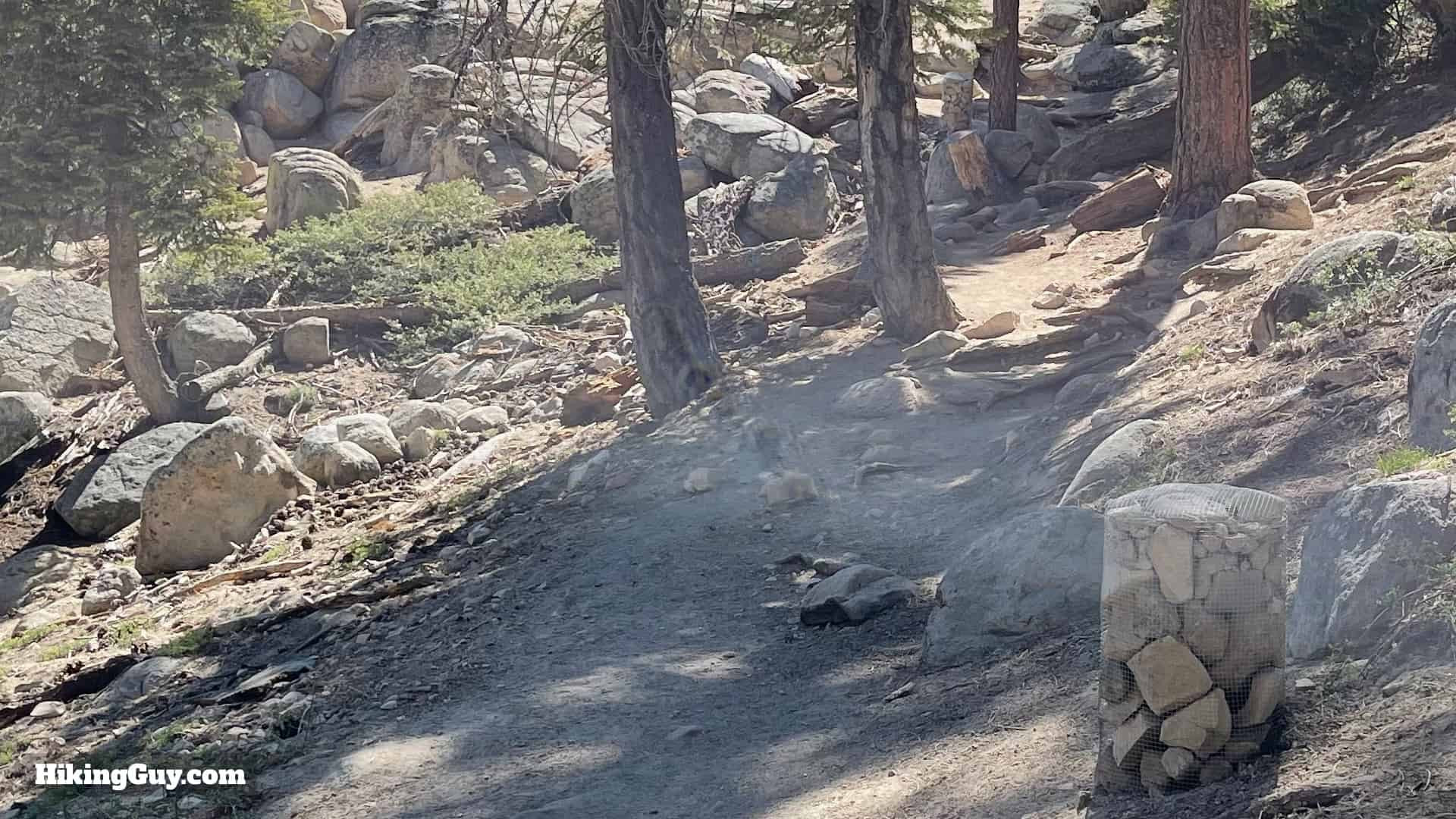
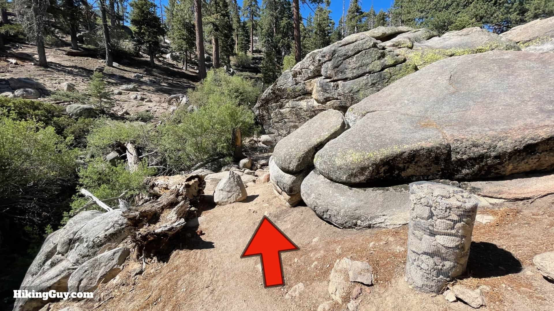 Descending through boulders on Castle Rock Trail
- The trail then leads you down slightly through an area with large boulders.
 T-junction on Castle Rock Trail, right to Castle Rock
- You will arrive at a distinct T-junction. To reach Castle Rock, make a right turn. If you plan to proceed to Bluff Lake later, remember this junction as you will return here to go left.
 Sign pointing towards Castle Rock viewpoint
- As you descend slightly into a small dip, a sign indicating Castle Rock confirms you are heading in the right direction.
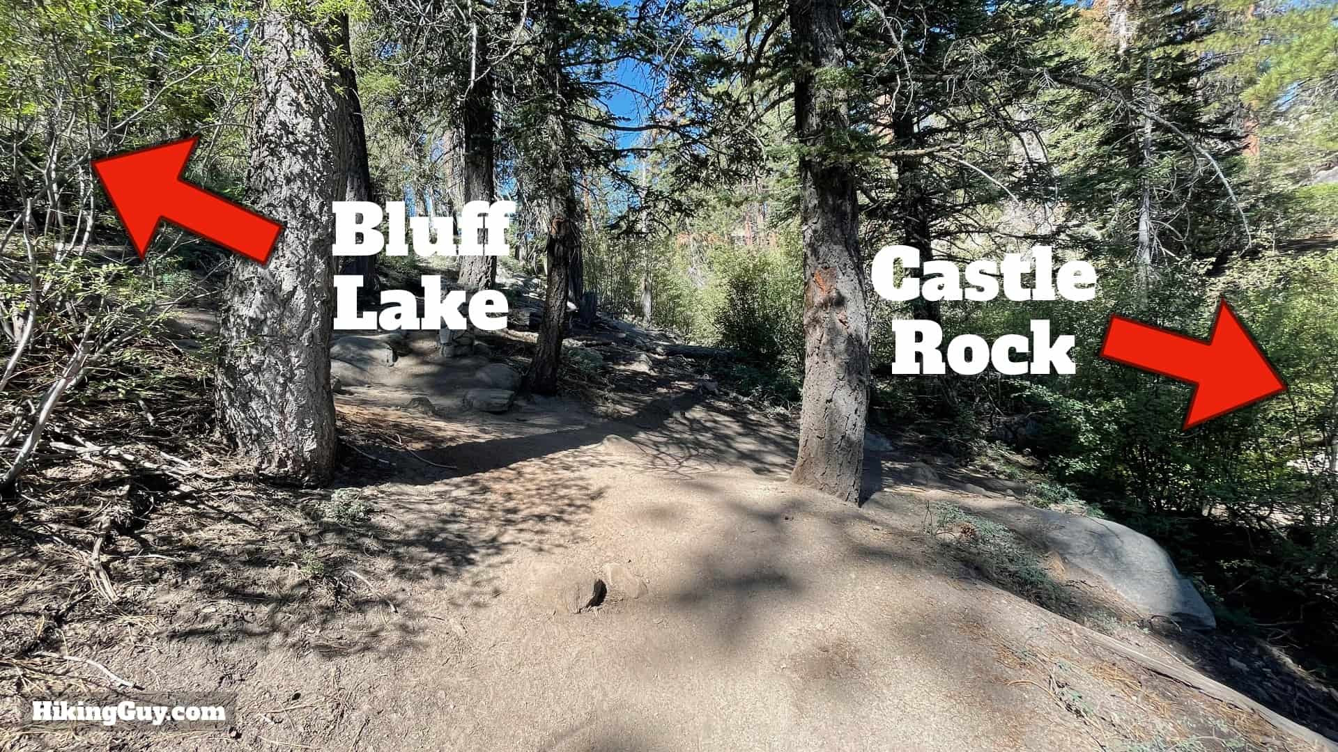
 Castle Rock boulder formation visible on the trail
- Castle Rock itself, a prominent boulder formation rising approximately 100 feet, will be visible on your right. The trail curves to the left of Castle Rock.
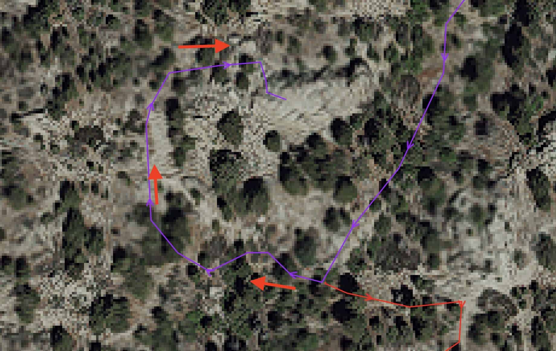 Map showing loop around Castle Rock summit
- Follow the trail as it loops around to the far side of Castle Rock, staying on the main path and avoiding any side trails.
 Trail leading around Castle Rock
- Continue around Castle Rock to its opposite side.
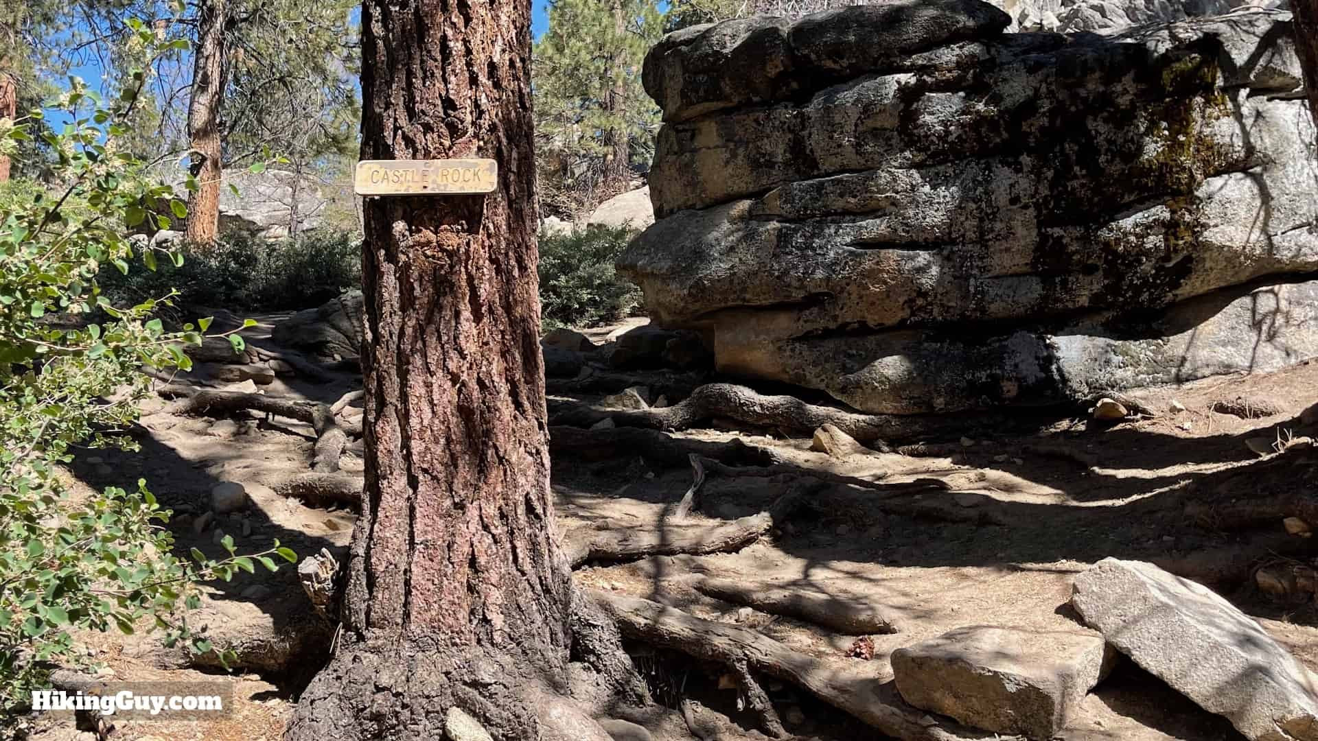
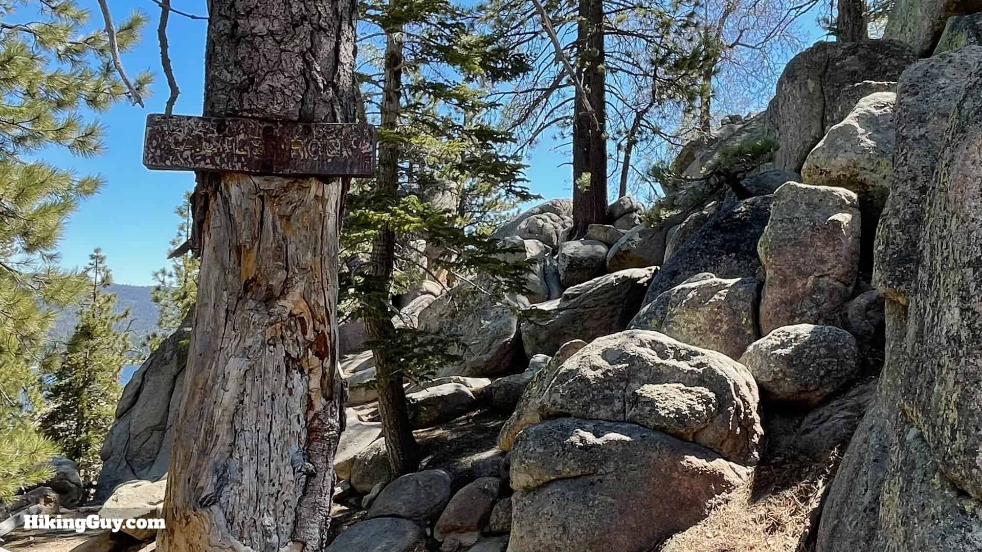 Sign indicating arrival at Castle Rock viewpoint
- An older trail sign will signal your arrival at the Castle Rock viewpoint.
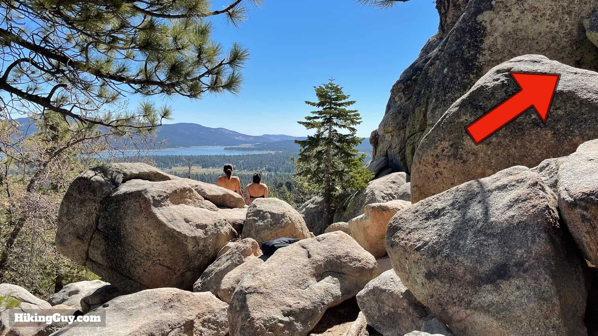 Viewpoint at Castle Rock overlooking Big Bear Lake
- Proceed straight ahead to reach the main viewpoint area, offering expansive views of Big Bear Lake. To scramble to the summit of Castle Rock, you’ll need to backtrack slightly to your right.
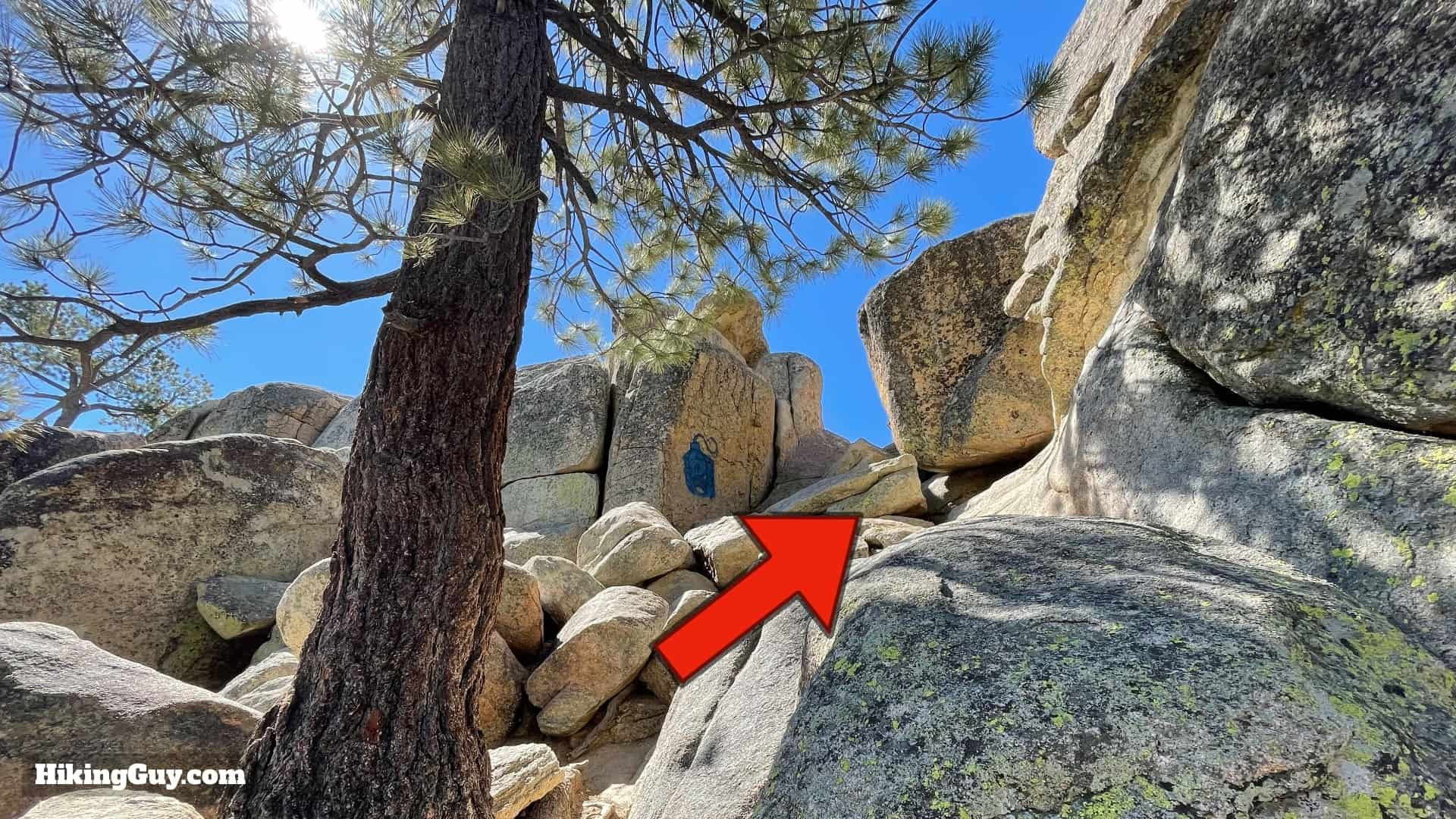 Notch for scrambling to the top of Castle Rock
- If you are interested in scrambling to the very top of Castle Rock, look for a notch located behind the main viewpoint area.
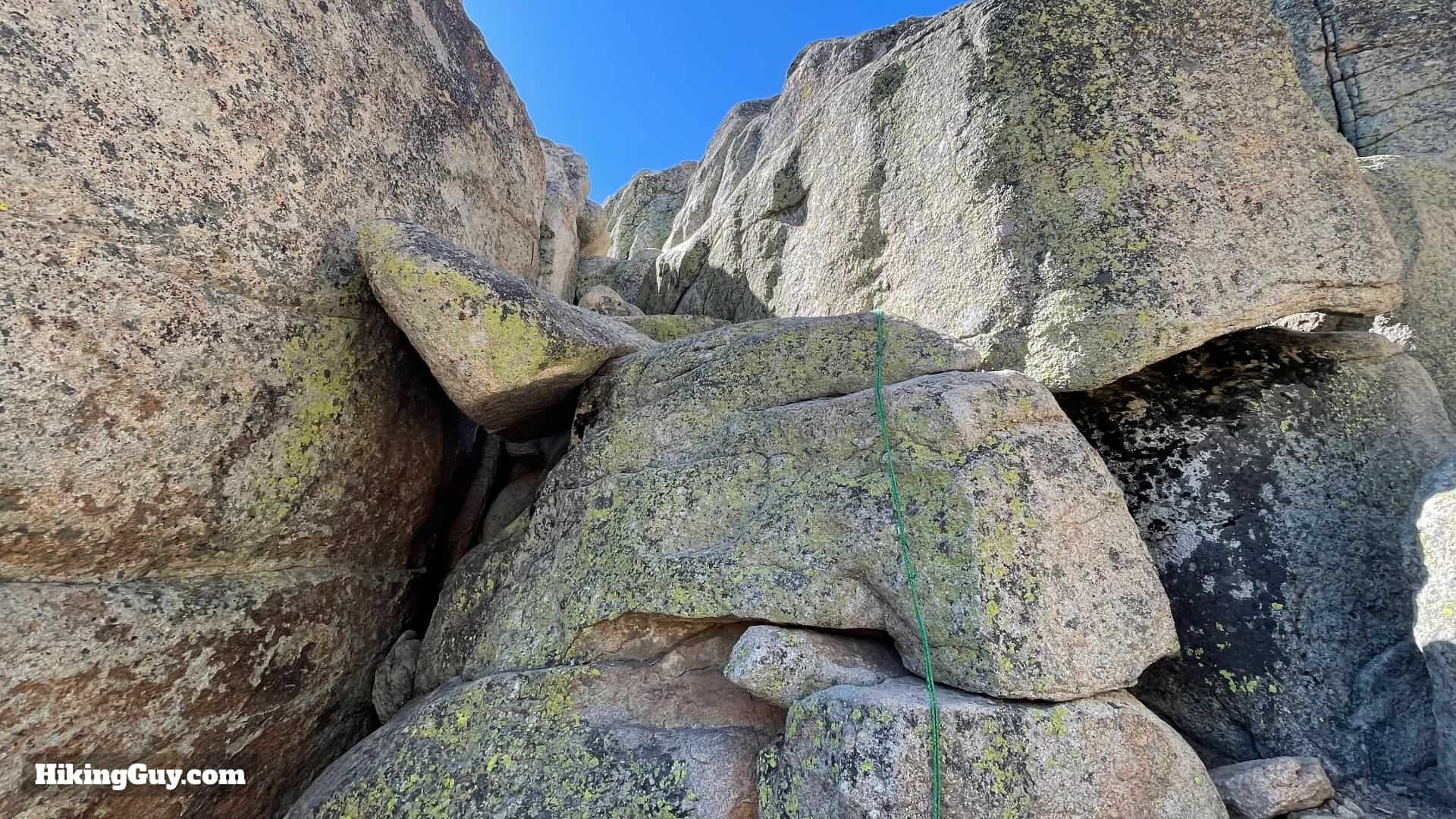 Rope assist for scrambling to the top of Castle Rock
- A rope is available to assist with the initial part of the scramble. Following this, another challenging boulder must be navigated. This final scramble is not recommended for children and may be skipped by many adults. If you are not comfortable with this type of climb, it’s best to admire the views from the established viewpoint below.
After enjoying the panoramic scenery from Castle Rock, return to the T-junction encountered earlier to either head back or continue to Bluff Lake.
Optional Extension to Bluff Lake
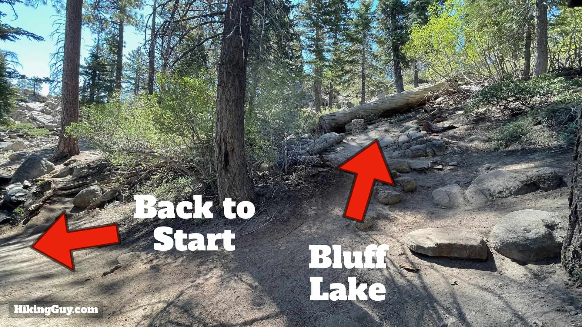 Junction to return or continue to Bluff Lake on Castle Rock Trail
- At the junction, to return to the trailhead, turn left and follow the stone markers back down, retracing your steps. To extend your hike to Bluff Lake, proceed straight ahead.
 Steep section towards Bluff Lake from Castle Rock Trail
- The initial part of the trail towards Bluff Lake is steep and continues to be marked by stone bins.
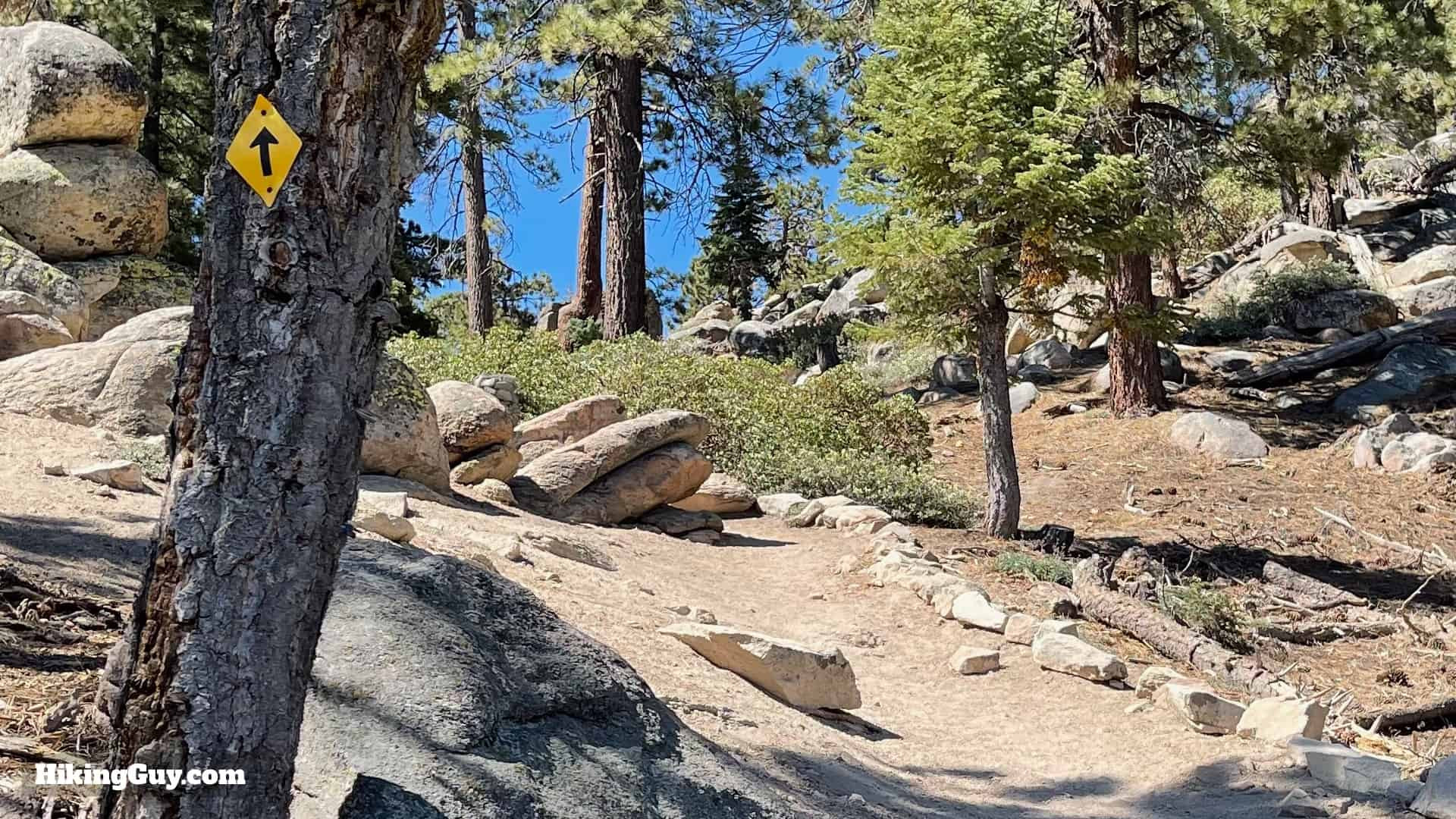 Yellow trail markers appearing on the path to Bluff Lake
- As you progress towards Bluff Lake, the stone markers become less frequent, and you’ll start to see yellow trail markers affixed to trees, guiding your way.
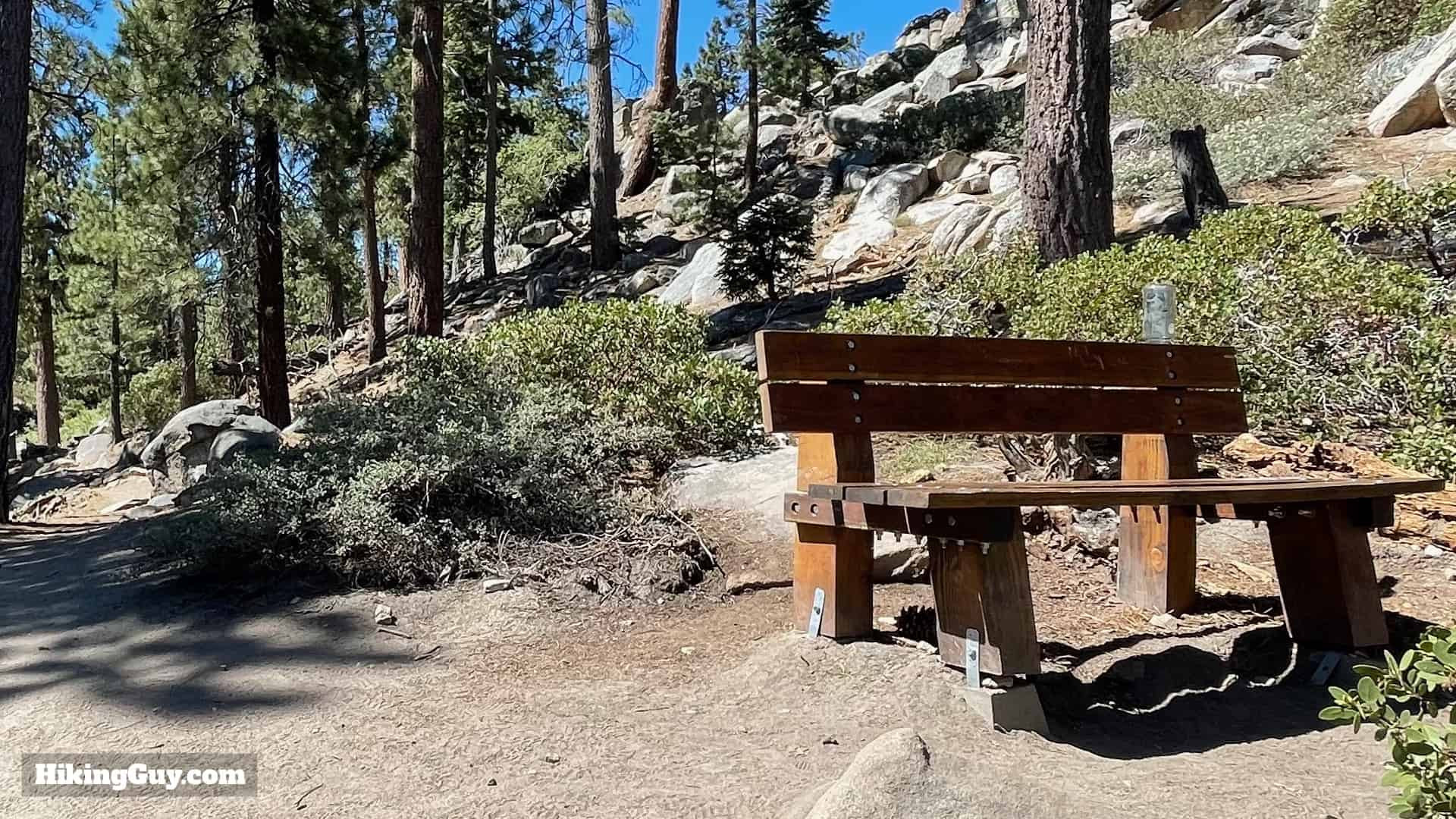 Bench with views of Castle Rock on the way to Bluff Lake
- You’ll pass a bench that provides a scenic spot to rest and look back at Castle Rock.
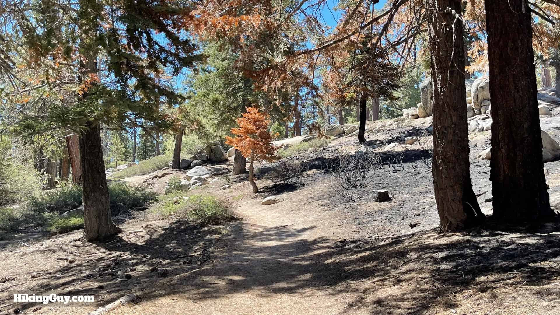 Level trail section towards Bluff Lake
- Shortly after the bench, the trail levels out, becoming a gently rolling and much easier walk. The majority of the climbing is now complete.
 Castle Rock Trail ending at Kidd Creek Rd
- The Castle Rock Trail section officially ends at Kidd Creek Rd (Forest Service Road 2N86). Turn right onto this dirt road.
 Kidd Creek Rd towards Bluff Lake
- Kidd Creek Rd (2N86) is flat and easy to walk, continuing your path towards Bluff Lake.
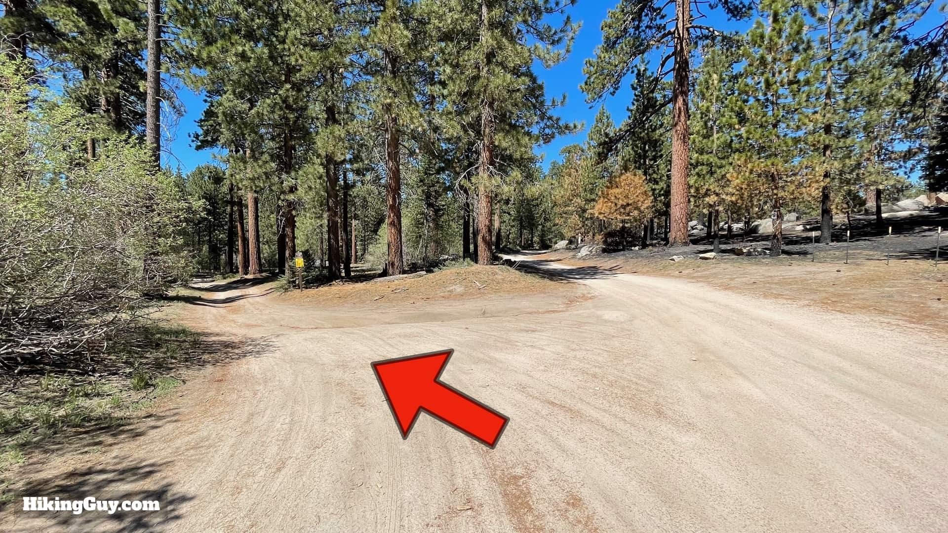 Bear left at the split on Kidd Creek Rd to Bluff Lake
- At a fork in the road, bear left to stay on course for Bluff Lake.
 Road leading to Bluff Lake Reserve and cabin
- The road will lead to a dead-end at a small cabin. Hike in the direction of the cabin.
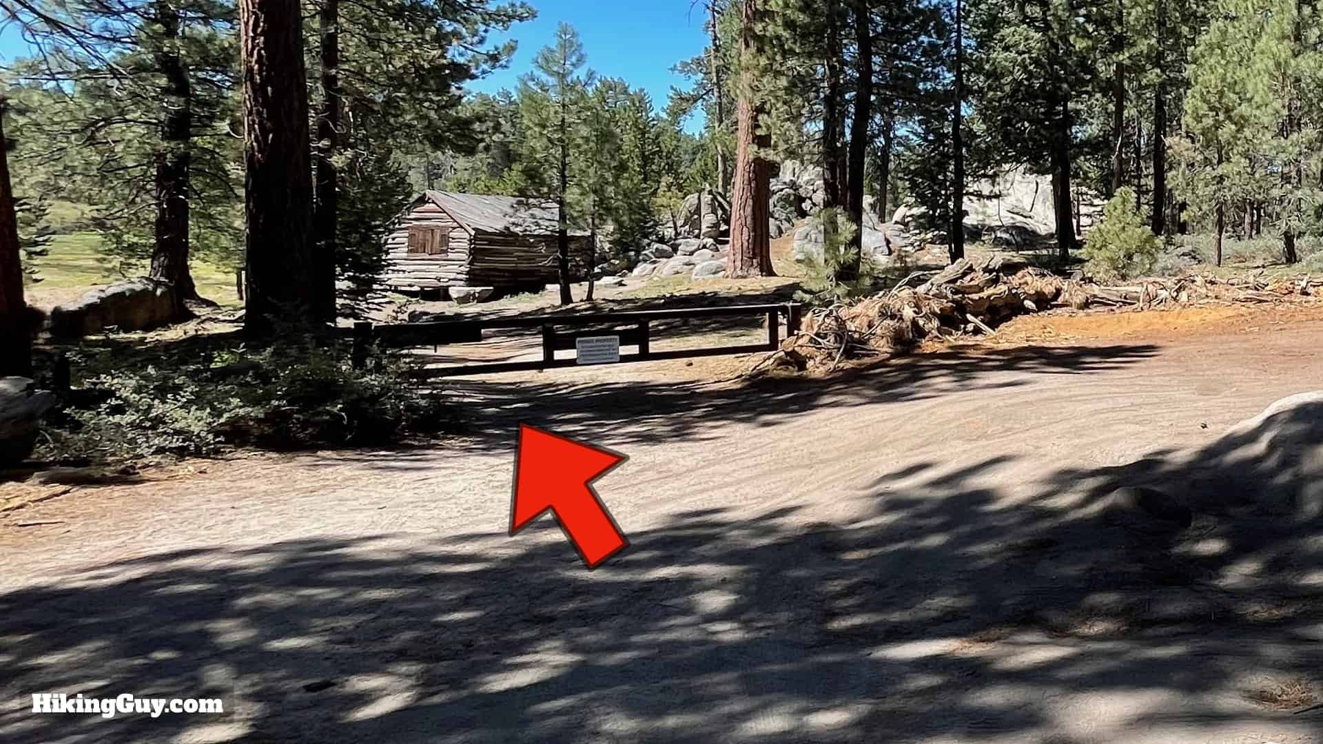
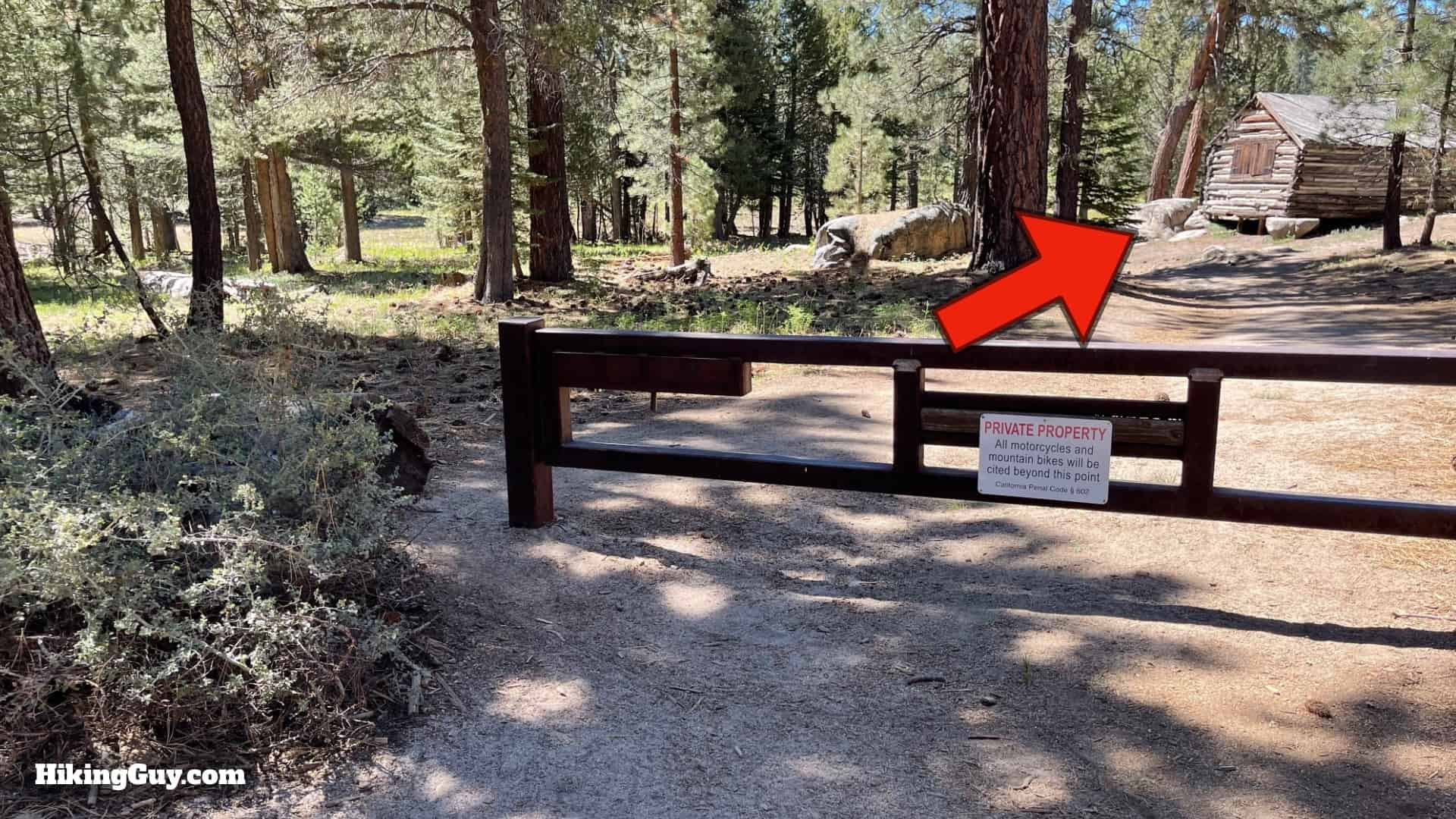 Gate to Bluff Lake Reserve
- Proceed through the gate to enter Bluff Lake Reserve. The “private property” signs are intended to deter vehicles, not hikers on foot.
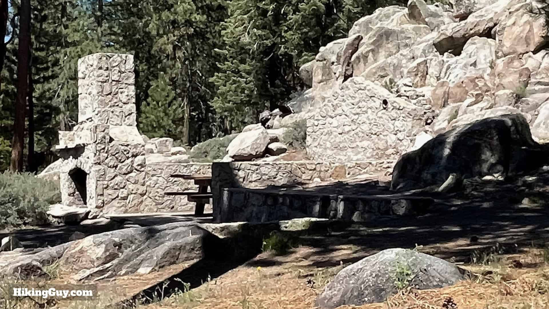 Remains of John Healy Williams's cabin at Bluff Lake
- You’ll pass the remnants of John Healy Williams’s cabin. Williams was a pastor at the historic Bluff Lake Resort, which operated from the 1890s. The cabin was unfortunately destroyed by fire in the 1950s.
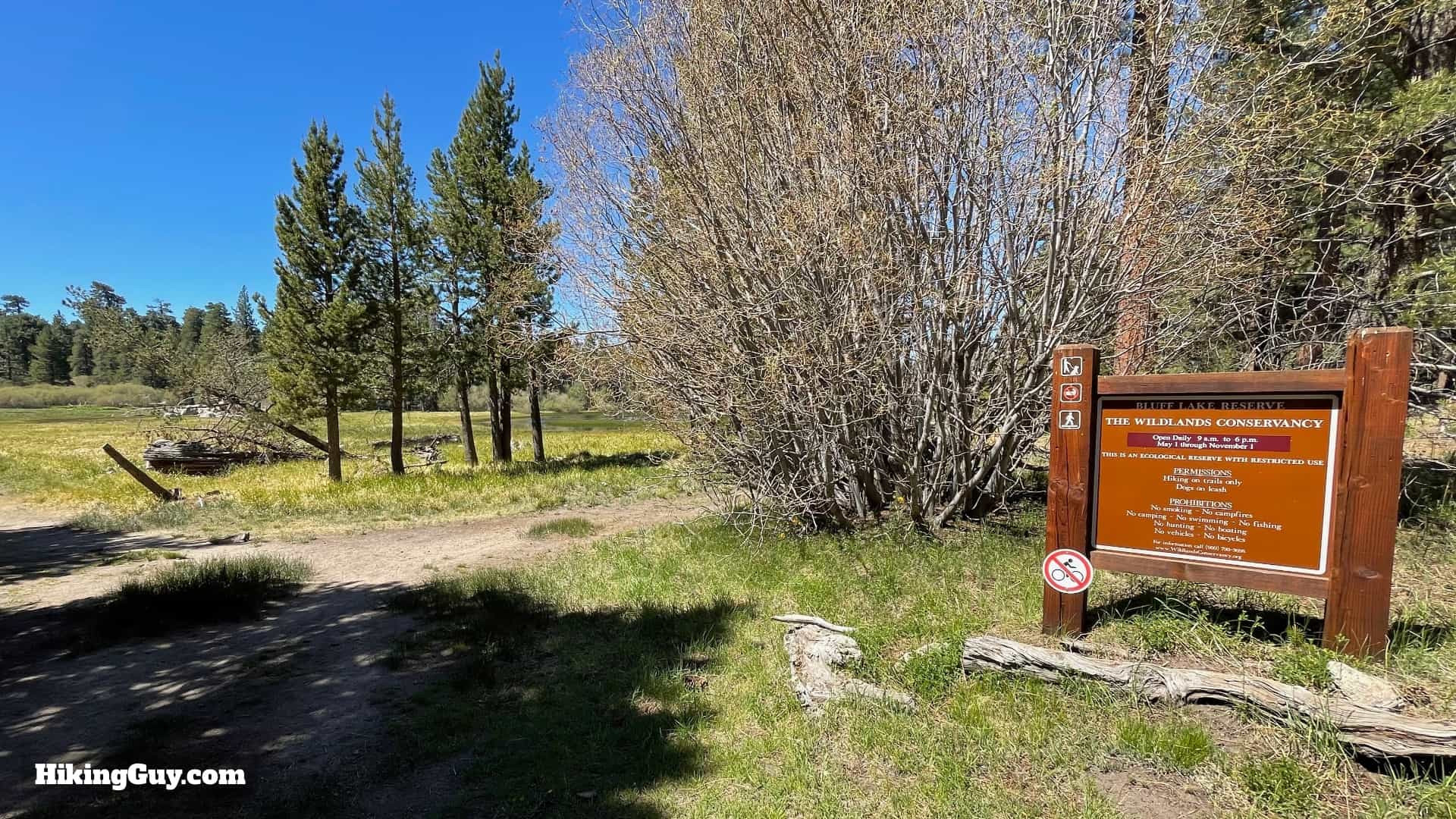 Sign for Wildlands Conservancy at Bluff Lake Reserve
- You’ll see a sign for the park, which is now owned and protected by the Wildlands Conservancy.
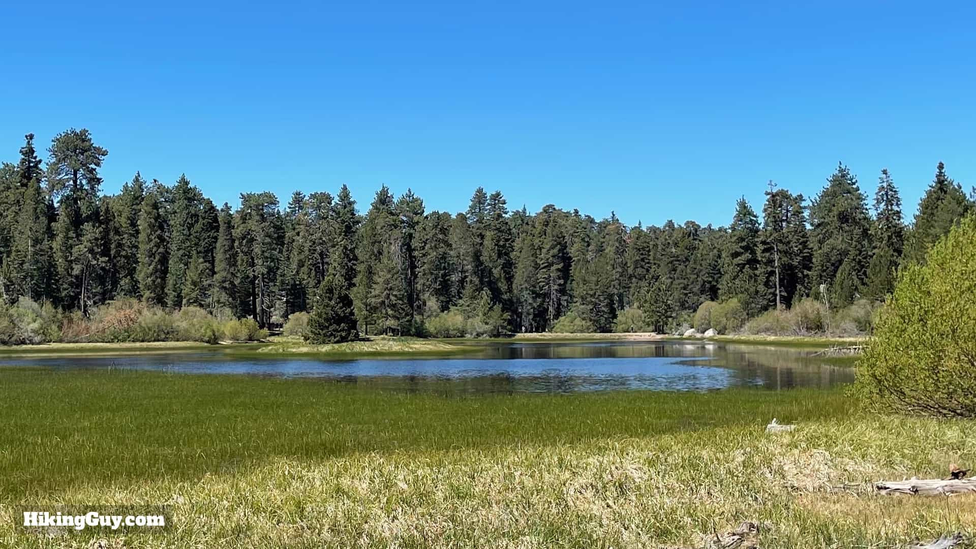 Bluff Lake in Big Bear
- Explore Bluff Lake and its surroundings. Interestingly, the lake was intentionally drained during conservation efforts to eliminate invasive species. For movie trivia enthusiasts, the area might look familiar as it served as a filming location for Dr. Doolittle 2.
After enjoying Bluff Lake, simply return by retracing your route back to the Castle Rock Trailhead.
Conclusion
The Castle Rock Trail, with its challenging ascent and breathtaking summit views, stands as a testament to the rugged beauty of the Big Bear region. The unique rock formations, culminating in the iconic Castle Rock itself, offer a rewarding experience for geology enthusiasts and casual hikers alike. Whether you choose to conquer just the Castle Rock viewpoint or extend your adventure to the historically rich Bluff Lake, this hike promises a memorable outdoor experience. Lace up your boots, embrace the climb, and discover the stunning natural artistry of the Castle Rock Trail. For more trails featuring remarkable rock formations and scenic vistas, explore other destinations on rockscapes.net.