Eagle Rock Ca, located along the Pacific Crest Trail (PCT) near Warner Springs, is a breathtaking granite formation resembling a giant eagle with outstretched wings. This hike offers a diverse landscape, from oak-lined creeks to chaparral and grassy hills, appealing to a wide range of hikers. This guide will provide a detailed overview of the Eagle Rock hike, including directions, trail conditions, and what to expect along the way.
Exploring the Eagle Rock Trail
The Eagle Rock trailhead is conveniently located near Highway 79 in Warner Springs, making it accessible for a day trip. The trail begins across from the Warner Springs Fire Station, where the PCT crosses the road. Hikers should park on the wide gravel shoulder opposite the fire station and look for the marked metal pipe gate on the southwest side.
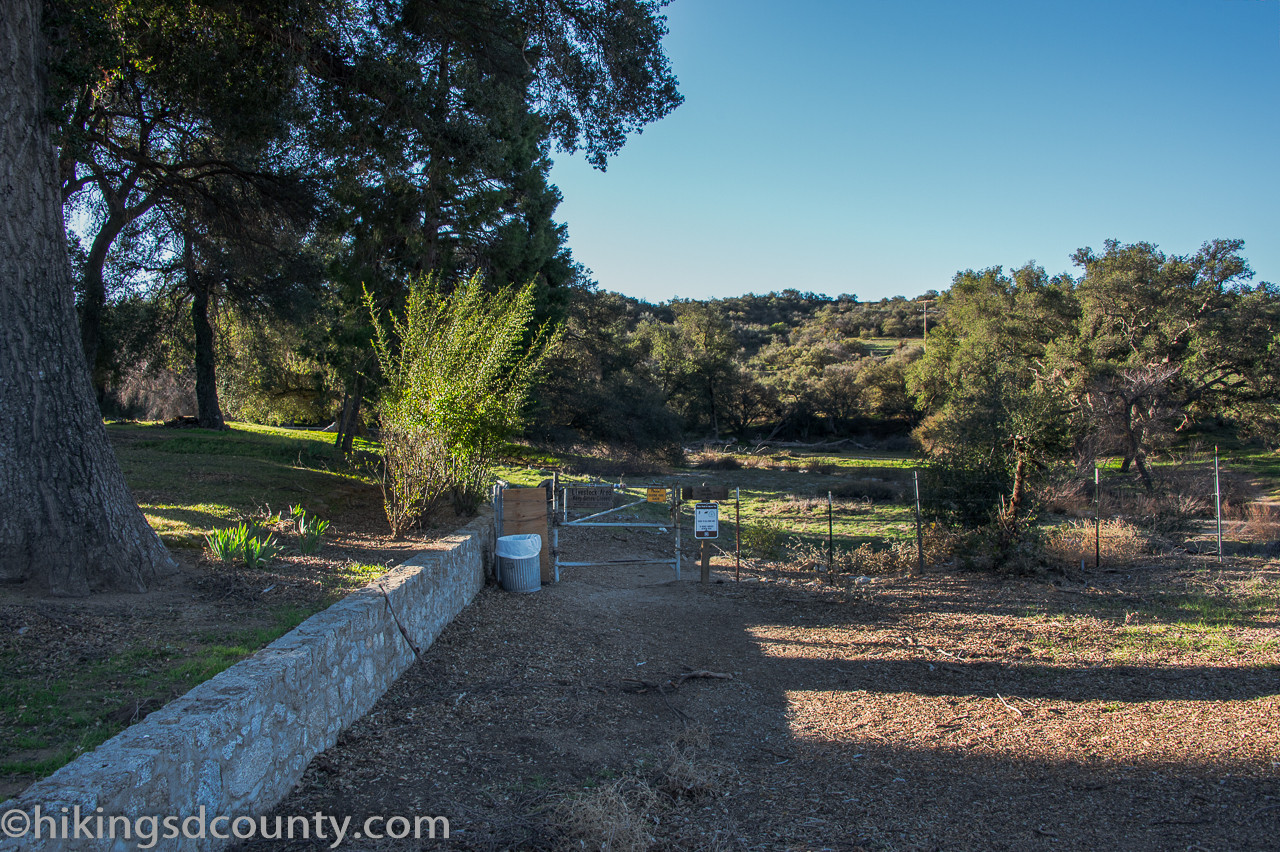 alt text: Hikers starting their journey on the PCT near Warner Springs Fire Station toward Eagle Rock.
The initial section of the trail meanders through a shaded oak woodland, crossing a dry stream bed before veering away from the highway.
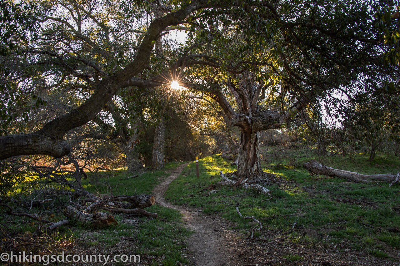 alt text: The PCT trail near Eagle Rock, shaded by oak trees and lined with lush green grass.
At about a quarter mile, hikers will pass through another gate, where the California Riding and Hiking Trail (CR&HT) branches off to the left. Continuing straight on the PCT, you’ll encounter a few more gates (ignoring any “No Trespassing” signs as there’s a public easement for the trail). Soon, the tranquil sounds of Cañada Verde Creek will greet you, offering a refreshing respite.
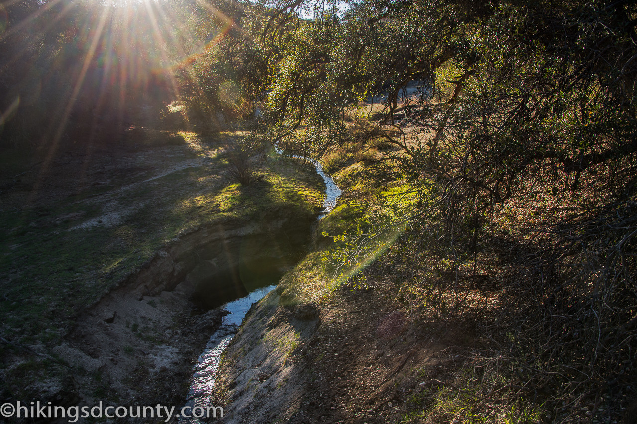 alt text: A picturesque view of Cañada Verde Creek along the Eagle Rock hiking trail.
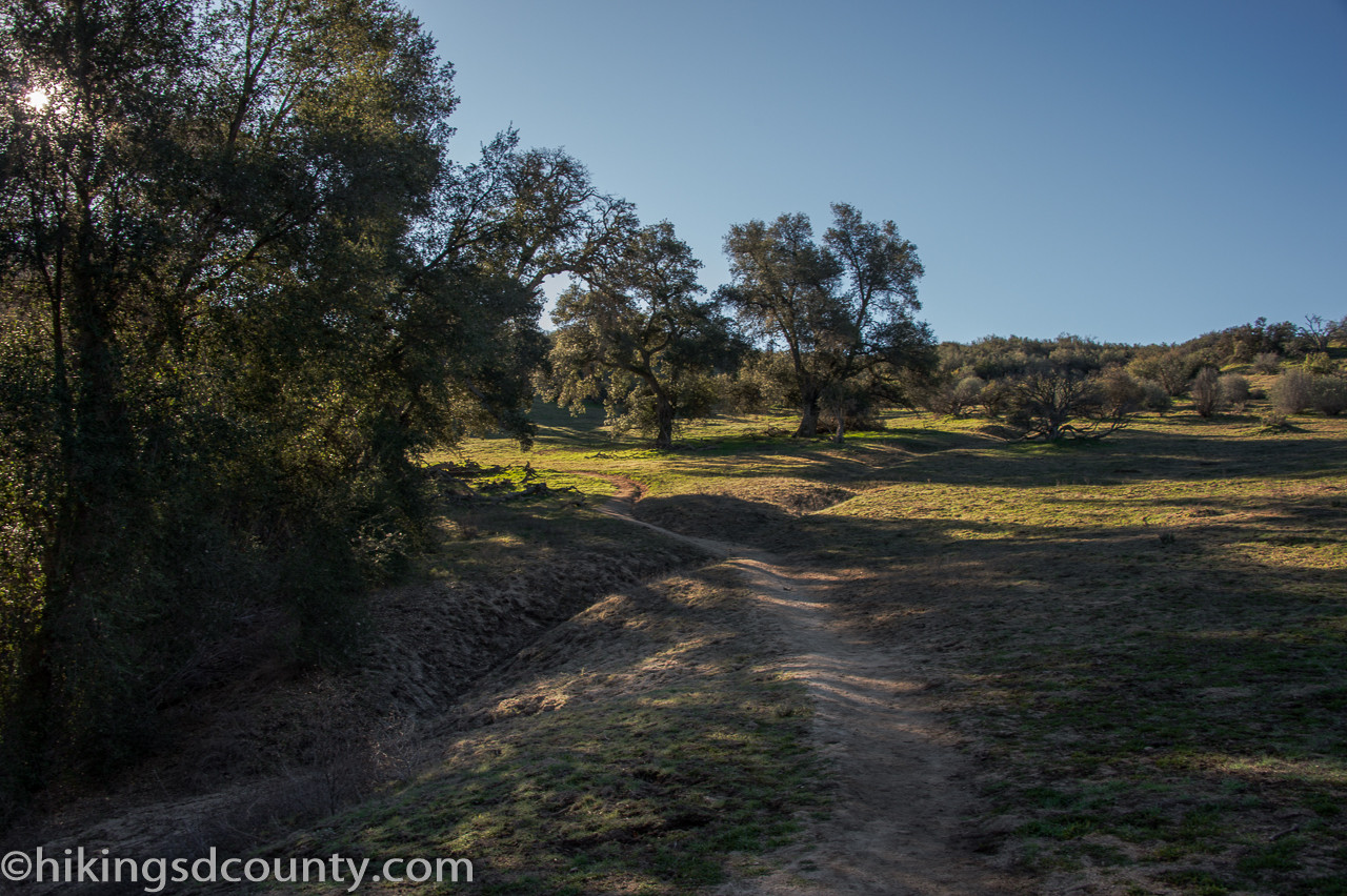
The trail gently ascends alongside the creek, passing through more oak-covered areas and grassy hillsides teeming with wildlife.
 alt text: A squirrel spotted along the Eagle Rock trail in a grassy, oak-covered area.
Around 1.6 miles, the landscape opens up to wider grassy expanses with panoramic views of the surrounding hills. As the oaks give way to chaparral, you might even catch a glimpse of the Palomar Mountain Observatory and fire lookout in the distance.
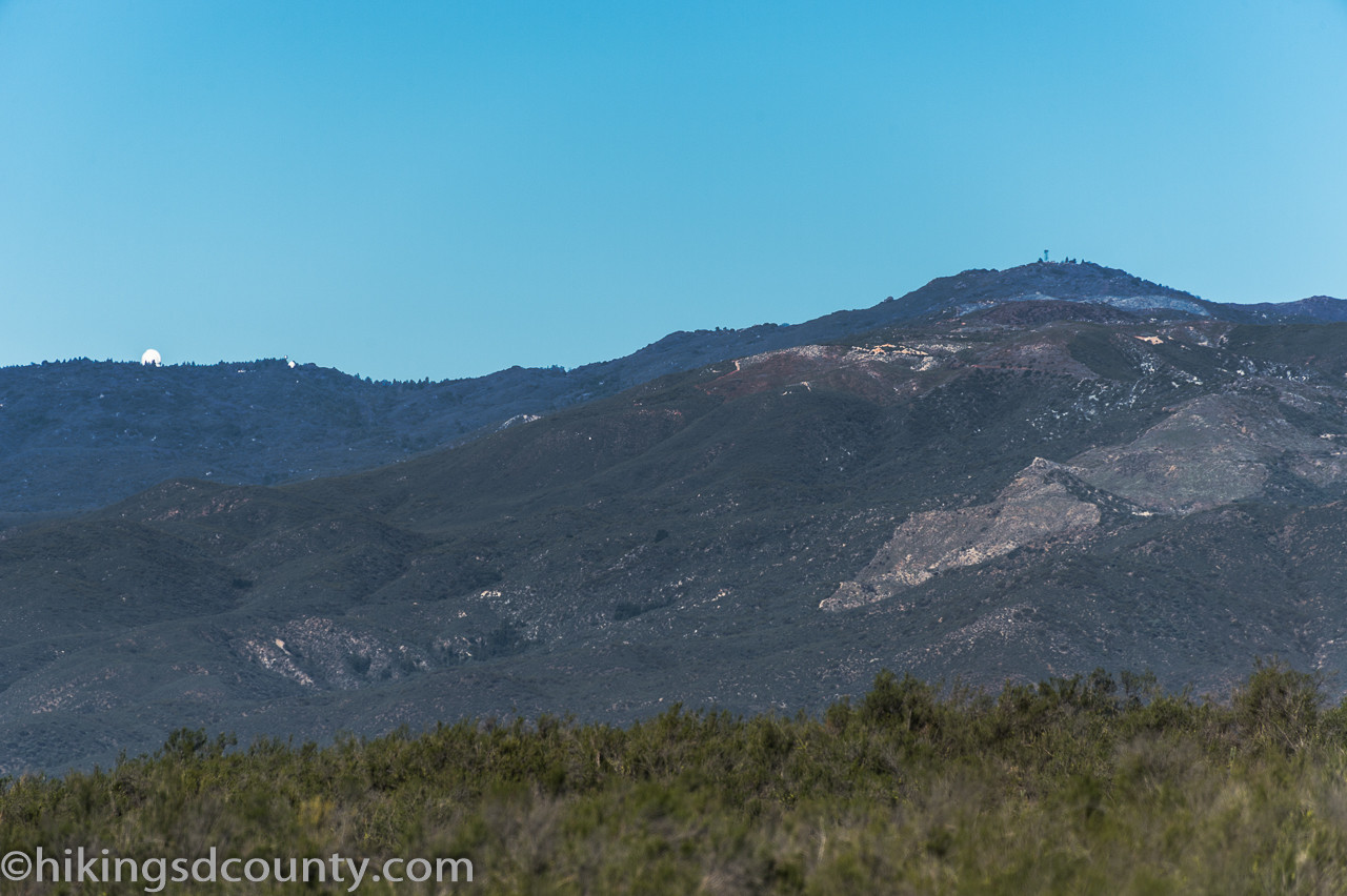 alt text: A distant view of the Palomar Observatory from the Eagle Rock trail.
The final stretch of the trail traverses rolling grasslands dotted with boulders, eventually leading to the majestic Eagle Rock formation at around 3.2 miles. A short use trail to the left leads to the base of Eagle Rock.
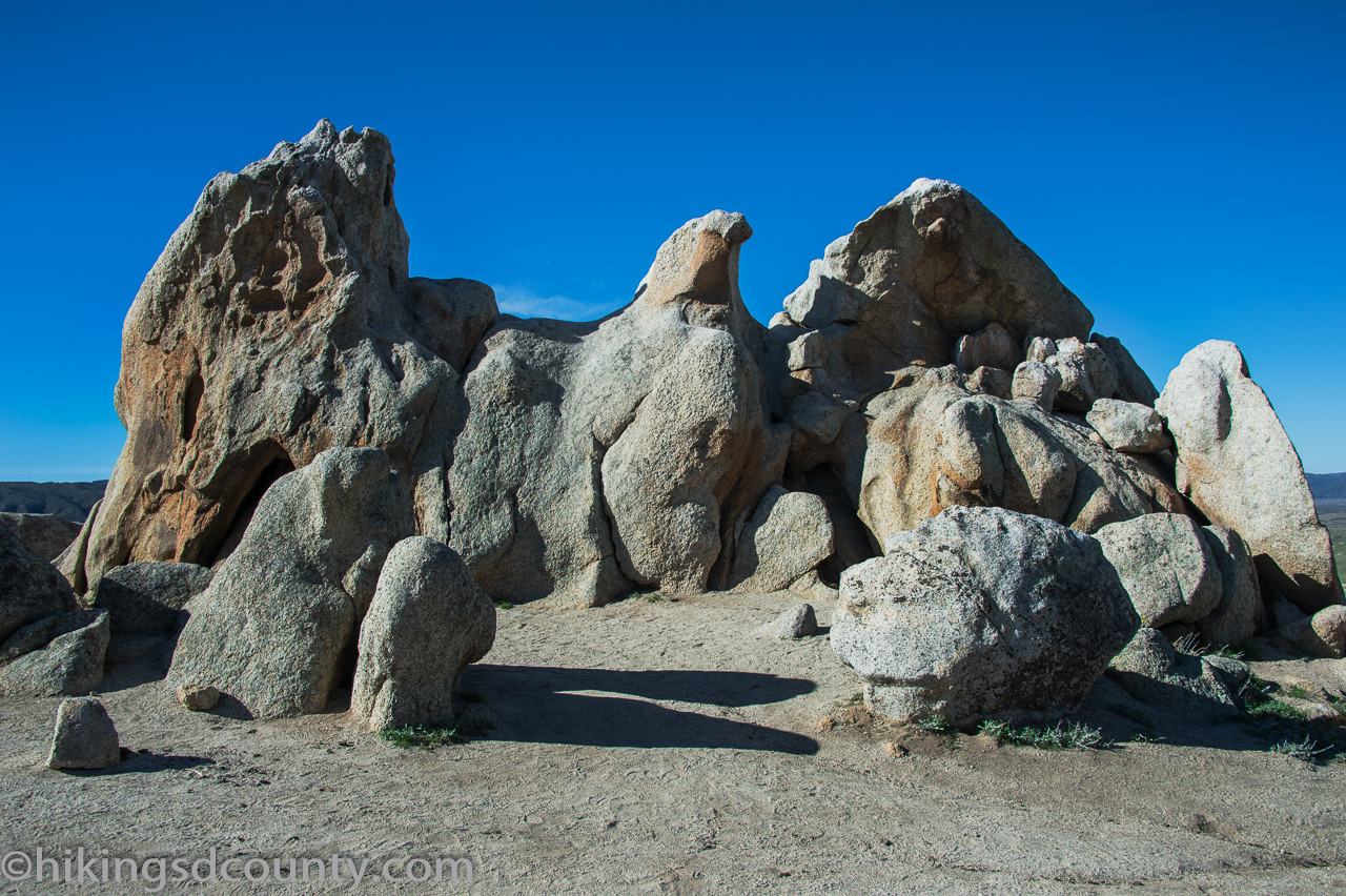 alt text: The impressive Eagle Rock formation in Warner Springs, California.
Reaching the Summit: Eagle Rock CA
Reaching Eagle Rock is a rewarding experience, offering stunning views and a chance to explore the unique rock formations. The area is also home to grazing cattle, so be mindful of your surroundings and leave no trace.
Conclusion
The hike to Eagle Rock CA is a moderately challenging but rewarding adventure. The diverse scenery and the impressive rock formation itself make it a worthwhile destination for hikers of all levels. Remember to bring plenty of water, wear appropriate footwear, and be prepared for varying weather conditions. The out-and-back hike is approximately 6.5 miles with an elevation gain of 988 feet. Enjoy the journey and the breathtaking views at the summit!