Nestled in the Cascade Mountains of Washington State, the Goat Rocks Wilderness offers a stunning landscape of rugged peaks, vibrant meadows, and pristine alpine lakes. Bordered by the iconic Mount Rainier and Mount Adams, this wilderness area is a haven for hikers and nature enthusiasts seeking breathtaking scenery and challenging trails. Its growing popularity, especially amongst those from Southwest Washington and Portland, Oregon, highlights its accessible beauty and the increasing pressure on its trails.
The Goat Rocks Wilderness is facing challenges due to reduced public funding, leading to trail and road deterioration. Organizations like WTA (Washington Trails Association) are actively involved in the “Lost Trails Found” campaign, prioritizing the Goat Rocks to advocate for and restore trails, ensuring their accessibility for future generations.
Despite these challenges, numerous trails within the Goat Rocks Wilderness remain open and ready to explore, offering incredible hiking experiences. Here are ten exceptional trails that provide a glimpse into the diverse and magnificent terrain of the Goat Rocks region.
Explore the Eastern Goat Rocks Wilderness Trails
Surprise Lake Trail
Mileage: 13.0 miles roundtrip
Elevation Gain: 1505 feet
Highest Point: 5260 feet
The Surprise Lake trail is a less frequented path that meanders through diverse landscapes, starting with wildflower-strewn meadows and transitioning into dense forests. As you approach Surprise Lake, the trail opens up to reveal breathtaking alpine clearings. The lake itself, a jewel nestled in the mountains, is framed by the dramatic, craggy peaks that define the Goat Rocks Wilderness, offering a quintessential alpine vista.
> Plan your trip to Surprise Lake using WTA’s Hiking Guide
Bear Creek Mountain Trail
Mileage: 7.0 miles roundtrip
Elevation Gain: 1237 feet
Highest Point: 7337 feet
Embark on the Bear Creek Mountain trail, leading you to the third-highest accessible trail for hikers in the Goat Rocks Wilderness. After crossing the charming Bear Creek, the trail winds through a vibrant meadow bursting with a wide array of wildflowers. Discover monkeyflower, daisies, lupine, and delicate buttercups painting the landscape with color. Ascending further, you’ll reach the site of a former fire lookout, now offering unobstructed 360-degree views encompassing Mount Adams, Mount Rainier, the imposing Goat Rocks, and the rolling countryside stretching north and east.
> Plan your trip to Bear Creek Mountain using WTA’s Hiking Guide
Round Mountain Trail
Mileage: 5.2 miles roundtrip
Elevation Gain: 1700 feet
Highest Point: 5970 feet
The Round Mountain trail provides a short yet rewarding hike, ideal for a half-day exploration of the Goat Rocks Wilderness. Its accessibility makes it a great option for visitors staying at nearby resorts, or as an addition to a longer hiking day. It can also be incorporated as part of a thru-hike or a side trip while traversing the Pacific Crest Trail (PCT). Despite being a relatively easy destination, Round Mountain offers impressive views and a taste of the Goat Rocks’ beauty.
> Plan your trip to Round Mountain using WTA’s Hiking Guide
Shoe Lake Trail
Mileage: 15.7 miles roundtrip
Elevation Gain: 2500 feet
Highest Point: 6600 feet
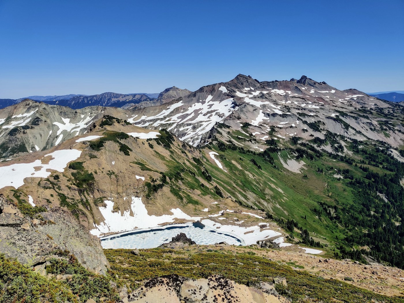
 Shoe Lake trail in Goat Rocks Wilderness presenting a serene alpine lake surrounded by forests and peaks
Challenge yourself with a day hike to Shoe Lake, a stunning destination that perfectly introduces the grandeur of the Goat Rocks wilderness. While camping is prohibited at Shoe Lake itself, its allure encourages hikers to venture deeper into the backcountry for overnight stays. The trail features a gentle to moderate grade, allowing for a quicker pace, and unfolds scenic vistas along the way. Begin in deep green woods, transition into fragrant, airy forests, and finally emerge onto an alpine traverse that dramatically reveals the Shoe Lake basin and the majestic Goat Rocks peaks beyond.
> Plan your trip to Shoe Lake using WTA’s Hiking Guide
Explore the Western Goat Rocks Wilderness Trails
Heart Lake via Lily Basin Trail
Mileage: 13.0 miles roundtrip
Elevation Gain: 1900 feet
Highest Point: 6148 feet
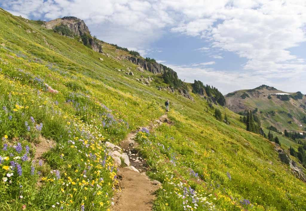 Lily Basin trail in Goat Rocks Wilderness displaying alpine meadows, wildflowers, and mountain backdrop
The Heart Lake via Lily Basin trail is an alpine adventure offering a quintessential wilderness experience. Hikers will encounter a diverse range of natural beauty, including expansive meadows, vibrant wildflower displays, tranquil lakes, and towering snow-capped peaks. Wildlife sightings are also common in this rich ecosystem. The trail eventually intersects with the Angry Mountain trail, but initially guides hikers through the upper reaches of Lily Basin and to the pristine headwaters of Glacier Creek, showcasing the raw beauty of the Goat Rocks.
> Plan your trip to Heart Lake via Lily Basin using WTA’s Hiking Guide
Angry Mountain Trail
Mileage: 16.8 miles roundtrip
Elevation Gain: 3409 feet
Highest Point: 6049 feet
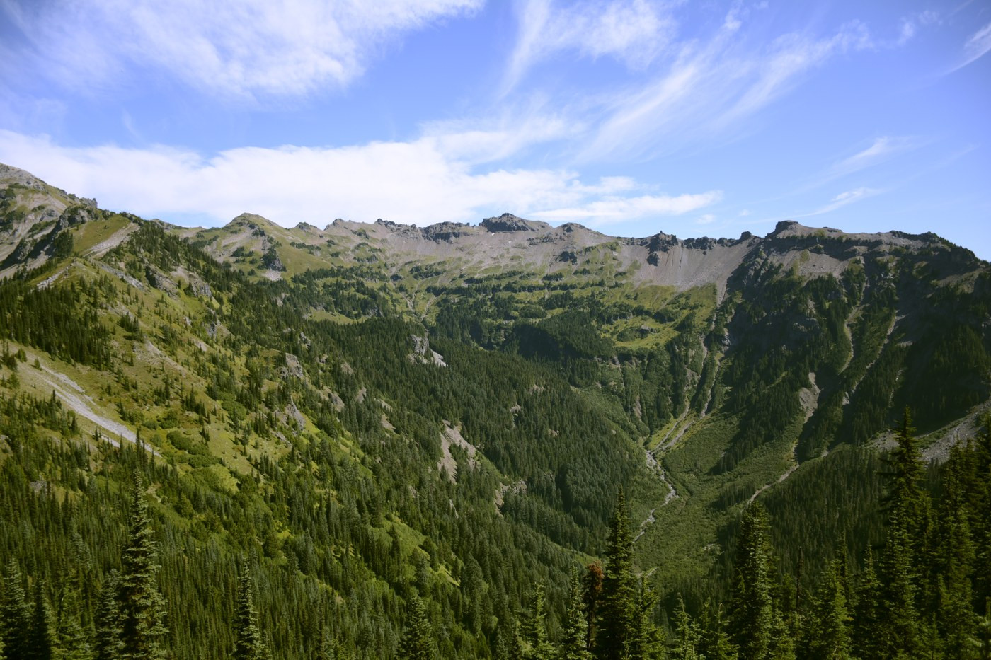 Angry Mountain trail in Goat Rocks Wilderness showing challenging terrain and remote wilderness scenery
For hikers seeking solitude and a true adventure, the Angry Mountain trail beckons. Be prepared for potentially challenging trail conditions that might justify the mountain’s evocative name. The ascent from Forest Road 21 is steep and demanding, but the reward is substantial. Miles into the hike, you’ll reach the ridge crest that divides two glaciated valleys, revealing a remote and stunning landscape. This trail embodies the wild and less-traveled aspects of the Goat Rocks Wilderness.
> Plan your trip to Angry Mountain using WTA’s Hiking Guide
Goat Lake Trail
Mileage: 12.0 miles roundtrip
Elevation Gain: 2000 feet
Highest Point: 6600 feet
 Goat Lake trail in Goat Rocks Wilderness featuring a hiker at a pristine alpine lake surrounded by rocky terrain
The Goat Lake trail begins in cool, shaded thick forests, offering a pleasant start before opening into sun-drenched meadows after the first junction. These meadows accompany you as you ascend to the ridge top, where you are rewarded with panoramic views of the Jordan Creek Basin to the west and the Goat Creek basin to the east. Continuing onward, you’ll arrive at Goat Lake, a refreshing, cold lake nestled beneath a dramatic rocky outcrop, a perfect spot to appreciate the high alpine environment.
> Plan your trip to Goat Lake using WTA’s Hiking Guide
Glacier Lake Trail
Mileage: 4.0 miles roundtrip
Elevation Gain: 800 feet
Highest Point: 2905 feet
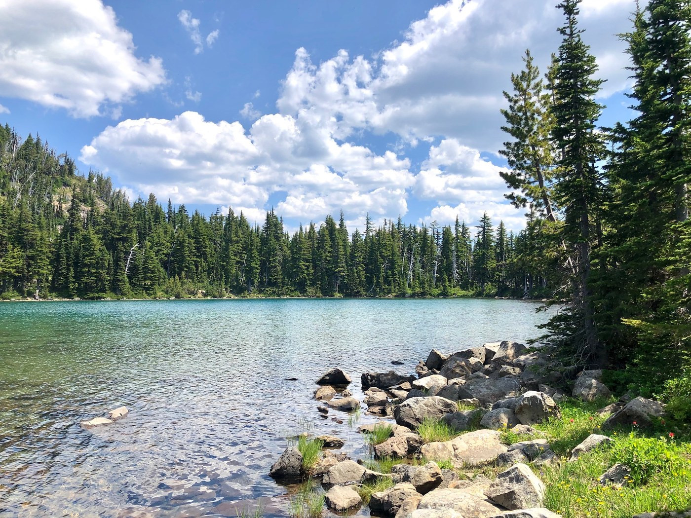
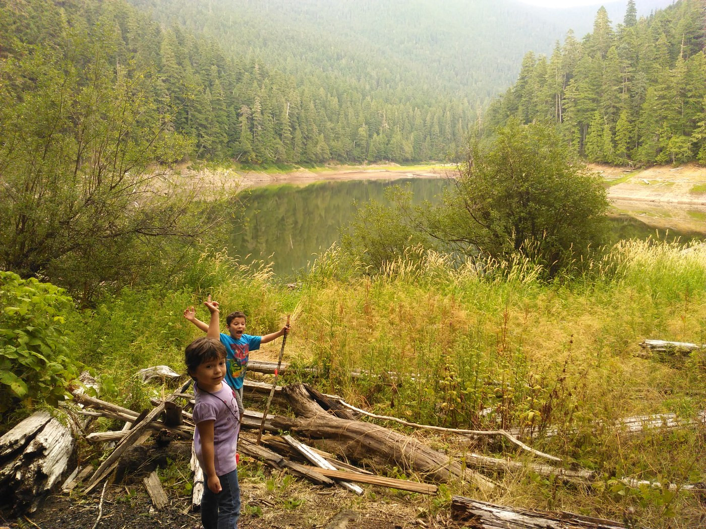 Glacier Lake trail in Goat Rocks Wilderness presenting an accessible lake suitable for families and fishing
While the Goat Rocks is known for its strenuous hikes, the Glacier Lake trail offers an accessible and enjoyable option, perfect for families and hikers with young children. With only a 2-mile hike to reach the lake, it maximizes lake time for relaxation, swimming, or even fishing. Along the trail, enjoy the abundance of huckleberries and the diverse ecological environment, making it a delightful and easy wilderness experience within the Goat Rocks.
> Plan your trip to Glacier Lake using WTA’s Hiking Guide