Pumpkin Rock is more than just a boulder; it’s a Southern California landmark that beckons hikers, especially during the Halloween season. This easy but quirky trail leads to a giant rock painted like a pumpkin, offering fantastic photo opportunities and a memorable outdoor experience. While the trail to Pumpkin Rock might seem straightforward, navigating the Norco Hills trails can be a bit confusing. This comprehensive guide provides you with the essential route, complete with parking information and nearby restroom facilities, ensuring a smooth and enjoyable hike.
Pumpkin Rock presents a mixed experience, making it an adventure worth undertaking at least once. On one hand, it’s a relatively family-friendly hike, captivating children with its playful pumpkin visage and manageable trail length. However, the area around the rock can sometimes be marred by broken glass and litter, and occasionally, inappropriate graffiti may appear on the rock itself. Despite these minor drawbacks, the unique appeal of Pumpkin Rock and the surrounding natural beauty make it a worthwhile destination.
Unveiling the Mystery: What is Pumpkin Rock?
 Pumpkin Rock Jack Skellington: Discover the iconic pumpkin-shaped rock in Norco, California, painted as Jack Skellington from The Nightmare Before Christmas, a popular Halloween hiking destination.
Pumpkin Rock’s artistic inspiration stems from Jack Skellington, the beloved “Pumpkin King” from Halloween Town.
Pumpkin Rock is not your average boulder; it’s a massive rock transformed into a giant, grinning pumpkin, reminiscent of Jack Skellington, the iconic “Pumpkin King” from Tim Burton’s classic film, [The Nightmare Before Christmas](https://en.wikipedia.org/wiki/The_Nightmare_Before Christmas). Perched atop a ridge in Norco, California, Pumpkin Rock’s visibility from the highway has cemented its status as a local landmark over the years.
Long before its pumpkin makeover, the boulder was known as “elephant butt rock,” a nod to its large, gray form and a distinctive crack running down the middle. Throughout the years, this adaptable rock has been repainted in various guises, including a festive Christmas ornament and even a 76 gas station logo. The pumpkin version we know today first emerged in the mid-1990s and has become the most enduring and beloved iteration. Local residents diligently repaint Pumpkin Rock to maintain its cheerful appearance, often touching it up to cover any graffiti. It’s even been known for hikers to bring their own paint for touch-ups, showing the community love for this quirky landmark. The original artist behind the pumpkin transformation remains a delightful mystery – if you happen to know, feel free to share the information!
Plan Your Visit: Getting to the Pumpkin Rock Trailhead
For easy navigation, use this trailhead address: Norco Animal Control Shelter, Norco, CA, 92860, USA.
Conveniently, public restrooms are available just a short 2-minute drive from the trailhead parking area at Pikes Peak Park (111 Sixth St, Norco, CA 92860).
While several trails lead to Pumpkin Rock through Norco Hills’ extensive network, the recommended route offers distinct advantages. This path boasts ample parking, is easy to follow without any challenging scrambles, and provides the convenience of nearby restrooms, making it ideal for most hikers.
Be aware that Google Maps lists a “Pumpkin Rock Trailhead” location that differs from this recommended starting point. Choosing that alternative trailhead will lead you to a steeper ascent with street parking in a residential area and no restrooms nearby. Sticking to the directions provided here ensures a more hiker-friendly experience.
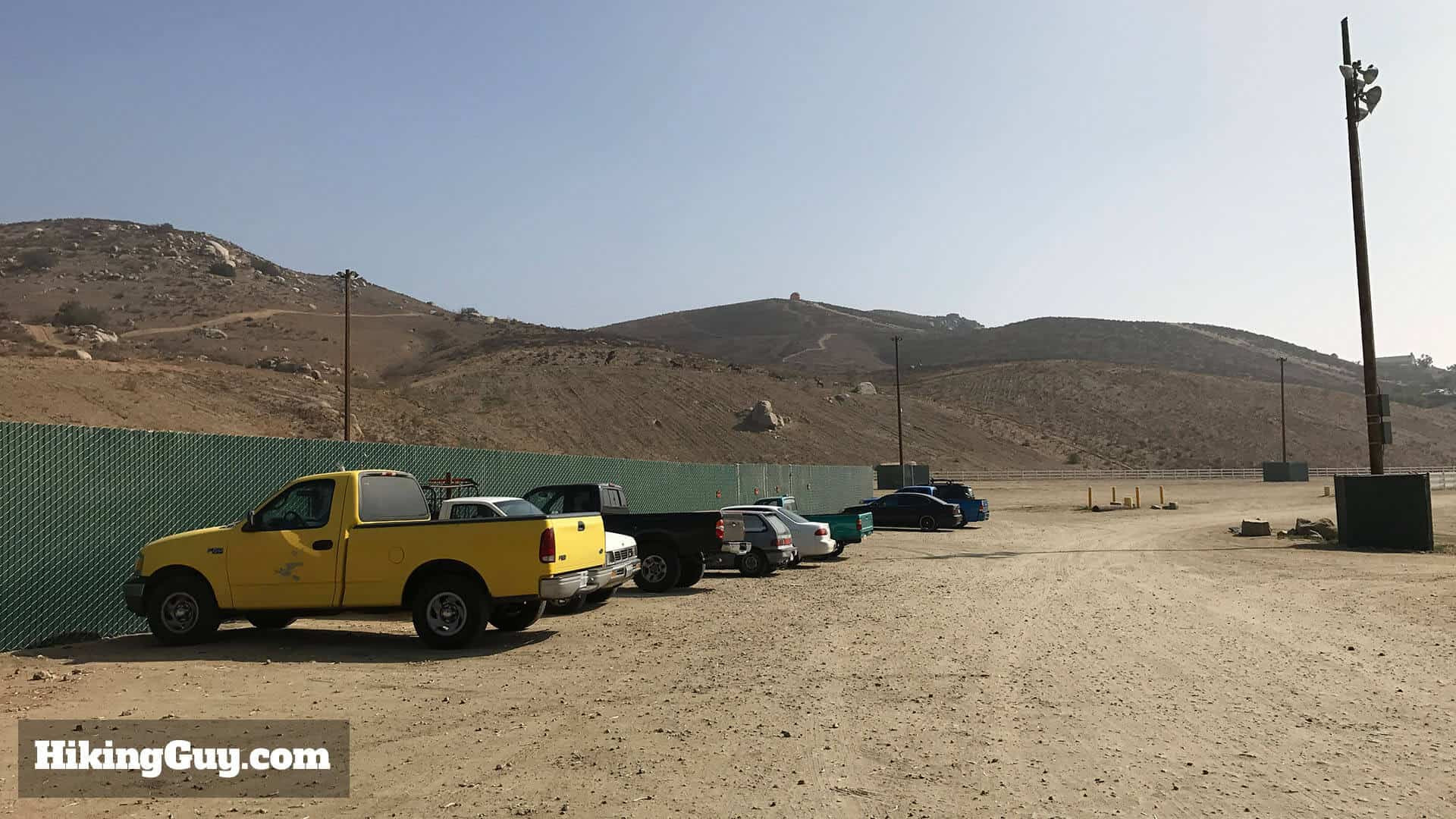 Pumpkin Rock Trailhead Parking: Ample parking available at the equestrian center for hikers visiting Pumpkin Rock in Norco, California.
Follow directions to the equestrian center address for plentiful parking. Be mindful of posted “no parking” signs in certain sections.
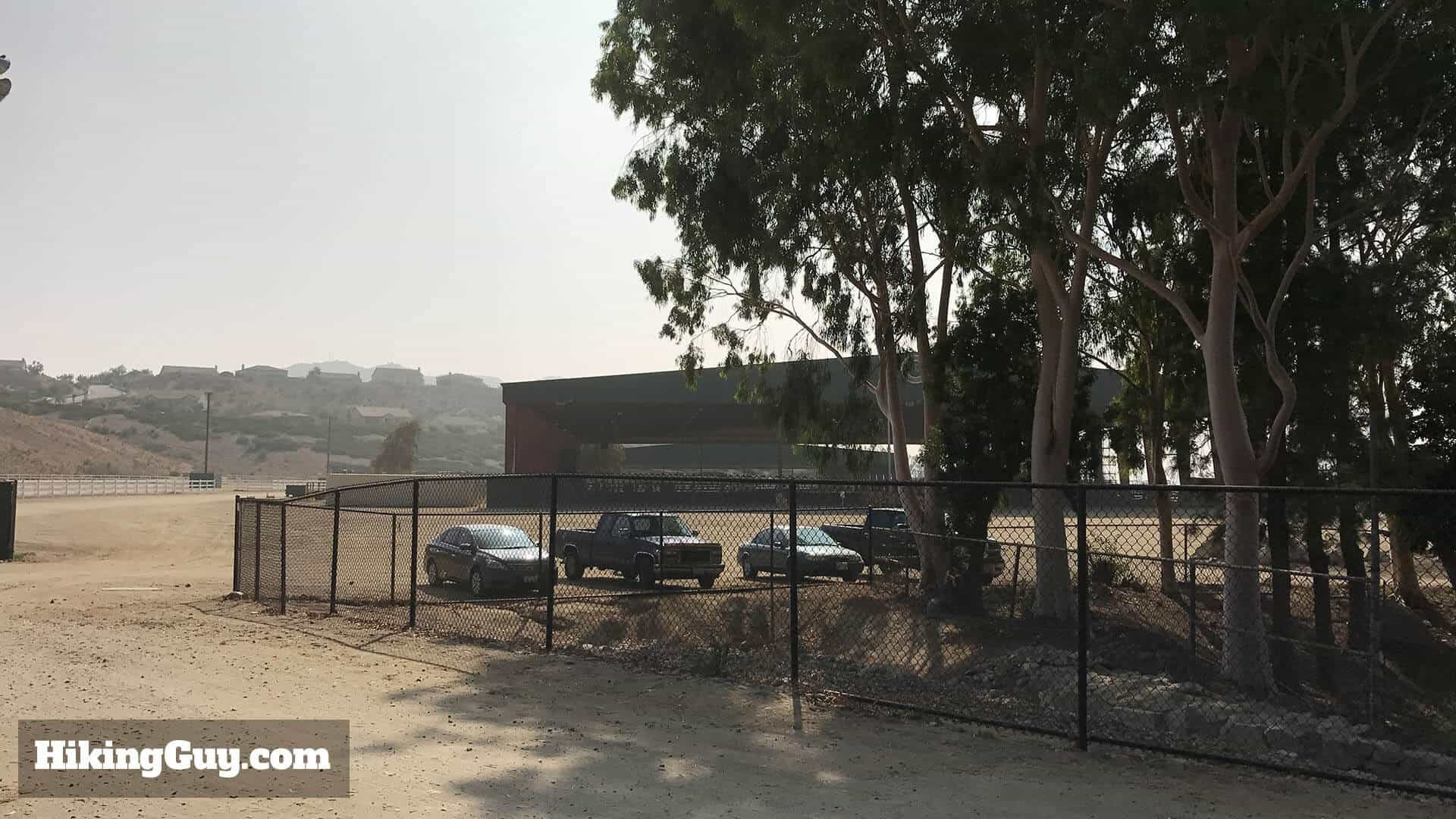 Equestrian Center Parking for Pumpkin Rock Hike: Additional parking spots are located closer to the equestrian center, a large facility adjacent to the Pumpkin Rock trailhead parking area.
More parking is available closer to the equestrian center, the prominent structure to the right of the main parking area. Norco, often called “Horsetown USA,” lives up to its name. As you approach the trailhead, you’ll notice the equestrian influence with ranches, feed stores, and hitching posts dotting the landscape. Horses are said to outnumber people here by a ratio of 2:1! The equestrian center itself is a hub of activity, hosting horse fairs, rodeos, and various equestrian events. It also serves as a large animal shelter, playing a crucial role during Southern California wildfires by airlifting and sheltering displaced large animals – a truly remarkable sight.
Essential Gear for Your Pumpkin Rock Hike
Given that the Pumpkin Rock hike is relatively short and easy, standard fitness attire is perfectly suitable. However, remember that shade is scarce on this trail, and the area can become quite hot, especially during warmer months.
Recommended Gear:
- Water: Bring plenty of water, especially on warm days.
- Sun Protection: Sunscreen, hat, and sunglasses are essential due to the lack of shade.
- Comfortable Shoes: Hiking shoes or sturdy sneakers will work well.
- Optional Hiking Poles: While not necessary for everyone, they can be helpful on the steeper sections for some hikers.
For a comprehensive list of recommended hiking gear, check out our Gear Picks Page for our latest recommendations (updated February 2025).
Navigating the Pumpkin Rock Trails
Be aware that the trails in Norco Hills are shared with horses and mountain bikers. Stay alert and yield to horses and bikes by giving them ample space to pass safely.
If you’re looking to extend your hike, Norco Hills offers a network of interconnected trails, perfect for exploring. The area is fairly contained, so feel free to wander a bit. Cell phone reception is generally reliable, allowing you to use Google Maps satellite view for navigation if needed. For a slightly longer hike, consider continuing along the main trail on Norco Ridge (more details below).
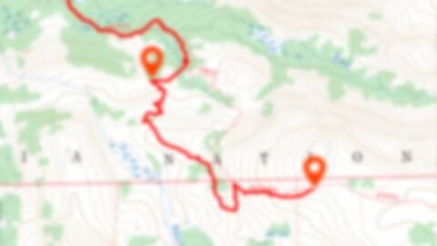 Pumpkin Rock Trail Map Placeholder: Interactive map for the Pumpkin Rock hike in Norco Hills, California, aiding hikers in navigation and route planning.
Click for Interactive Map
GPX Download Print & View on CalTopo My Nav Gear
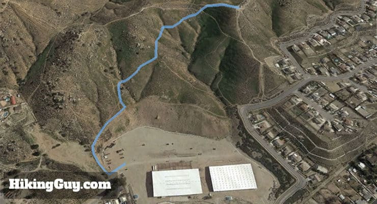 3D Map of Pumpkin Rock Hike Trail: A 3D trail map visualizing the route to Pumpkin Rock, starting from the equestrian center and ascending through Norco Hills.
The Pumpkin Rock hike begins at the equestrian center and ascends into Norco Hills towards the iconic painted pumpkin. While not excessively long, the trail does involve some steep inclines. Take your time, as the heat can amplify the perceived difficulty.
Step-by-Step Directions to Pumpkin Rock
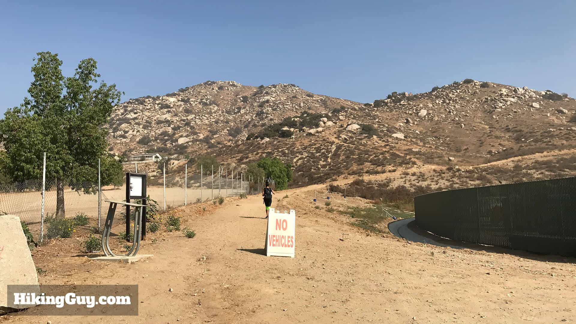 Pumpkin Rock Trailhead Entrance: The trailhead to Pumpkin Rock is clearly marked at the parking lot entrance, starting the hiking adventure.
The trailhead is conveniently located right at the parking lot entrance.
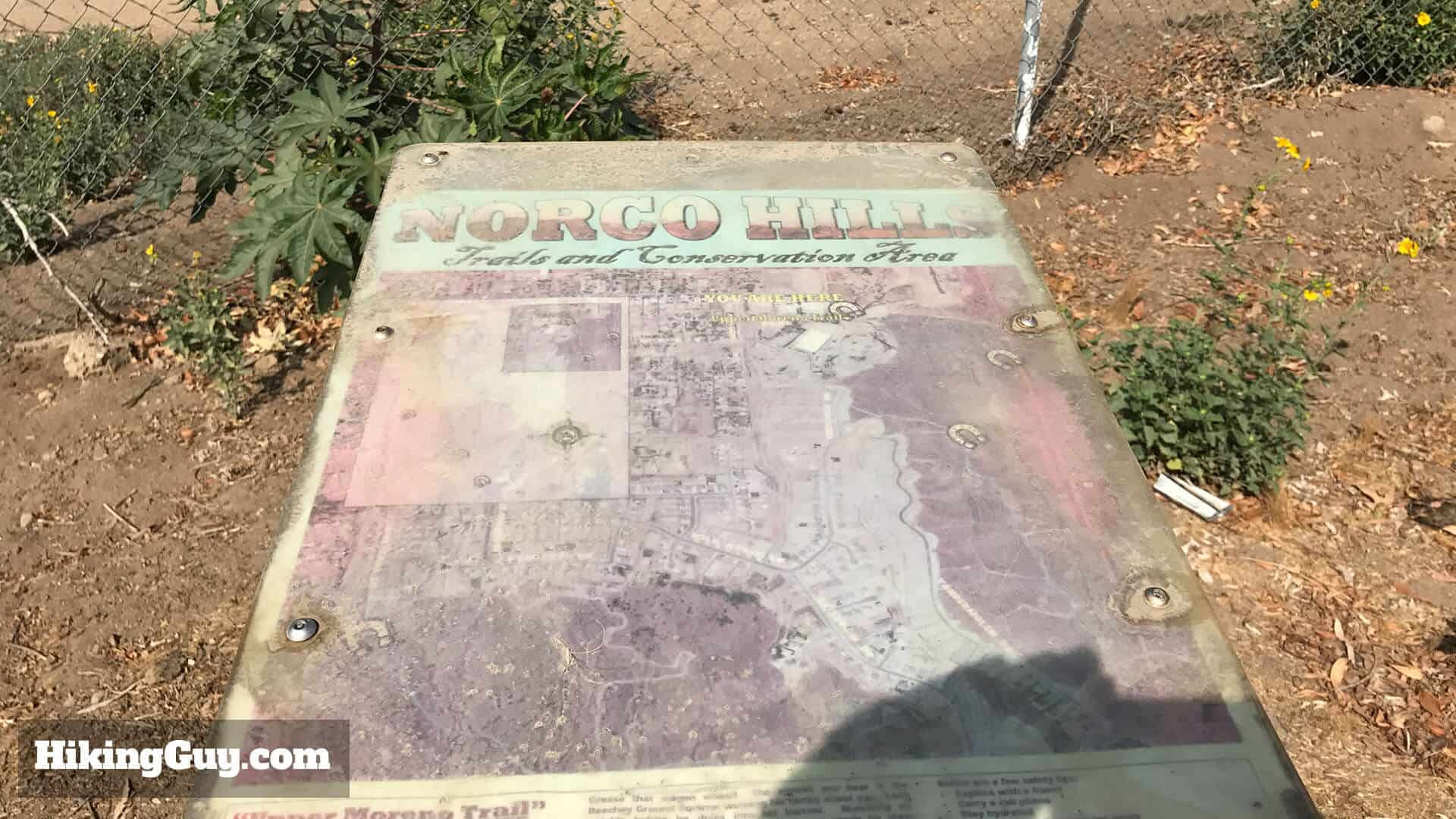 Norco Hills Trail Sign for Pumpkin Rock: A weathered Norco Hills sign marks the trail, though cell reception aids navigation for most hikers.
Look for the Norco Hills sign, which may show signs of wear. Park signage is minimal, but cell reception is generally good for using Google Maps.
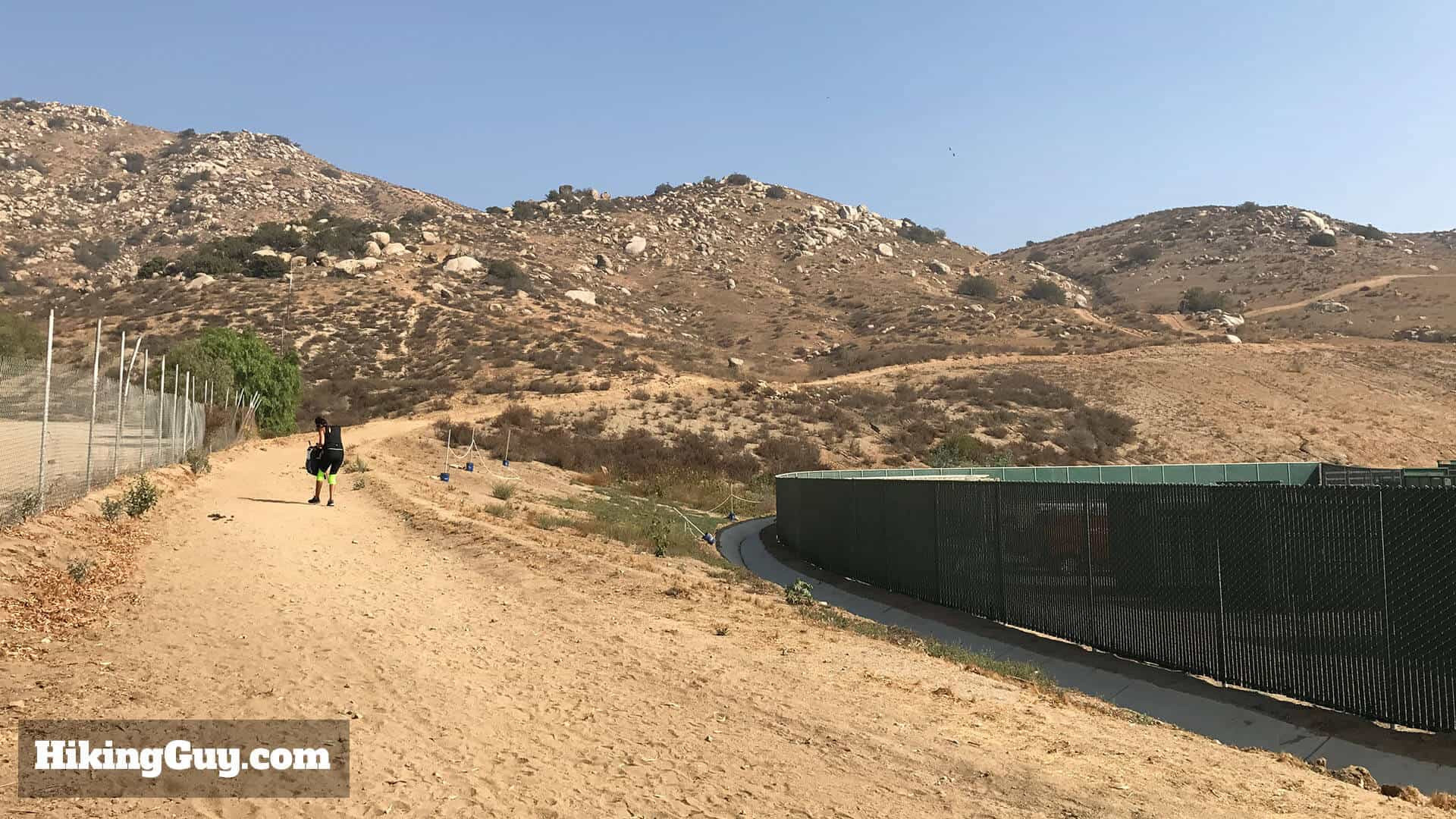 Wide Trail to Pumpkin Rock Norco Hills: Begin your hike on this wide, well-maintained trail leading towards Pumpkin Rock in Norco Hills.
Start on the wide trail heading uphill and to the right.
 Stay on Main Trail to Pumpkin Rock: Keep to the wider, established path and avoid smaller side trails to stay on the correct route to Pumpkin Rock.
Ignore smaller side trails and stick to the main, more prominent path.
 Trail Junction on Pumpkin Rock Hike: At approximately 0.2 miles, turn left at this trail junction to continue towards Pumpkin Rock in Norco.
At about 0.2 miles, you’ll encounter a larger trail branching to the left. Turn left here.
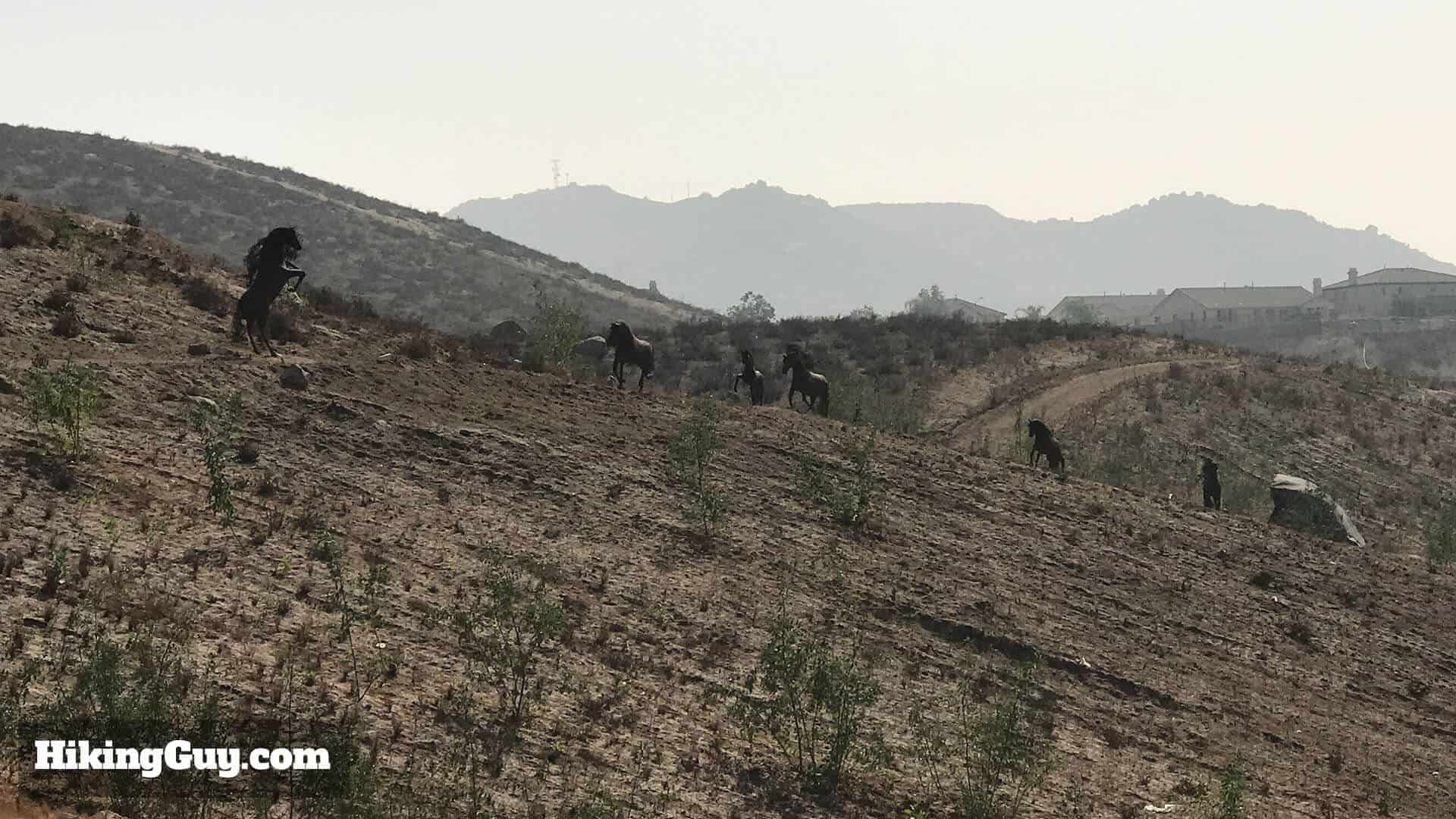 Horse Sculptures near Pumpkin Rock Trail: Discover these horse sculptures on a slight detour from the main Pumpkin Rock trail, adding an artistic touch to the hike.
If you continued straight at the last junction, you would have spotted these interesting horse sculptures. Consider a quick detour on your return to see them.
 Well-Defined Uphill Trail to Pumpkin Rock: The trail becomes well-defined and heads uphill after the trail junction, leading closer to Pumpkin Rock.
After the turn, the trail ascends uphill and is clearly marked.
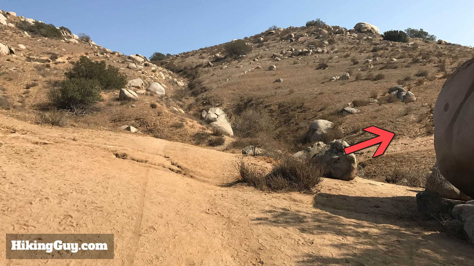 Trail Intersection near Boulder Field on Pumpkin Rock Hike: Navigate straight to the right at this intersection near a boulder field to stay on course to Pumpkin Rock.
Shortly after, you’ll reach a trail intersection near a boulder field. Go straight to the right.
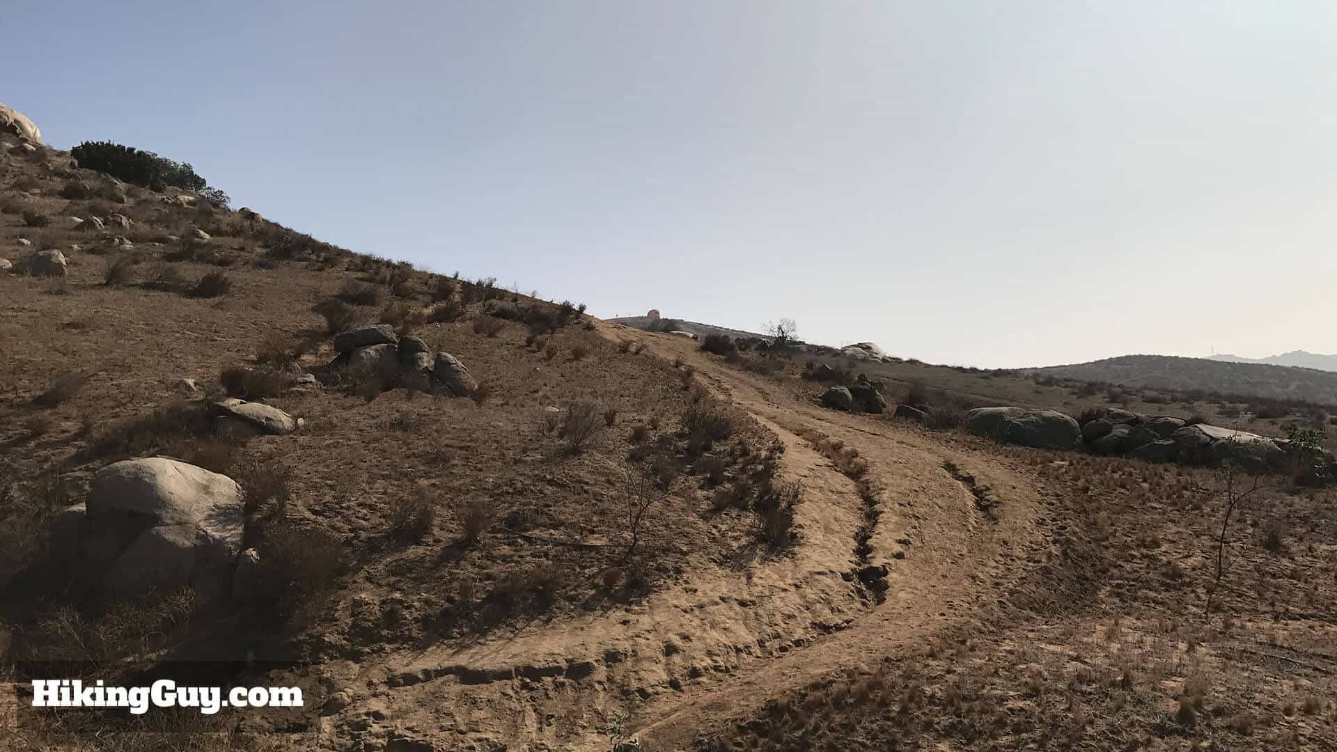 Uphill Section of Pumpkin Rock Trail: Continue uphill on the well-worn path as you progress closer to Pumpkin Rock in Norco Hills.
The trail continues its uphill climb.
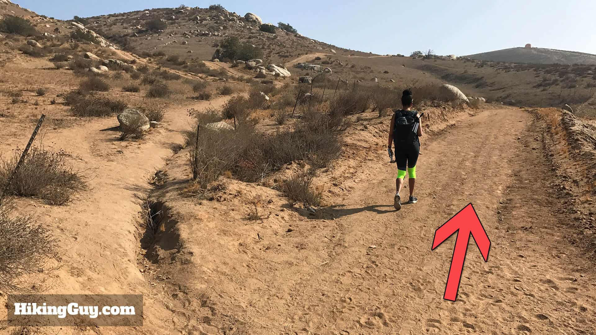
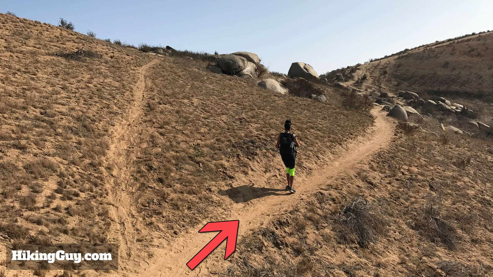
 Pumpkin Rock Visible in the Distance on Trail: At around 0.3 miles, head left towards Pumpkin Rock, now visible in the background, guiding your path.
Around 0.3 miles, head left towards Pumpkin Rock, which you can now see in the distance.
 Narrower Sections of Pumpkin Rock Trail: The trail narrows with some loose sand; watch your footing as you approach Pumpkin Rock.
The trail narrows in sections as it continues uphill. Be mindful of your footing on loose sand.
 Stay on Worn Path to Pumpkin Rock: Continue on the more worn path and avoid small side trails to ensure you are heading directly to Pumpkin Rock.
Again, avoid smaller side trails and stay on the more established path.
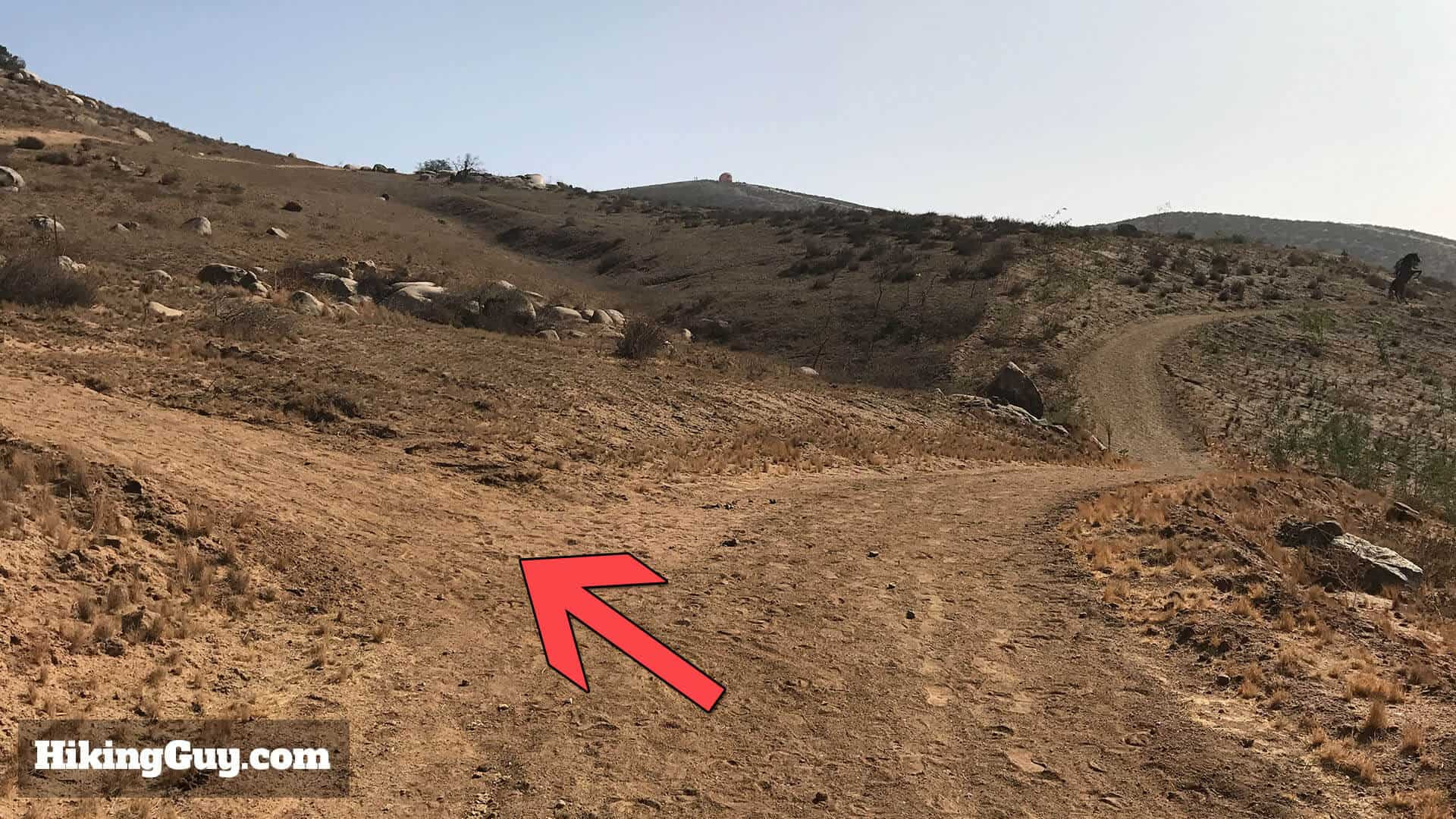
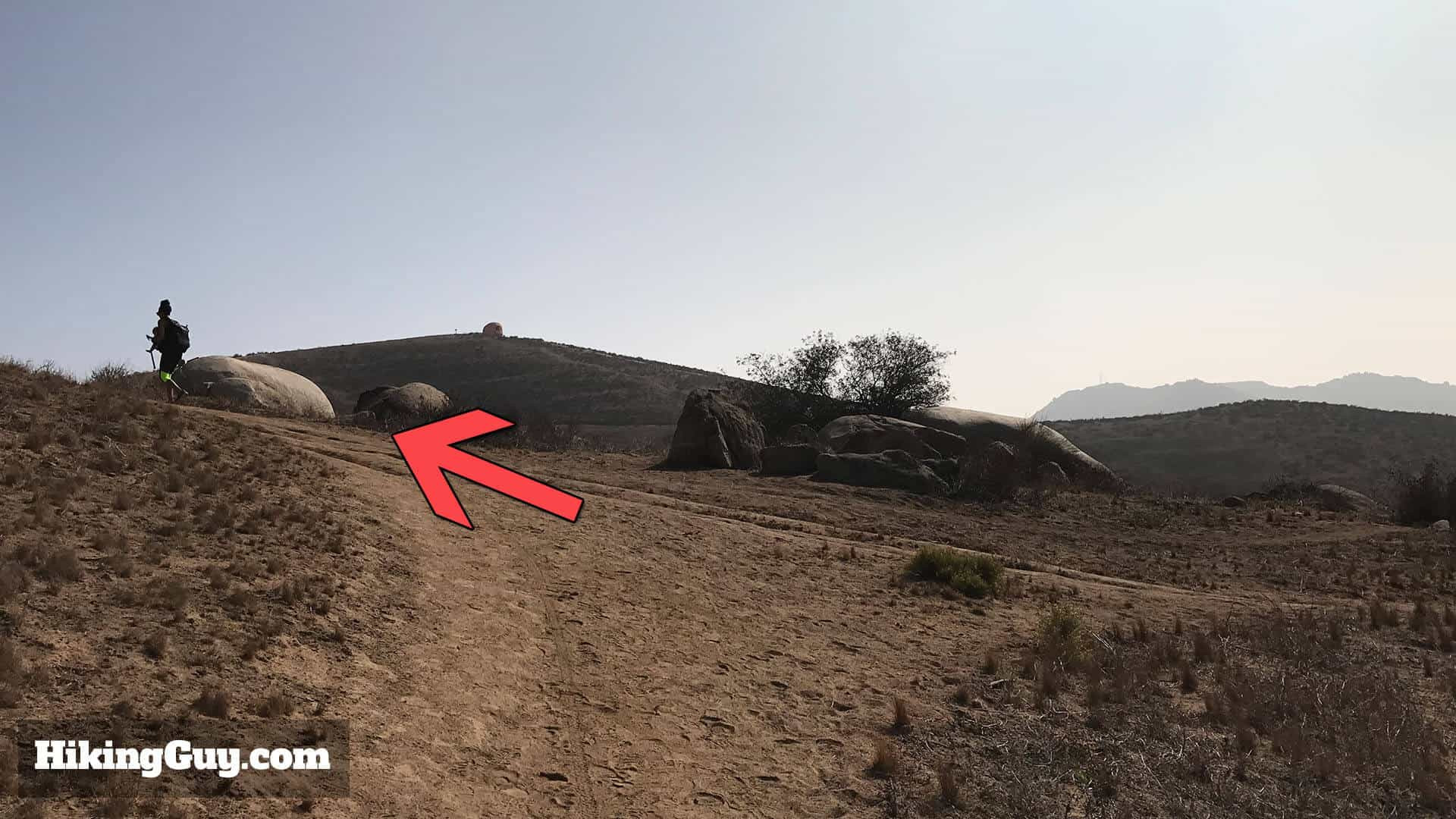
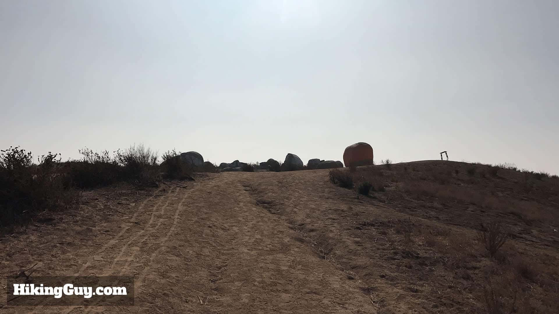
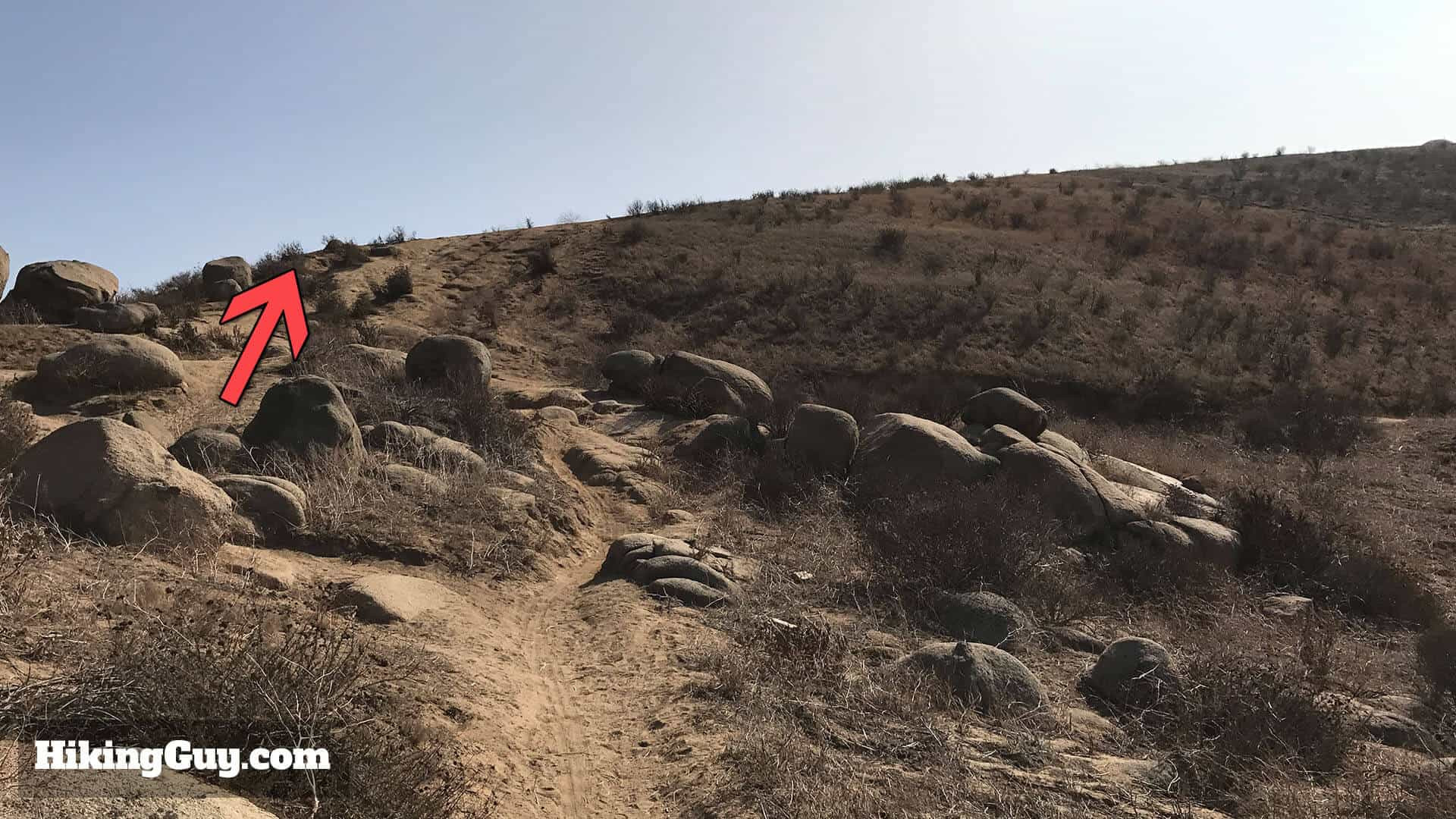 Final Stretch to Pumpkin Rock: At the next major intersection with boulders, proceed straight up the final hill towards Pumpkin Rock.
At the next significant intersection with boulders, go straight through and up the final hill.
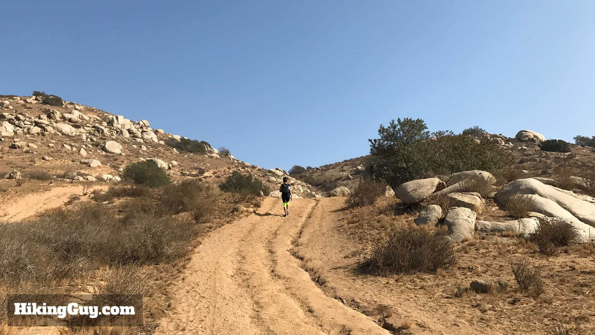
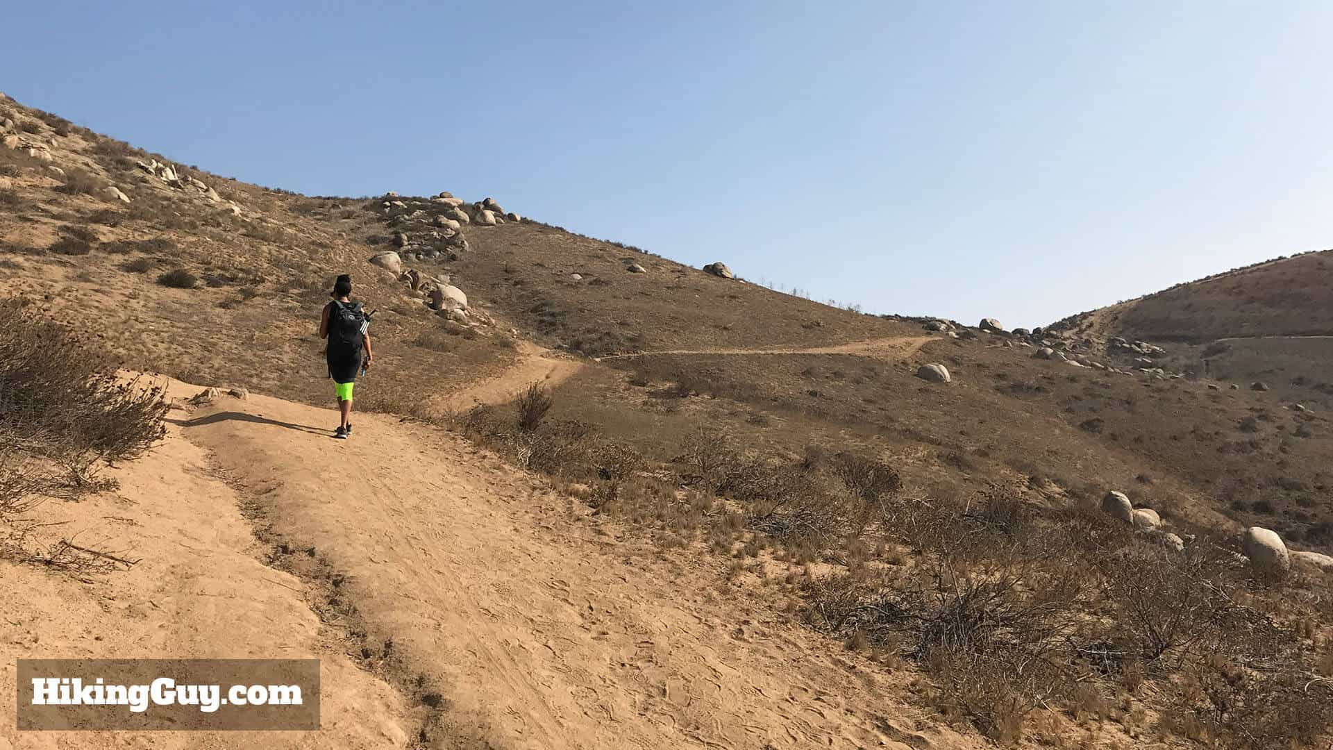
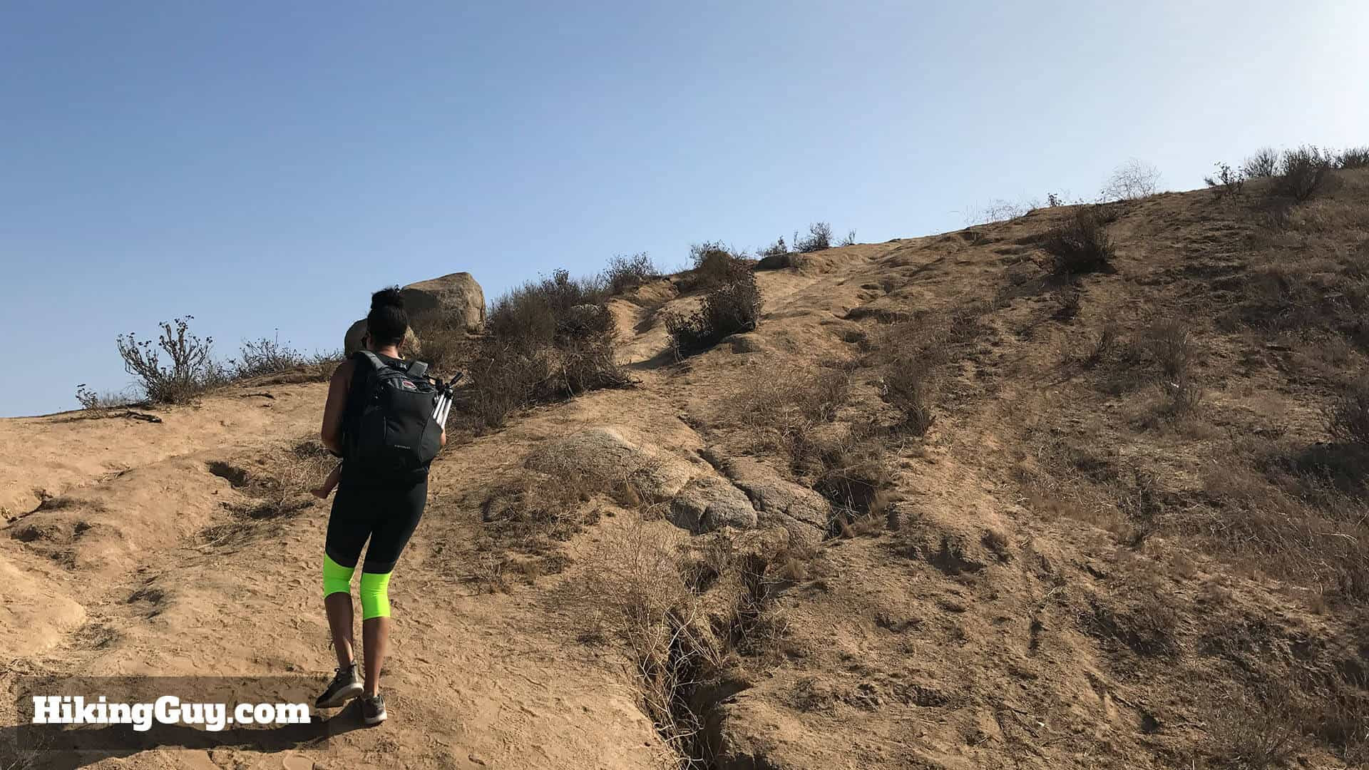 Steepest Part of Pumpkin Rock Hike: This is the steepest section of the hike, the last push to reach the summit and Pumpkin Rock.
This final stretch is the steepest part of the hike.
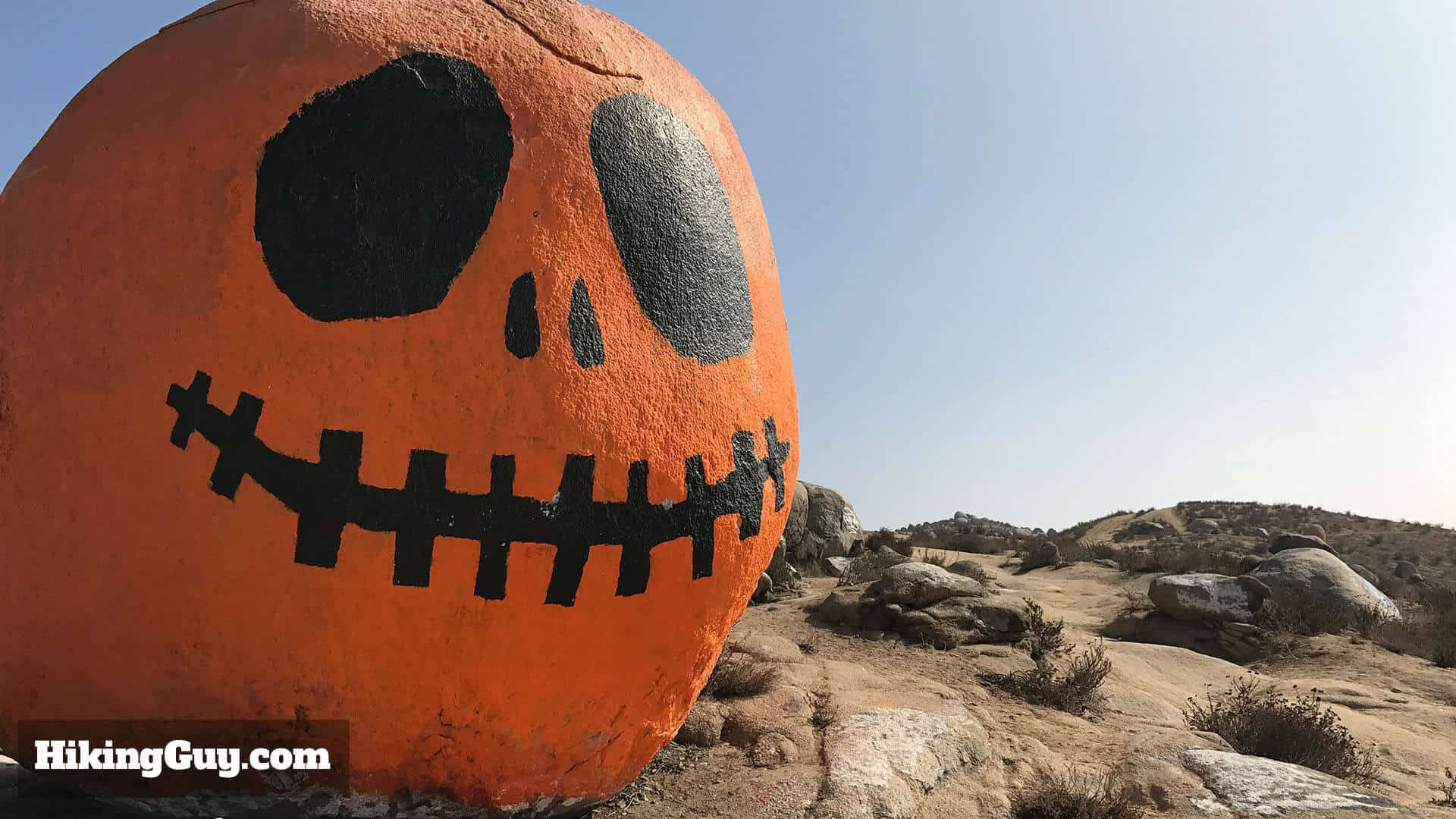
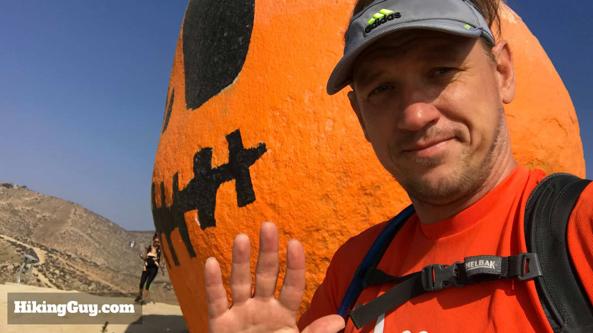
 Pumpkin Rock Monument Norco California: Finally, reach the iconic Pumpkin Rock, a zipper-mouthed monument and photo opportunity in Norco, CA.
Finally! You’ve arrived at the zipper-mouthed monument: Pumpkin Rock!
 Close-up of Pumpkin Rock: A closer view of Pumpkin Rock, hoping the graffiti is minimal for a better viewing and photo experience.
Here you are, Pumpkin Rock! Hopefully, the graffiti is minimal during your visit. Sometimes, the rock might have unexpected additions – once, someone humorously (or not so humorously) painted some anatomy next to its mouth.
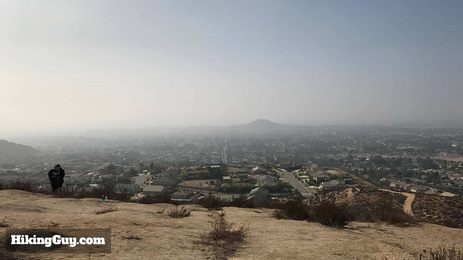 Panoramic Views from Pumpkin Rock: Enjoy spectacular views of Norco and Corona from atop Pumpkin Rock, enhancing your hiking experience.
The panoramic views of Norco and Corona from this vantage point are also quite spectacular.
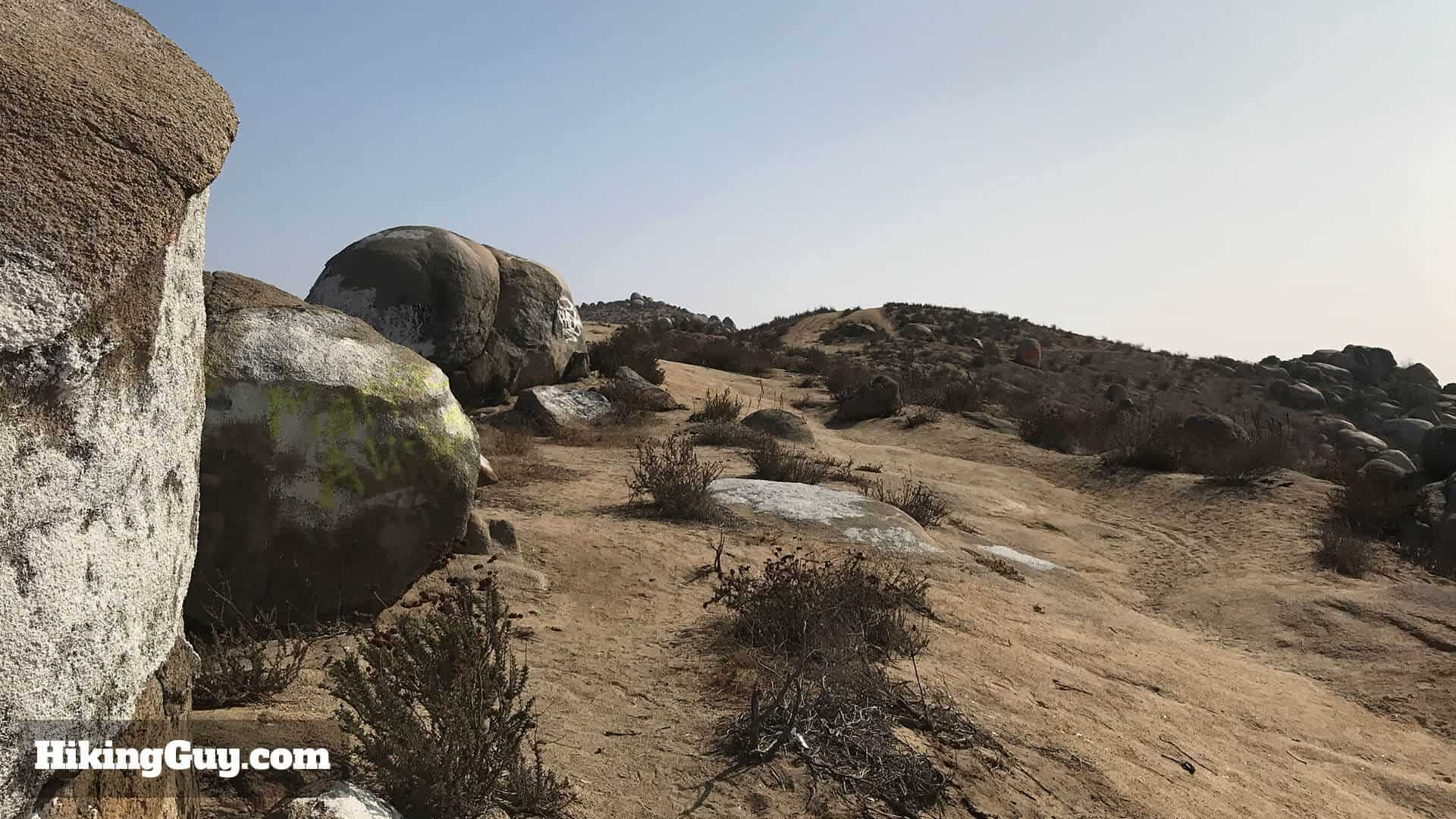 Ridge Trail Beyond Pumpkin Rock: Extend your hike by following the ridge trail past Pumpkin Rock for further exploration and scenic views in Norco Hills.
If you want to extend your hike, continue on the ridge trail that extends beyond Pumpkin Rock. Google Maps can help you navigate further if you choose to explore.
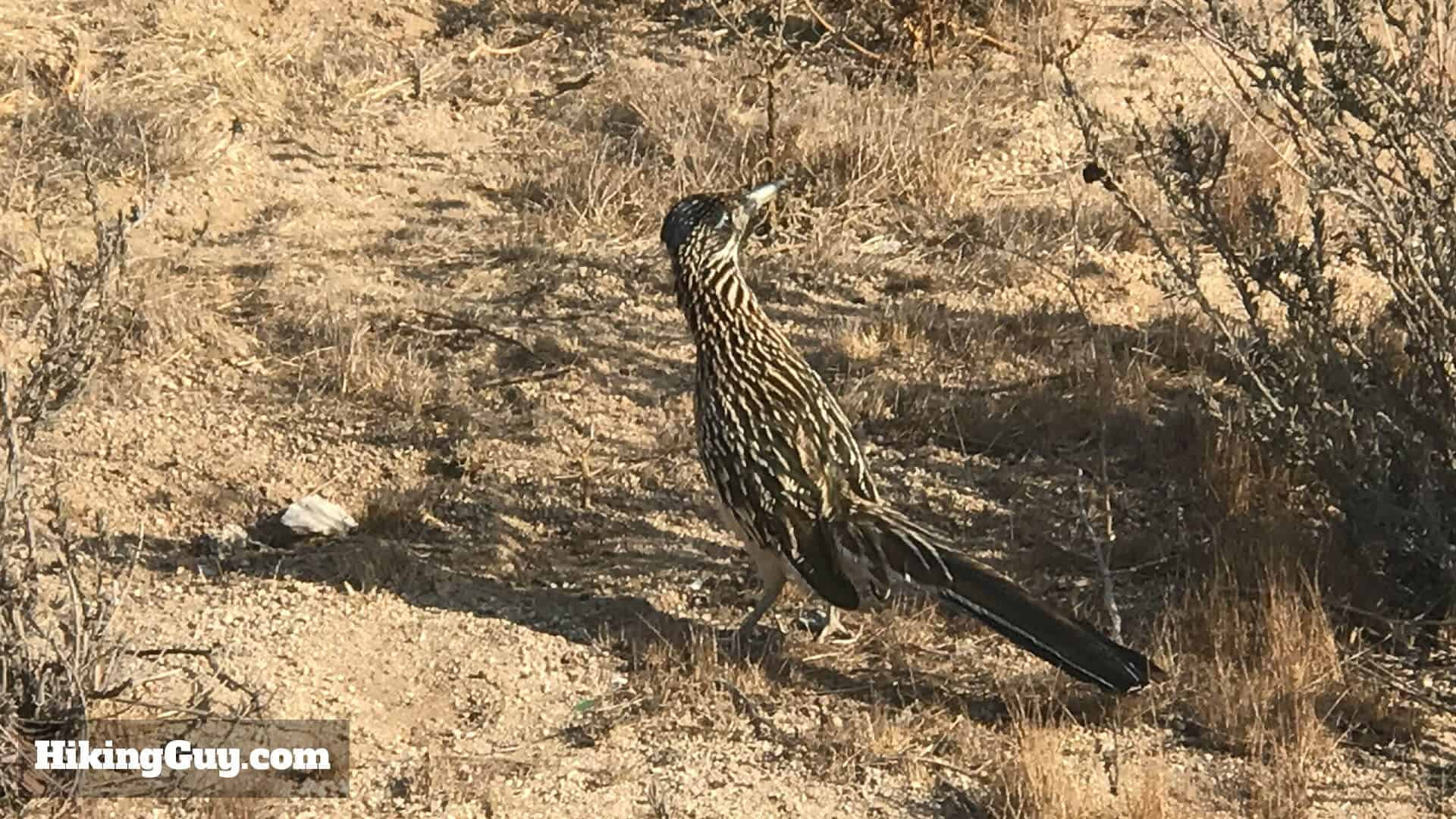 Roadrunners Wildlife on Pumpkin Rock Trail: Keep an eye out for wildlife like roadrunners along the Pumpkin Rock trail, adding to the natural experience.
If you explore further, keep an eye out for local wildlife such as roadrunners, rattlesnakes, squirrels, and hawks.
 Hiker at Pumpkin Rock Summit: A hiker enjoys the view at Pumpkin Rock, marking the rewarding end of the trail with scenic vistas and a unique landmark.
To return, simply retrace your steps back down the trail. Happy trails and happy Halloween!