Los Angeles is known for its vibrant city life, but escape the urban bustle and discover natural wonders like Skull Rock. Nestled within the scenic Temescal Gateway Park and extending into Topanga State Park, the Temescal Loop Trail offers an invigorating hike culminating at the fascinating Skull Rock formation. This trail, particularly enchanting as the sun sets, provides a moderate challenge with rewarding panoramic views and a unique geological attraction: Skull Rock itself.
Temescal Loop Trail & Skull Rock Hike: Trail Details
For those eager to explore Skull Rock, here’s a quick overview to prepare for your hike:
- Distance: 5.1 miles loop, including the spur to Skull Rock
- Time: Approximately 2 hours, allow more for photos and enjoying the views from Skull Rock
- Difficulty: Moderate, suitable for most fitness levels with some uphill sections
- Elevation Gain: 1,103 feet, providing a good workout and scenic vistas
- Dogs: Not allowed in Topanga State Park sections of the trail, please leave your furry friends at home
- Best Time to Hike: Year-round, but late afternoon offers cooler temperatures and stunning sunset views. Be aware of warmer temperatures during midday in summer.
This enhanced Temescal Loop Trail experience, thanks to the detour to Skull Rock, stretches just over 5 miles and involves a satisfying elevation gain. Along the path, you might even encounter the often-elusive Temescal Canyon waterfall. While often just a trickle, legends speak of its beauty after substantial rainfall. Curious to see what awaits? Continue reading!
Getting to the Temescal Canyon Trailhead
Your Skull Rock adventure begins at Temescal Gateway Park, conveniently located at 15601 Sunset Blvd., Pacific Palisades, CA (intersection of Temescal Canyon Road and Sunset Boulevard). Easily accessible, you have parking options: free street parking along Temescal Canyon Road or paid parking within the park itself (currently $7, payable via envelope at a locked box).
Upon entering the canyon, you’ll pass a conference center complex. This area offers restrooms with plumbing and an information kiosk detailing the canyon’s history and trail maps.
Important Parking Note: The kiosk maps primarily display trails within Temescal Gateway Park and may not fully represent the loop extending into Topanga State Park, which includes the route to Skull Rock. This guide covers the complete loop, including the Topanga State Park section leading to Skull Rock.
Hiking the Temescal Canyon and Skull Rock Trail
The Temescal Loop Trail is a loop, hikeable in either direction. A counter-clockwise route, as described here, is recommended for optimal shade during the uphill portion. This direction takes you up the canyon first, then to Skull Rock, and finally down the ridge trail, maximizing comfort and enjoyment. Prefer a clockwise direction? Alternative guides exist for that preference.
Starting at the back of Temescal Gateway Park, follow the Temescal Canyon Trail deeper into the canyon. You’ll walk past charming, rustic buildings still in use for events. As you proceed into the shaded canyon, the tranquility increases as you move away from busier park areas.
The initial canyon trail section offers pleasant shade, winding beside the typically dry Temescal Creek bed. You’ll continue to see conference center buildings briefly, but stay on the path heading into the canyon; the trail soon becomes clearly defined and easy to follow.
Around the 1.2-mile mark (from Sunset Blvd.), the trail begins a more noticeable ascent. This uphill section is consistent and leads towards Skull Rock, but first, you’ll approach the (often dry) Temescal Canyon waterfall.
A bridge marks your arrival at the waterfall area. Without prior knowledge, you might easily miss the waterfall, as it’s frequently reduced to a mere trickle, even shortly after rainfall.
The “mythical” aspect of this waterfall is better understood by viewing historical photos, like this one from the park’s information kiosk, showcasing its potential grandeur.
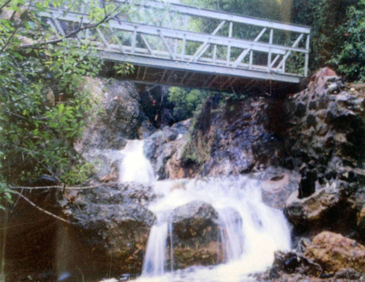 Historic photo of Temescal Canyon Waterfall in full flow
Over the next half mile, the trail ascends out of the canyon towards the ridgeline. Shade is plentiful in this section, making it a welcome feature on warmer days. Pause at breaks in the foliage to admire the evolving views back down the canyon.
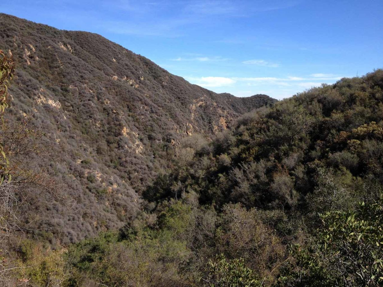 View looking back down Temescal Canyon from the ascending trail
Reaching the junction with the ridgeline trail presents a choice: turn left for a direct return to the trailhead via the Temescal Ridge Trail, or turn right to continue uphill towards Skull Rock. This out-and-back detour to Skull Rock adds approximately one mile to your hike but is highly recommended for experiencing this unique rock formation.
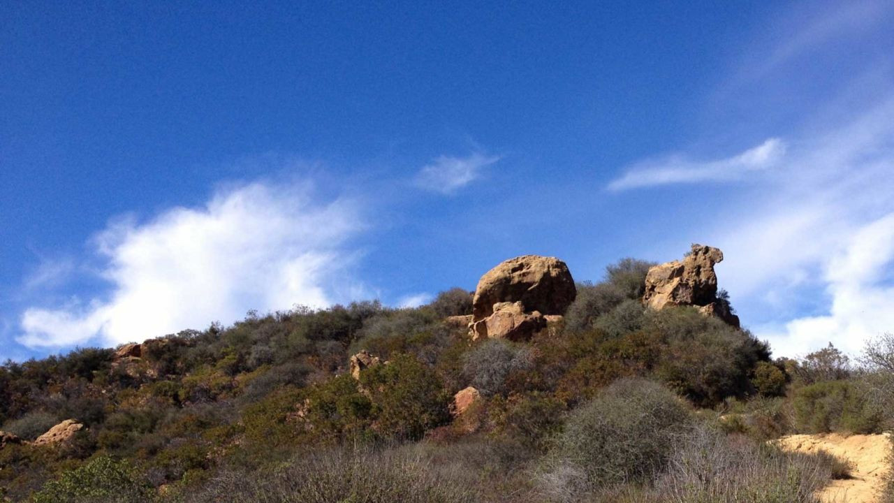 The distinctive shape of Skull Rock
The main trail passes near Skull Rock, continuing further into Topanga State Park. To reach Skull Rock itself, watch for unofficial, user-created trails branching off to the left, leading directly to the rock outcrop.
Standing atop Skull Rock, the skull-like resemblance might be subtle from certain angles. However, the panoramic view is undeniably breathtaking. To the south, the coastline stretches in a wide arc towards Palos Verdes, and on clear days, Catalina Island is visible on the horizon.
The Temescal Ridge Trail, your return path, can be seen from atop Skull Rock, winding along the ridge.
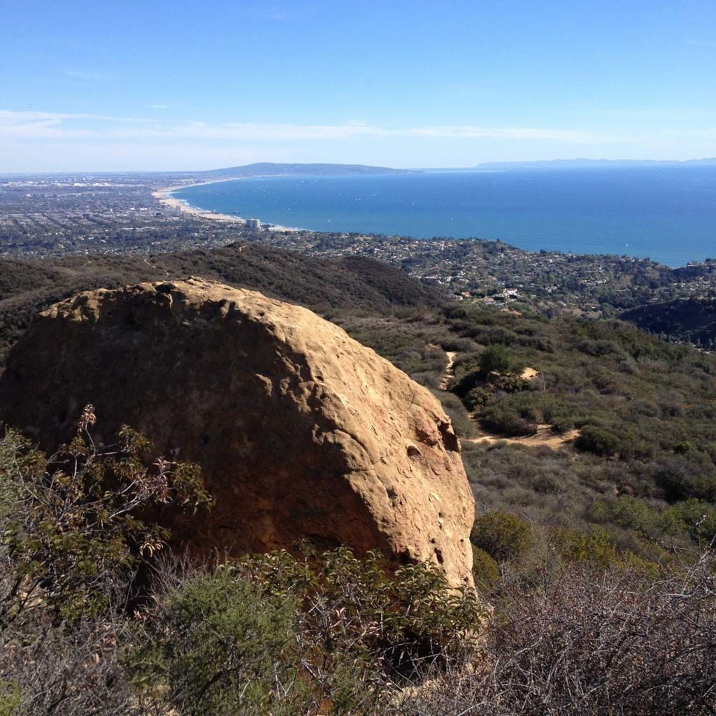 Panoramic coastal view from above Skull Rock
Having reached the highest point at Skull Rock, the remainder of the hike is downhill.
Carefully descend from Skull Rock back to the main trail, and retrace your steps to the junction with the Temescal Canyon Trail. This time, proceed straight onto the Temescal Ridge Trail, beginning your descent back to the trailhead.
Be aware of a couple of junctions along the descent that lead to residential areas far from your starting point. Stay on the main ridge trail, clearly marked Temescal Ridge Trail, and follow it downhill. Eventually, the trail transitions into switchbacks, easing the descent into the canyon and guiding you back to your starting location.
Navigating the Skull Rock and Temescal Loop Trail
[Interactive map or link to a map resource would be beneficial here, if possible with markdown]
[Map image would ideally be placed here, if conversion from original format is feasible and allowed]
Downloadable file: skull-rock-and-temescal-loop.gpx
Explore More: Skull Rock and Temescal Loop Trail Photo Gallery
Click on any image to enlarge.
[Gallery of images from the original article, as presented in the original markdown, would be included here]
Skull Rock Hiking Tips for a Great Experience
- Sunset Hikes: Hiking in the late afternoon as the sun lowers is highly recommended for beautiful light and cooler temperatures.
- Traffic Awareness: Be mindful of stop light cameras on Temescal Canyon Road when driving to the trailhead.
- Parking Options: Utilize street parking for free or choose paid parking within Temescal Gateway Park. Observe all parking signs and regulations.