Table Rock Lake is rapidly approaching its record high water level, prompting the U.S. Army Corps of Engineers to release a near-record amount of water from the dam’s spillway gates. While the lake was initially projected to rise an additional 7 feet, the inflow has begun to slow, potentially averting the need for increased releases.
Current Water Levels and Release Rates
The record flood pool for Table Rock Lake is 935.47 feet, set in 2011. Current projections estimate the lake will crest at 935 feet. To manage the rising water, all ten spillway gates at Table Rock Dam are open 4.5 feet, releasing water into Lake Taneycomo downstream. Combined with the dam’s hydropower turbines, approximately 67,000 cubic feet of water per second are being released. This volume is just shy of the record 69,000 cubic feet per second released during the 2011 flood.
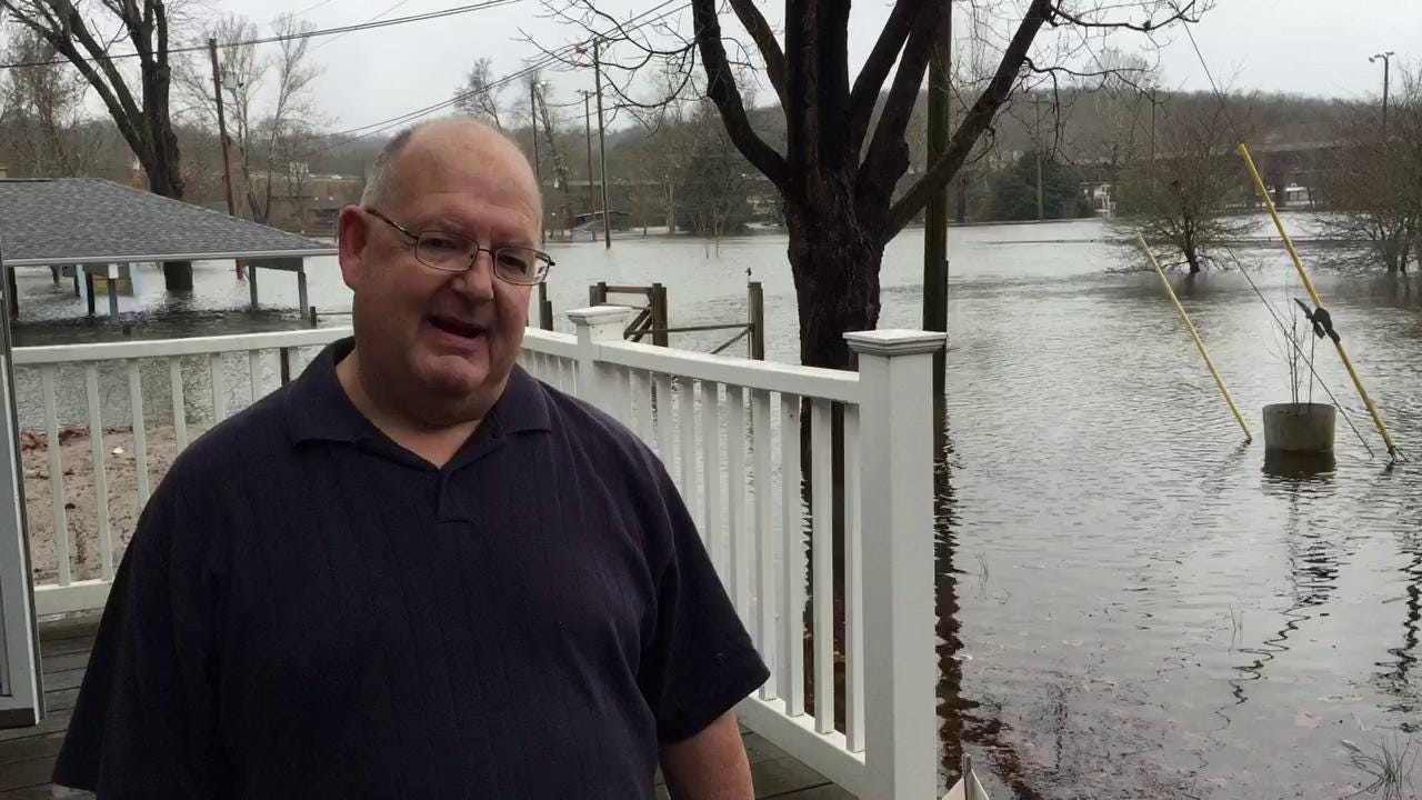 Table Rock Lake Spillway Gates Open
Inflow and Upstream Conditions
The immense inflow into Table Rock Lake is driven by heavy rainfall and releases from upstream dams. Currently, 2.2 million gallons of water flow into the lake every second. Beaver Lake, located upstream in Arkansas, is also experiencing significant flooding, with its spillway gates releasing 91,500 cubic feet of water per second—its second-highest release on record. This massive volume of water contributes significantly to Table Rock Lake’s rising water level.
Downstream Impacts and Branson’s Response
Downstream from Table Rock Dam, Lake Taneycomo’s rising water levels are being closely monitored. While businesses on Branson Landing remain open, some residential areas have experienced flooding, leading to voluntary evacuations in Lakewood Estates. Branson officials are working with the Army Corps of Engineers to monitor the situation and keep the public informed. Despite the flooding, Branson remains open for business, though several roads are closed due to high water.
Table Rock Lake Spillway Gates Open
Statewide Flooding Impacts
The record rainfall has impacted other areas in Missouri and Arkansas. A dam at Lily Lake in Mountain Grove experienced erosion, prompting evacuations. However, the dam was deemed stable, and residents have returned home. The Buffalo National River in Arkansas and the Current and Jacks Fork Rivers in Missouri are closed due to extreme flooding. In Springfield, the James River crested above flood stage but is now receding.
Conclusion
The Table Rock Lake Water Level remains a critical concern as it nears record highs. The U.S. Army Corps of Engineers continues to manage the situation by releasing large amounts of water from the dam. While the slowing inflow offers some hope, downstream communities remain vigilant. The widespread flooding throughout Missouri and Arkansas underscores the significant impact of this record rainfall.