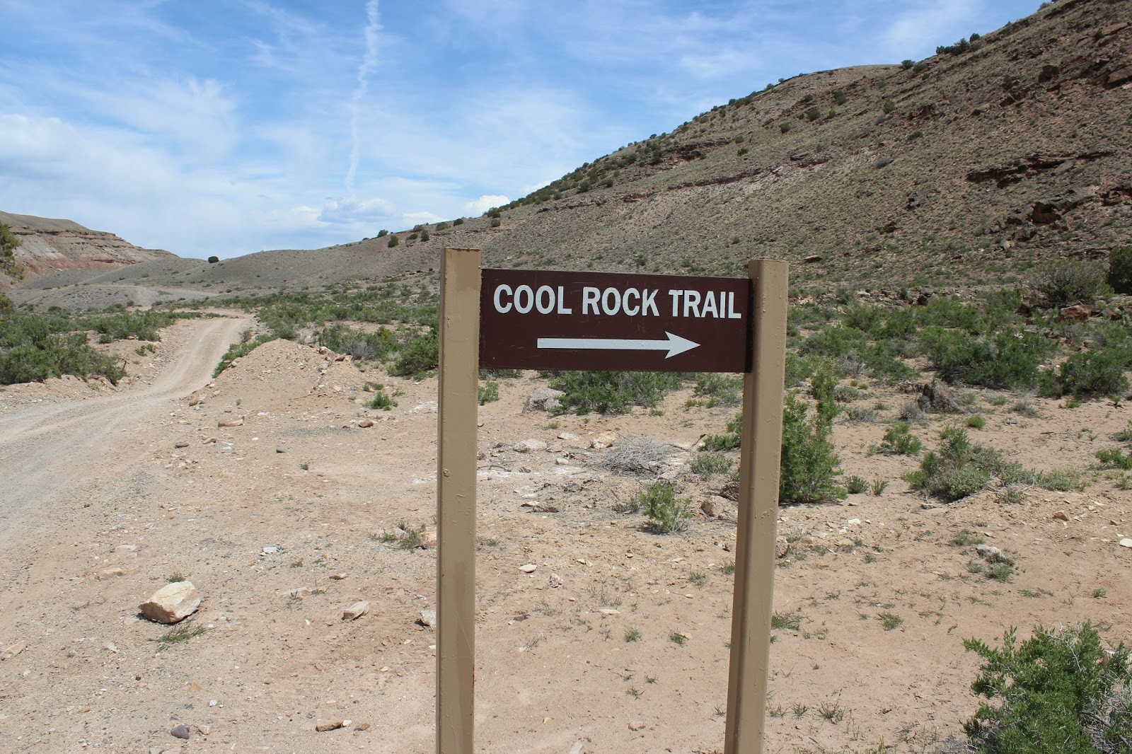
Nestled within the Gunnison Gorge National Conservation Area and Wilderness, near Delta, Colorado, lies the captivating Cool Rock Canyon trail. This moderately challenging hike offers an immersive experience into a scenic canyon, showcasing remarkable geology and, as the name suggests, plenty of cool rocks. Spanning approximately 4 miles round trip, this trail is perfect for a half-day adventure, inviting hikers to explore its unique terrain and breathtaking views.
Getting to the trailhead is part of the adventure. While GPS directions work well, the route involves a drive east from Delta on Highway 92, followed by a turn onto either H75 Road or 2200 Road. H75 Road provides a more direct path. From the intersection of H75 and 2200 Roads, it’s about 5.3 miles on H75 Road to the South River Road split. The final 2.4 miles on South River Road descend a steep hill to the Gunnison River level, leading directly to the Cool Rock trailhead. Be aware that H75 Road is gravel, and South River Road is dirt. While accessible to most vehicles, an SUV is recommended, especially in potentially wet conditions, due to the steep descent on South River Road.
 Trailhead parking area for Cool Rock Canyon hike in Gunnison Gorge, Colorado.
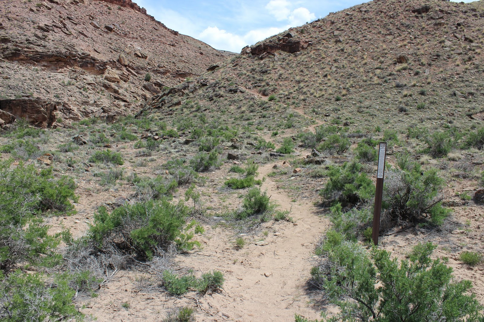
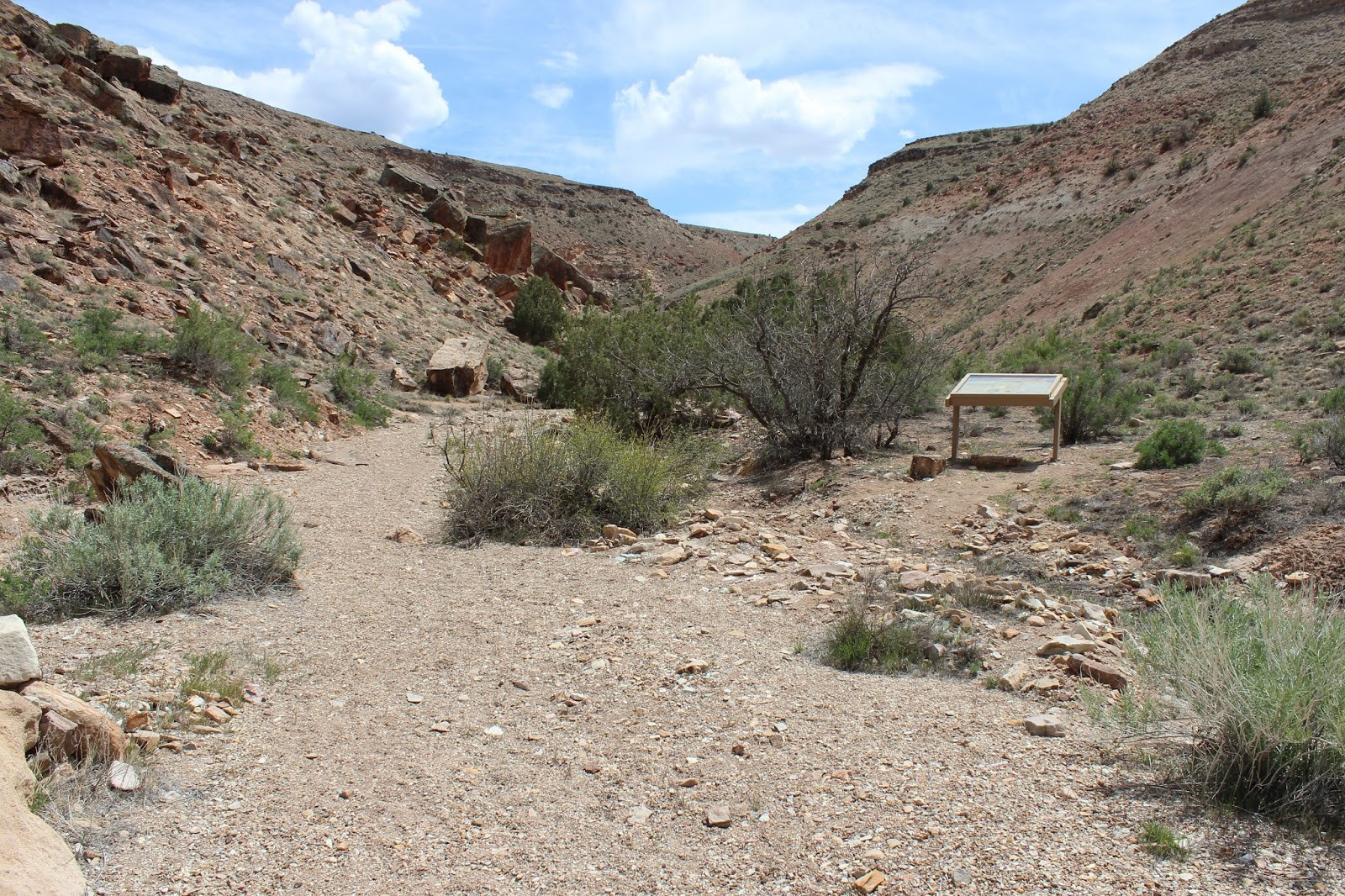
The Cool Rock Canyon trail begins with a gentle climb around a dry waterfall marking the canyon’s entrance. This initial ascent quickly leads into the heart of the wash, which becomes the primary path for the majority of the hike. A kiosk near the start provides some information about the area, enriching the experience with context right from the beginning.
 Dirt road leading to the Cool Rock Canyon trailhead in Colorado, suitable for SUVs and cars.
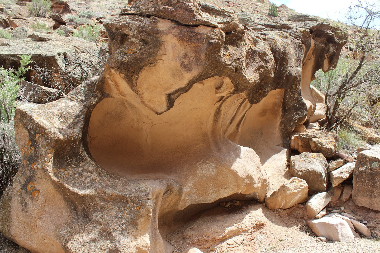
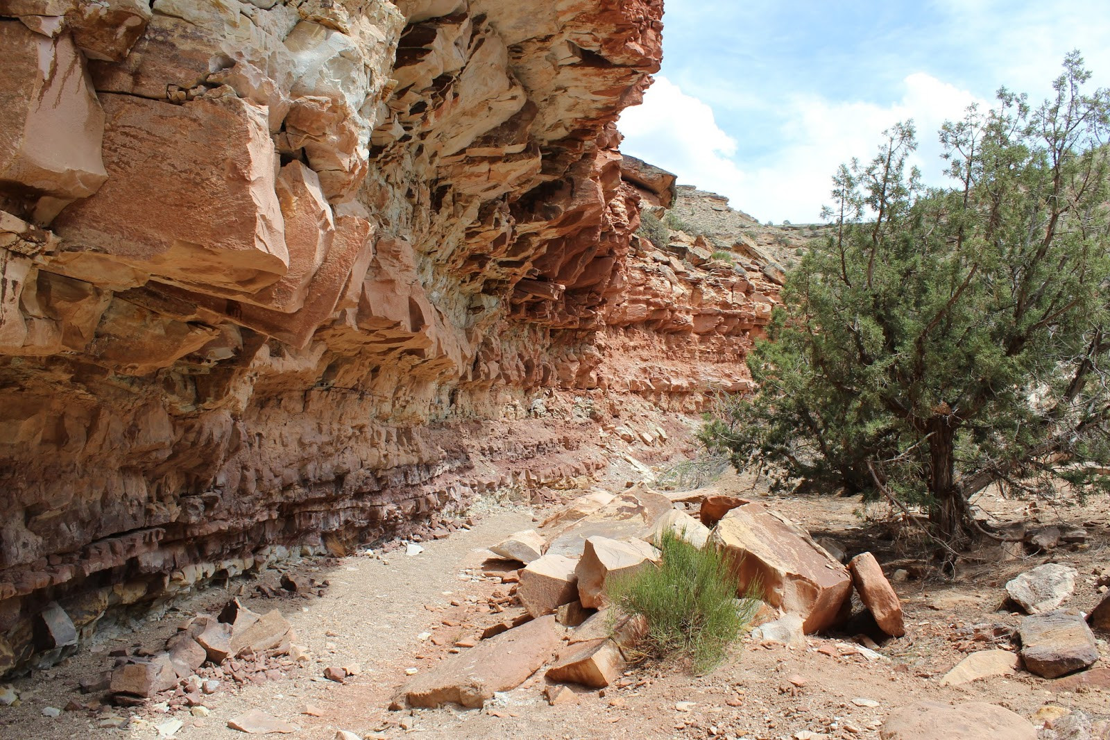
As you venture deeper into Cool Rock Canyon, the trail unveils a mesmerizing landscape of colorful bends and unique rock formations. Among the many interesting geological features, one particular water-worn sandstone block stands out, embodying the “cool rocks” that give the canyon its name. The canyon walls themselves are a spectacle, with some sections appearing precariously balanced, a testament to the forces of erosion shaping this dramatic environment over time.
 Unique water-worn sandstone rock formation in Cool Rock Canyon, showcasing the canyon's namesake features.
The trail is rated as moderate due to sections requiring minor scrambling over boulders. While equestrian use is permitted, these boulder fields likely restrict horses to the lower mile of the canyon. Navigating these obstacles adds a touch of adventure and physical engagement to the hike, enhancing the overall experience for those seeking a bit more challenge than an easy stroll.
 Trail kiosk at Cool Rock Canyon trailhead providing information about the area's features and regulations.
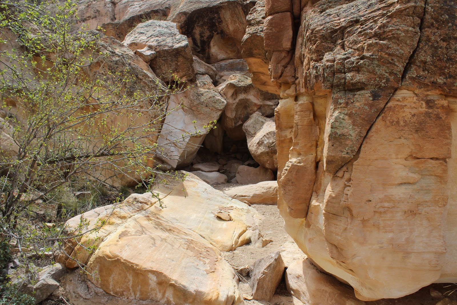
Further along, a significant boulder jam obstructs the wash, necessitating a detour onto a side trail on the canyon’s right side. Exploring around these large boulders before taking the detour is a fun interlude, offering a closer look at the canyon’s rugged beauty. Beyond the boulder field, the trail becomes easier once more, allowing for relaxed hiking and continued appreciation of the surroundings.
 Close-up of a distinctive "cool rock" in Cool Rock Canyon, highlighting the textures and colors of the sandstone.
The designated turnaround point is marked by a fence crossing the canyon at the two-mile mark. While technically the trail extends beyond this point within the Gunnison Gorge National Conservation Area, this fence serves as the described endpoint for this segment of the Cool Rock Canyon trail.
 Colorful canyon walls along the Cool Rock Canyon trail, showcasing the geological diversity of the area.
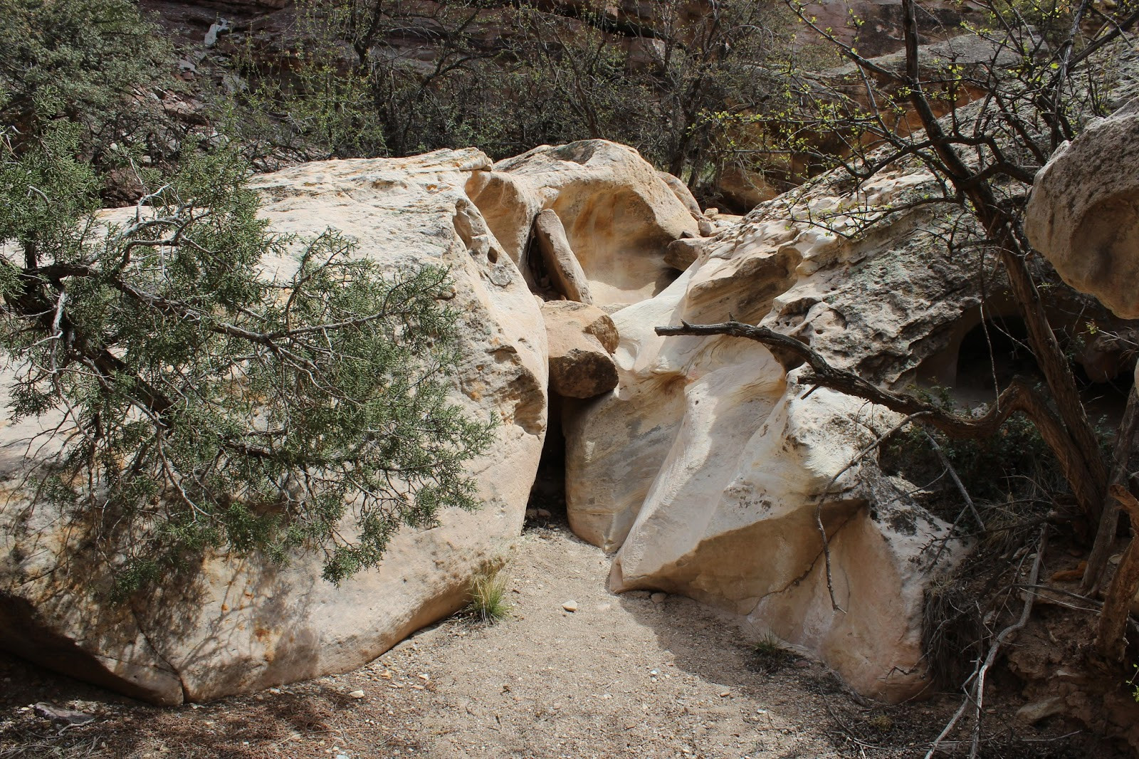
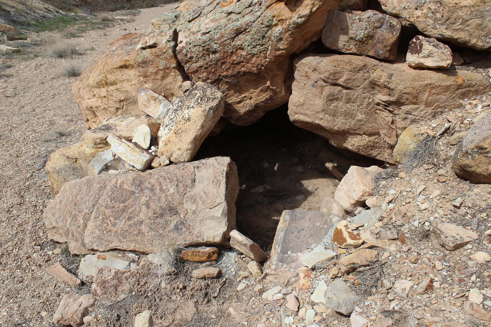
Adding to the area’s intrigue, a mylar post near the trailhead mentions archaeological sites. An ancient rock shelter, tucked within the wash, provides a tangible link to the past. This shelter, constructed by packing rocks around boulders to create a small entrance, hints at temporary use, possibly by hunters in the region. While its exact history remains speculative, it offers a fascinating glimpse into the human history intertwined with this natural landscape.
 Hikers navigating boulders in Cool Rock Canyon, illustrating the moderate difficulty and terrain of the trail.
For those wishing to extend their visit, a designated campsite is located by the river at the trailhead, with additional campsites further into the gorge, some reserved for rafters. The Gunnison River in this section is designated as Gold Medal water, renowned for fly fishing. This makes Cool Rock Canyon and its surroundings an appealing destination for multi-day trips combining hiking and fishing.
 Boulder jam along the Cool Rock Canyon trail, requiring hikers to use a side trail to bypass the obstacle.
While the Gunnison Gorge brochure might classify Cool Rock Canyon trail as “Easy/Family Friendly,” the moderate scrambling sections suggest it leans more towards a moderate rating. It’s an excellent choice for families with older children or anyone seeking a moderately challenging and visually rewarding hike. To truly appreciate the unique beauty of Colorado’s cool rocks and canyon landscapes, taking a hike on the Cool Rock Canyon trail is an experience not to be missed.
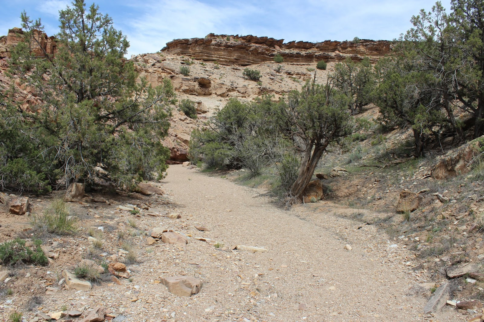
 Easy section of the trail after the boulder jam in Cool Rock Canyon, showing the varied terrain.
 Fence marking the turnaround point of the Cool Rock Canyon trail at the two-mile mark.