How Are Rocks Dated, revealing the story of Earth’s dynamic past? Dating rocks, a fascinating process called geochronology, allows us to understand the timing of geological events, crucial for unraveling Earth’s history. At rockscapes.net, we delve into these methods, providing insights for homeowners, landscape designers, and anyone passionate about the stones beneath our feet, helping you choose the perfect materials and designs. You can explore rock formations and discover the secrets they hold using radiometric dating, cosmogenic surface exposure dating, and paleomagnetism, improving rock identification and geological timescales.
1. What is Geochronology and Why Is It Important?
Geochronology is the science of determining the age of rocks, fossils, and sediments. Why is it important? Geochronology provides the timeline for Earth’s history, allowing us to understand the sequence and rate of geological events such as volcanic eruptions, earthquakes, and the formation of mountain ranges. Understanding how old rocks are is essential for everything from resource exploration to hazard assessment.
Geochronology is like being a detective for the Earth’s history. Just as a detective uses clues to solve a case, geochronologists use various techniques to determine the age of rocks and geological events. By dating these events, we can build a timeline of Earth’s past, understanding how our planet has changed over millions of years. This knowledge is essential for understanding present-day geological processes and even predicting future events.
1.1 How Does Geochronology Help in Understanding Geological Events?
Geochronology provides the essential temporal framework for understanding geological events, answering the crucial “when” question. By knowing when events occurred, we can determine their rates and causes, and even make predictions about future activity. For example, dating volcanic rocks helps us understand eruption frequency and magma behavior.
Geochronology isn’t just about finding out how old something is; it’s about understanding the story behind that age. By dating different rock layers, we can reconstruct the sequence of events that shaped a landscape. We can learn how quickly a mountain range formed, how often a volcano erupts, or how long ago a glacier retreated. This information allows us to understand the forces that have shaped our planet and continue to do so.
1.2 What Are the Key Applications of Geochronology?
The key applications of geochronology are vast, impacting various fields including geology, archaeology, and environmental science. Dating rocks helps us understand the rates of geological processes, reconstruct past environments, and even study the evolution of life. In landscape design, understanding the age and origin of rocks can enhance the aesthetic and historical value of a project.
Imagine using geochronology to select the perfect stone for your rock garden at rockscapes.net. Knowing the age and origin of different types of rocks can add a unique dimension to your design. A piece of ancient granite, for example, can serve as a conversation starter, connecting your landscape to billions of years of Earth’s history.
2. Radiometric Dating: Unlocking Time Through Radioactive Decay
Radiometric dating uses the decay of radioactive isotopes to determine the age of rocks and minerals. This method measures the ratio of parent isotopes (the original radioactive atoms) to daughter isotopes (the stable atoms they decay into) to calculate how much time has passed since the rock formed. It is a cornerstone of geochronology.
Think of radiometric dating as a built-in clock within rocks. Radioactive elements decay at a constant rate, like the ticking of a clock. By measuring the amount of the original radioactive element (the parent isotope) and the amount of the element it decays into (the daughter isotope), scientists can determine how long that clock has been ticking, revealing the age of the rock.
2.1 How Does Radiometric Dating Work?
Radiometric dating works by measuring the predictable decay of radioactive isotopes. Radioactive isotopes decay at a known rate, called a half-life, which is the time it takes for half of the parent isotopes to decay into daughter isotopes. By measuring the ratio of parent to daughter isotopes, geochronologists can calculate the age of the sample.
Here’s a simplified analogy: Imagine you have a bag of popcorn. You know that every hour, half of the kernels pop. If you come back later and find that half the kernels are popped, you know it’s been one hour. If three-quarters are popped, it’s been two hours, and so on. Radiometric dating works similarly, using the known decay rates of radioactive elements to determine how long ago a rock formed.
2.2 What Are the Different Types of Radiometric Dating?
There are many different types of radiometric dating, each suited for different age ranges and materials. Some of the most common include:
- Carbon-14 dating: Used for dating organic materials up to about 50,000 years old.
- Potassium-Argon dating (40Ar/39Ar): Used for dating volcanic rocks and minerals from thousands to billions of years old.
- Uranium-Lead dating: Used for dating very old rocks and minerals, often billions of years old.
- U-series dating: Used to date calcium carbonate materials like travertine
Each method has its strengths and limitations, and geochronologists choose the most appropriate method based on the material they are dating and the age range they are interested in.
2.2.1 Carbon-14 Dating: Dating Recent Organic Materials
Carbon-14 dating is a radiometric technique used to determine the age of organic materials up to around 50,000 years old. Living organisms constantly replenish their supply of carbon, including the radioactive isotope carbon-14. When an organism dies, it no longer takes in carbon, and the carbon-14 begins to decay.
Carbon-14 dating is particularly useful for dating archaeological artifacts, such as wood, bone, and charcoal. For example, if you find charcoal in a layer of sediment beneath a lava flow, carbon-14 dating can tell you when the vegetation burned, providing a maximum age for the lava flow. While not directly applicable to dating the rocks used in most landscaping projects, it can help understand the context of the environment where those rocks are found.
2.2.2 Potassium-Argon (40Ar/39Ar) Dating: Dating Volcanic Rocks
40Ar/39Ar dating is a radiometric technique used to date volcanic rocks and minerals ranging in age from thousands to billions of years. It is based on the decay of potassium-40 (40K) to argon-40 (40Ar). Argon is an inert gas that is trapped within the crystal structure of minerals in volcanic rocks.
40Ar/39Ar dating is widely used in volcanology to determine the ages of volcanic eruptions and to understand the history of volcanic activity in a region. According to research from Arizona State University’s School of Earth and Space Exploration, in July 2025, scientists will use 40Ar/39Ar dating to analyze rock samples from a recent volcanic eruption to better understand the volcano’s eruption history. This technique is versatile and can be applied to a wide range of volcanic rocks, making it a valuable tool for geochronologists.
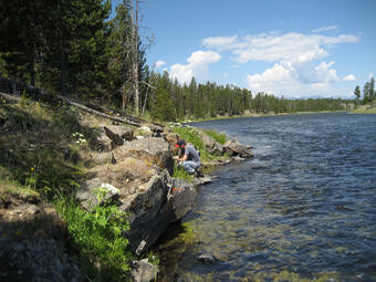 Geologist samples a basaltic lava flow along the Madison River, for 40Ar/39Ar geochronology
2.2.3 Uranium-Lead Dating: Dating Ancient Rocks
Uranium-lead dating is a radiometric technique used to date very old rocks and minerals, often billions of years old. It is based on the decay of uranium isotopes (238U and 235U) to lead isotopes (206Pb and 207Pb). Uranium-lead dating is particularly useful for dating zircon crystals, which are common in igneous and metamorphic rocks.
Uranium-lead dating has been used to determine the age of the oldest rocks on Earth, providing insights into the early history of our planet. This method is essential for understanding the formation and evolution of continents and the early Earth’s crust.
2.3 What Are the Limitations of Radiometric Dating?
Radiometric dating has limitations. It requires specialized equipment and expertise. Not all rocks contain suitable radioactive isotopes, and the method can be affected by contamination or alteration of the sample. However, when applied carefully, radiometric dating provides highly accurate and reliable ages.
Just like any scientific method, radiometric dating isn’t perfect. It’s essential to understand its limitations and to use it in conjunction with other dating techniques. Geochronologists carefully select samples and methods to minimize potential errors and ensure the most accurate results.
3. Cosmogenic Surface Exposure Dating: Measuring Exposure to Cosmic Rays
Cosmogenic surface exposure dating determines how long a rock surface has been exposed to cosmic rays. These high-energy particles from space interact with atoms in the rock, producing rare isotopes. Measuring the concentration of these isotopes allows scientists to calculate the exposure time.
Imagine a rock sitting on the surface of the Earth, constantly bombarded by cosmic rays from space. These cosmic rays interact with the atoms in the rock, creating new, rare isotopes. The longer the rock has been exposed, the more of these isotopes accumulate. By measuring the concentration of these isotopes, scientists can determine how long the rock has been sitting on the surface.
3.1 How Does Cosmogenic Surface Exposure Dating Work?
Cosmogenic surface exposure dating works by measuring the accumulation of cosmogenic isotopes in exposed rock surfaces. When cosmic rays interact with atoms in the rock, they produce isotopes such as beryllium-10, aluminum-26, and chlorine-36. The production rate of these isotopes is known, so by measuring their concentration, scientists can calculate the exposure time.
This technique is particularly useful for dating relatively young surfaces, such as those created by glacial retreat or landslides. It provides valuable information about the timing of geomorphic processes and landscape evolution.
3.2 What Materials Can Be Dated Using This Method?
Cosmogenic surface exposure dating can be used on a variety of rock types, including granite, sandstone, and basalt. The key requirement is that the rock surface has been exposed to cosmic rays for a sufficient amount of time to accumulate measurable concentrations of cosmogenic isotopes.
This method is often used to date boulders, bedrock surfaces, and other landforms that have been exposed by erosion or tectonic activity. It is also used to date sediments in river terraces and alluvial fans.
3.3 What Are the Applications of Cosmogenic Dating?
The applications of cosmogenic dating are diverse. It is used to date glacial deposits, determine erosion rates, and understand landscape evolution. It also helps constrain the timing of volcanic eruptions and fault movements. The technique provides insights into Earth’s surface processes and their rates.
For example, cosmogenic dating can be used to determine when a glacier retreated from a valley, leaving behind exposed bedrock surfaces. By dating these surfaces, scientists can reconstruct the history of glacial activity and understand how climate change has affected ice cover over time.
4. Paleomagnetism: Reading the Earth’s Magnetic History
Paleomagnetism uses the magnetic properties of rocks to determine their age and the position of the Earth’s magnetic poles in the past. When a rock forms, magnetic minerals align with the Earth’s magnetic field. This alignment is “locked in” as the rock cools, providing a record of the magnetic field at the time of formation.
Imagine the Earth as a giant magnet, with a magnetic field that surrounds the planet. When a rock forms, tiny magnetic minerals within the rock align themselves with this magnetic field, like tiny compass needles. As the rock cools and solidifies, these minerals become locked in place, preserving a record of the Earth’s magnetic field at that time.
4.1 How Does Paleomagnetism Work?
Paleomagnetism works by measuring the direction and intensity of the magnetic field preserved in rocks. Scientists use a magnetometer to measure the magnetic alignment of minerals in a rock sample. By comparing this alignment to the known variations in the Earth’s magnetic field over time, they can determine the age of the rock.
The Earth’s magnetic field is not static; it changes over time, both in direction and intensity. These changes, known as geomagnetic variations, are well-documented for the past few million years. By comparing the magnetic alignment in a rock sample to this record, scientists can determine when the rock formed.
4.2 What Information Can Be Obtained from Paleomagnetic Studies?
Paleomagnetic studies provide information about the age of rocks, the movement of continents, and the behavior of the Earth’s magnetic field. They can also reveal information about past climate conditions and the history of tectonic activity in a region.
Paleomagnetism has played a crucial role in understanding plate tectonics, the theory that the Earth’s surface is divided into large plates that move over time. By studying the magnetic alignment in rocks from different continents, scientists have been able to reconstruct the past positions of the continents and track their movement over millions of years.
4.3 What Are the Limitations of Paleomagnetism?
Paleomagnetism has limitations. The method requires rocks with stable magnetic minerals and a well-defined magnetic signature. It can be affected by subsequent alteration or heating of the rock. However, when applied carefully, paleomagnetism provides valuable information about the Earth’s history and magnetic field.
Just like any scientific method, paleomagnetism has its limitations. The magnetic signal in a rock can be altered or erased by various geological processes, such as heating, weathering, or the presence of strong magnetic fields. Geochronologists carefully select samples and methods to minimize these effects and ensure the most accurate results.
5. Combining Dating Techniques for Accurate Results
Combining different dating techniques provides the most accurate and reliable age determinations. No single method is perfect, and each has its own strengths and limitations. By using multiple methods, geochronologists can cross-validate their results and reduce the potential for error.
Think of it like solving a puzzle. Each dating technique provides a piece of the puzzle, and by combining all the pieces, we get a complete picture of the Earth’s history. For example, radiometric dating can provide an absolute age, while paleomagnetism can provide information about the Earth’s magnetic field at the time of formation. By combining these methods, we can get a more accurate and complete understanding of the age and origin of a rock.
5.1 Why Is It Important to Use Multiple Methods?
Using multiple dating methods is crucial for several reasons. It helps to identify potential errors or biases in a single method, provides a more complete picture of the geological history of a sample, and increases the confidence in the age determination.
Different dating methods are sensitive to different factors, such as the type of rock, the age range, and the presence of contaminants. By using multiple methods, geochronologists can account for these factors and obtain the most accurate and reliable results.
5.2 How Do Geochronologists Choose the Right Techniques?
Geochronologists choose the appropriate dating techniques based on several factors, including the type of rock or material being dated, the age range of the sample, the available equipment and expertise, and the specific research questions being addressed.
They carefully consider the strengths and limitations of each method and select the combination that will provide the most accurate and reliable results. They also take into account the geological context of the sample and any potential sources of error or bias.
5.3 Examples of Successful Combined Dating Studies
There are numerous examples of successful combined dating studies that have provided valuable insights into the Earth’s history. One example is the dating of volcanic rocks in Yellowstone National Park, where 40Ar/39Ar dating and U-series dating have been combined to understand the timing of eruptions and magma chamber processes.
Another example is the dating of glacial deposits, where cosmogenic dating and radiocarbon dating have been combined to reconstruct the history of glacial activity and climate change. These studies demonstrate the power of combining different dating techniques to unravel the complexities of Earth’s past.
6. Dating Rocks in Landscape Design: Adding Depth and Meaning
Dating rocks in landscape design adds depth and meaning to your projects. Understanding the age and origin of the stones you use can enhance the aesthetic and historical value of your landscape. It allows you to create a landscape that tells a story, connecting your space to the vastness of geological time.
Imagine using ancient granite boulders in your rock garden, knowing that they formed billions of years ago deep within the Earth’s crust. Or imagine using volcanic rocks in your water feature, knowing that they were erupted from a volcano millions of years ago. These details add a unique dimension to your landscape, making it more meaningful and engaging.
6.1 How Does Knowing the Age of Rocks Enhance a Landscape?
Knowing the age of rocks enhances a landscape by adding a sense of history and connection to the Earth. It allows you to create a landscape that is not only visually appealing but also intellectually stimulating. It can also inspire conversations and educate visitors about the geological history of your region.
For example, if you live in an area with exposed bedrock, you can incorporate this natural feature into your landscape design. Knowing the age and origin of the bedrock can help you choose plants and other materials that complement the geological character of your site.
6.2 What Types of Rocks Are Commonly Used in Landscaping?
Various types of rocks are commonly used in landscaping, each with its own unique characteristics and aesthetic appeal. Some of the most popular include:
- Granite: A hard, durable igneous rock with a coarse-grained texture, often used for boulders, paving stones, and retaining walls.
- Sandstone: A sedimentary rock composed of sand grains, often used for paving stones, wall stones, and decorative features.
- Limestone: A sedimentary rock composed of calcium carbonate, often used for paving stones, wall stones, and decorative features.
- Slate: A metamorphic rock with a layered structure, often used for paving stones, roofing tiles, and wall cladding.
- Basalt: A dark-colored volcanic rock, often used for gravel, paving stones, and decorative features.
Each of these rocks has its own unique age and origin, which can add depth and meaning to your landscape design. Rockscapes.net offers a wide selection of these materials.
6.3 How Can You Incorporate Geological History into Your Design?
You can incorporate geological history into your landscape design in several ways. You can use rocks that are native to your region, showcasing the local geology. You can create features that mimic natural geological formations, such as rock outcrops or riverbeds. And you can educate visitors about the geological history of your site through signage or guided tours.
For example, you could create a rock garden that features different types of rocks from your region, arranged in chronological order to represent the geological history of the area. You could also create a water feature that mimics a natural spring or waterfall, using rocks that are characteristic of those environments.
7. Trends in Rock Dating Technology in the US
The trends in rock dating technology in the US are rapidly evolving, driven by advances in instrumentation, analytical techniques, and computational power. These advancements are leading to more precise, accurate, and efficient age determinations, revolutionizing our understanding of Earth’s history.
According to the United States Geological Survey (USGS), ongoing research focuses on refining existing dating methods and developing new techniques to address specific geological challenges. These advancements are crucial for understanding complex geological processes and making informed decisions about resource management, hazard assessment, and environmental protection.
7.1 What Are the Latest Advancements in Rock Dating?
The latest advancements in rock dating include:
- Laser Ablation Inductively Coupled Plasma Mass Spectrometry (LA-ICP-MS): This technique allows for the precise analysis of small areas within a rock or mineral sample, providing high-resolution age determinations.
- Secondary Ion Mass Spectrometry (SIMS): This technique allows for the analysis of trace elements and isotopes in situ, providing valuable information about the history and origin of rocks.
- Improved Data Processing and Modeling: Advances in computational power and statistical methods are allowing for more sophisticated data processing and modeling, leading to more accurate and reliable age determinations.
These advancements are enabling geochronologists to tackle more complex research questions and to refine our understanding of Earth’s history.
7.2 How Are These Technologies Being Used in Geological Research?
These technologies are being used in a wide range of geological research, including:
- Dating of ancient rocks to understand the early history of Earth.
- Determining the timing of volcanic eruptions and earthquakes to assess hazard risks.
- Reconstructing the movement of continents and the formation of mountain ranges.
- Understanding the history of climate change and its impact on the Earth’s surface.
These technologies are providing valuable insights into the processes that have shaped our planet over millions of years.
7.3 What Are the Implications for Future Research?
The implications for future research are significant. These advancements are opening up new avenues of inquiry and allowing geochronologists to address previously intractable problems. They are also enabling more interdisciplinary research, bringing together geologists, chemists, physicists, and computer scientists to tackle complex scientific challenges.
As these technologies continue to evolve, we can expect even more groundbreaking discoveries about the Earth’s past and its future.
8. Frequently Asked Questions (FAQ) About Dating Rocks
Here are some frequently asked questions about dating rocks:
Q1: What is the oldest rock ever dated?
The oldest rocks ever dated are found in the Acasta Gneiss Complex in northern Canada, with ages up to 4.03 billion years.
Q2: Can all rocks be dated?
No, not all rocks can be dated. The suitability of a rock for dating depends on its composition, age, and the availability of appropriate dating techniques.
Q3: How accurate is radiometric dating?
Radiometric dating can be very accurate, with uncertainties ranging from less than 1% to a few percent, depending on the method and the quality of the sample.
Q4: What is the difference between relative and absolute dating?
Relative dating determines the age of a rock or event in relation to other rocks or events, while absolute dating provides a numerical age in years.
Q5: Can sedimentary rocks be dated directly?
Sedimentary rocks are difficult to date directly because they are composed of fragments of other rocks. However, geochronologists can date the individual grains within the rock or date volcanic layers that are interbedded with the sedimentary layers.
Q6: How does contamination affect radiometric dating?
Contamination can significantly affect radiometric dating by altering the ratio of parent and daughter isotopes, leading to inaccurate age determinations.
Q7: What is the role of geochronology in understanding climate change?
Geochronology plays a crucial role in understanding climate change by providing a timeline for past climate events, allowing scientists to study the causes and consequences of climate change.
Q8: Are there any ethical considerations in geochronology?
Yes, there are ethical considerations in geochronology, such as the responsible collection and handling of samples, the accurate and transparent reporting of data, and the protection of geological heritage sites.
Q9: How do scientists ensure the accuracy of their dating results?
Scientists ensure the accuracy of their dating results by using multiple dating methods, carefully selecting and preparing samples, and rigorously calibrating and validating their instruments.
Q10: What are the future directions of geochronology?
The future directions of geochronology include the development of new dating methods, the application of geochronology to new research areas, and the integration of geochronology with other Earth science disciplines.
9. Discover the Beauty of Rockscapes with rockscapes.net
Ready to explore the world of rocks and landscape design? Visit rockscapes.net for inspiration, information, and expert advice. Whether you’re a homeowner, landscape designer, or simply a rock enthusiast, you’ll find everything you need to create stunning and meaningful rockscapes.
At rockscapes.net, we understand the power of rocks to transform outdoor spaces. Our team of experts is dedicated to providing you with the highest quality materials and the most innovative design ideas. Let us help you create a landscape that reflects your unique style and connects you to the beauty of the natural world.
9.1 Explore Design Ideas and Inspiration
Find inspiration for your next landscape project with our extensive collection of design ideas and photos. Whether you’re looking for a tranquil rock garden, a dramatic water feature, or a functional retaining wall, you’ll find plenty of inspiration at rockscapes.net.
Our design gallery is constantly updated with new and exciting projects from around the world. We also offer personalized design consultations to help you bring your vision to life.
9.2 Learn About Different Types of Rocks
Learn about the different types of rocks used in landscaping, their unique characteristics, and their geological history. Our comprehensive rock guide provides detailed information about granite, sandstone, limestone, slate, basalt, and more.
We also offer expert advice on how to choose the right rocks for your project, taking into account factors such as climate, soil conditions, and aesthetic preferences.
9.3 Get Expert Advice and Consultation
Get expert advice and consultation from our team of experienced landscape designers and geologists. We can help you with everything from site planning to rock selection to installation techniques.
We offer personalized consultations to help you create a landscape that meets your specific needs and goals. We can also provide on-site assessments to help you identify the best options for your property.
Ready to transform your outdoor space with the beauty and power of rocks? Contact rockscapes.net today! Visit us at 1151 S Forest Ave, Tempe, AZ 85281, United States, call us at +1 (480) 965-9011, or visit our website at rockscapes.net to explore our products and services. Let us help you create a landscape that tells a story and connects you to the Earth.