The Chain of Rocks Bridge stands as a remarkable testament to American ingenuity and a bygone era of travel. For those who have journeyed across it, the distinctive 30-degree bend at its midpoint, suspended high above the Mississippi River, is an unforgettable experience. This mile-long structure, soaring over 60 feet above the water, served for over three decades as a vital landmark for motorists traveling along the iconic Route 66. Its very name, “Chain of Rocks Bridge,” is steeped in the geography and history of the mighty Mississippi.
This intriguing name originates from a 17-mile stretch of treacherous shoals and rocky rapids known as the Chain of Rocks, located just north of St. Louis. These numerous submerged rock ledges made navigation along this section of the Mississippi River exceptionally perilous for boats and barges. To tame this hazardous natural feature, the U.S. Army Corps of Engineers constructed a low-water dam in the 1960s, effectively submerging the Chain of Rocks and rendering them invisible today. However, back in 1929, when the Old Chain Of Rocks Bridge was conceived and built, these rapids were a significant obstacle and a major concern for river navigation.
A colossal undertaking for its time, the old chain of rocks bridge project was initially budgeted at $1,250,000. The ambitious plan called for a straight, 40-foot wide roadway supported by five substantial trusses forming ten spans. Massive concrete piers, rising an impressive 55 feet above the high-water mark, were designed to anchor the entire structure. The project also included a four-mile approach road leading to the bridge’s northern end, demonstrating the scale of the infrastructure development.
However, the original straight-line design of the old chain of rocks bridge encountered significant opposition. Riverboat captains voiced strong protests due to the bridge’s planned proximity to two water intake towers belonging to the Chain of Rocks pumping station. Navigating between the bridge piers and these towers simultaneously, they argued, would create an extremely hazardous passage for river vessels and barges. Furthermore, geological surveys revealed that the bedrock at the initially proposed location was insufficient to bear the immense weight of the bridge piers. Necessity dictated a significant alteration to the original blueprint – the old chain of rocks bridge had to incorporate a bend.
Construction commenced simultaneously on both banks of the Mississippi in 1927, and by August 1928, the piers were completed, marking substantial progress. A grand opening celebration was scheduled for New Year’s Day 1929. However, the unpredictable forces of the Mississippi River intervened. Severe floods and ice accumulation hampered construction efforts, delaying the project’s completion. Finally, in July 1929, the old chain of rocks bridge was officially opened to traffic, marking a significant milestone despite the setbacks.
As is often the case with large-scale public works projects, the actual cost of constructing the old chain of rocks bridge exceeded the initial projections. The final expenditure reached just over $2.5 million, double the original estimate. Despite the cost overrun, the public arguably received exceptional value. The bridge approaches were beautifully landscaped, and the Missouri end featured a park-like setting surrounding a pool and an ornate toll booth. On the Illinois side, a grand avenue of 400 elm trees lined the approach. The bridge served as a gateway to St. Louis, leading travelers to the popular Chain of Rocks amusement park situated on the Missouri hills overlooking the river. On a clear day, crossing the old chain of rocks bridge was a truly delightful experience, offering stunning views and a sense of adventure. This pleasurable crossing officially became part of the iconic Route 66 experience in 1936 when the historic highway was rerouted to traverse the bridge.
During World War II, the distinct red sections of the old chain of rocks bridge were painted green as a wartime camouflage measure to reduce its visibility from the air, reflecting the anxieties of the era. Simultaneously, wartime gas rationing led to a decrease in traffic volume. To compensate for reduced revenue, the City of Madison increased bridge tolls to 35 cents per car, with an additional five cents charged per passenger. This toll structure contrasts sharply with modern toll systems that often favor carpooling, highlighting the different priorities and traffic patterns of the time.
In 1967, the New Chain of Rocks Bridge, designed to carry Interstate 270, opened just 2,000 feet upstream from the old chain of rocks bridge. The older bridge was subsequently closed to vehicular traffic in 1968. As the bridge deteriorated throughout the 1970s, it faced an ignominious potential fate. Army demolition teams even considered using the old chain of rocks bridge for demolition practice. By 1975, its destruction seemed imminent. However, a fortunate turn of economic circumstances intervened. A sharp decline in the market value of scrap steel made demolition financially unviable, saving the bridge from the wrecking ball. The old chain of rocks bridge then entered a period of limbo for two decades – too costly to demolish and too outdated and narrow for modern vehicles. In 1980, the bridge gained a different kind of notoriety when film director John Carpenter utilized the gritty, rusting structure as a location for his dystopian science fiction film, Escape from New York. Aside from this cinematic appearance, the bridge remained largely abandoned.
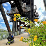
Today, the old chain of rocks bridge has completed a remarkable transformation and historical cycle. Originally built at the dawn of America’s automobile age, it now reflects a contemporary shift towards alternative modes of transportation. In the 1980s, greenways and pedestrian corridors gained significant popularity, and a dedicated group named Trailnet spearheaded the cleanup and restoration of the bridge. Integrated into a network of over 300 miles of trails on both sides of the Mississippi River, the old chain of rocks bridge triumphantly reopened to the public in 1999 as a key segment of the Route 66 Bikeway.
Preserved remarkably close to its original form, a visit to the old chain of rocks bridge today offers a powerful connection to the past. It provides an appreciation for early 20th-century bridge construction techniques and affords breathtaking panoramic views of the expansive Mississippi River. Recognizing its historical and engineering significance, the old chain of rocks bridge was officially listed on the National Register of Historic Places in 2006, cementing its place as a treasured landmark.
The Chain of Rocks Bridge is located parallel to U.S. 270 along West Chain of Rocks Rd., nestled between Riverview Dr. in St. Louis, MO, and Illinois 3 in Madison County, IL. It seamlessly connects to the MCT Confluence Trail, the Mississippi River Trail, and the St. Louis Riverfront Trail, offering extensive recreational opportunities. Free parking is conveniently available at the bridge entrance on the Illinois side and at North Riverfront Park, situated south of the bridge along the Riverfront Trail. On the Missouri side, a recently opened park (2024) provides amenities such as a pavilion, enhanced natural habitats, an event lawn, and a gated parking lot. The bridge welcomes bikers and pedestrians daily. For the latest information, you can call 314-436-7009 or visit the Great Rivers Greenway website.
To delve deeper into the bridge’s history and significance, you can explore the Chain of Rocks Bridge National Register nomination form.